The Christmas Blizzard of 2009
An intense blizzard affected much of the central US on 24 December – 25 December 2009, significantly disrupting travel and commerce from North Dakota to Texas. Oklahoma City OK received 14.1 inches of snow, which was both their greatest 24-hour snowfall and their greatest storm total snowfall on record. McIDAS images of the GOES-12 10.7 µm IR channel data (above; also available as a QuickTime animation) showed the evolution of a well-defined Trough of Warm Air Aloft (TROWAL) signature across Oklahoma and Texas — with moderate to heavy snow falling just to the north and west of the pivot point of the southern/eastern edge of the colder (-30º to -50º C, dark blue to violet color enhancement) cloud top temperatures. Surface winds gusted as high as 64 mph in Oklahoma, creating white-out conditions with blowing and drifting snow.
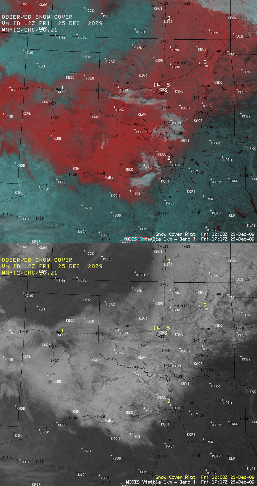
On the morning of 25 December, a comparison of AWIPS images of the MODIS visible channel and a false-color Red/Green/Blue (RGB) composite (below) showed the areal extent of significant snow remaining on the ground — snow cover on the RGB image was highlighted with a red color enhancement, in contrast to supercooled water droplet clouds which appeared as brighter white features. This also offers a glimpse at the type of RGB image capability that should be available with the upcoming AWIPS-2 software. For higher-resolution MODIS true color and false color images from 25 December, see the SSEC MODIS Today site.
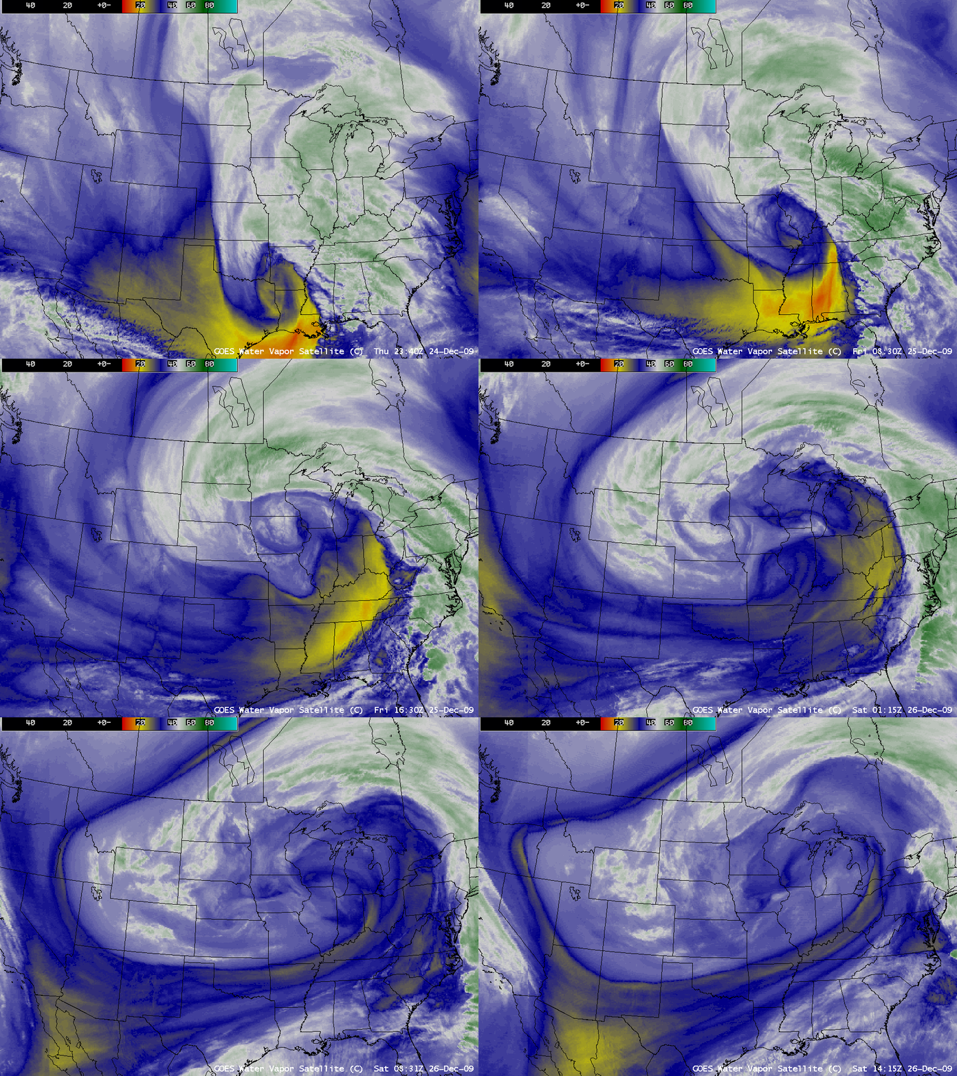
GOES-12 6.5 µm water vapor images (below; also available as a QuickTime animation) displayed the impressively large size of the circulation associated with the storm as it intensified from 25 December to 26 December. In the north-central US, entire Interstate highway systems were shut down for an extended period across the Dakotas — snowfall amounts were as high as 40.0 inches at Lead, South Dakota (with amounts over 24 inches in North Dakota and Minnesota). Significant accruals of ice (up to 0.4 inch) from freezing rain occurred in parts of Iowa, Illinois, and Indiana. Winds gusted as high as 76 mph in western South Dakota (HPC storm summary).


