Lake Effect Showers near Lake Michigan
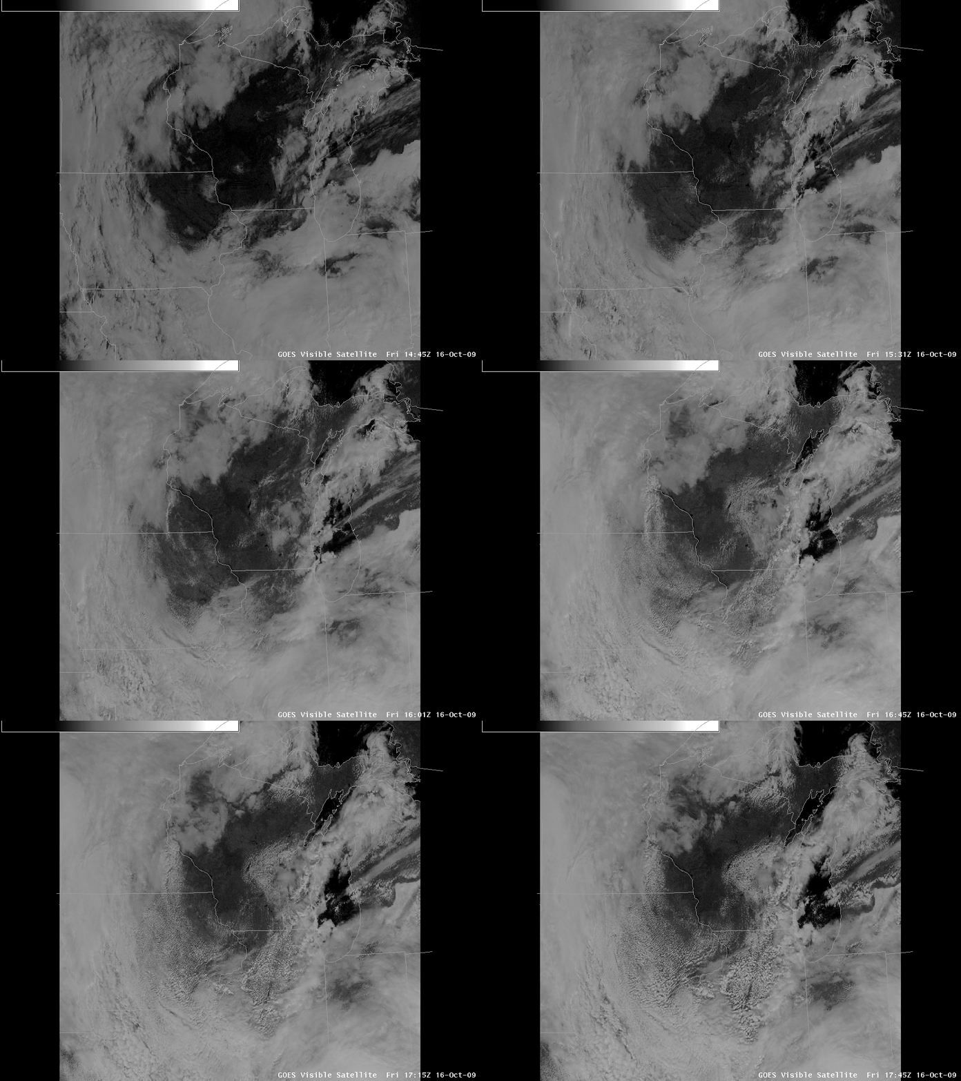
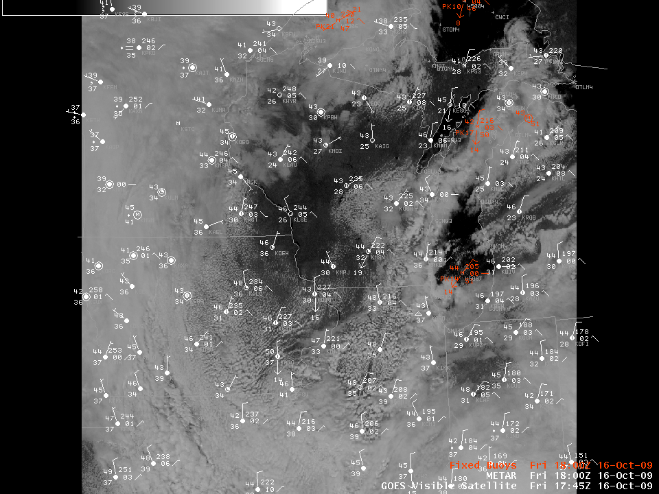
A cold airmass over the Great Lakes states and northeast that allowed an unprecedentedly early snowfall over central Pennsylvania (see precipitation totals ending at 1200 UTC on 16 October here) is also supporting the development of Lake-effect precipitation downwind of Lake Michigan. In the loop above (click the loop to enlarge), pay attention to the cumuliform cloud development over the relatively warm waters of Lake Michigan, and note how the straight lines of clouds move south-southwestward towards the lake counties of Wisconsin and Illinois. These cumuliform clouds contain showers as noted in the radar imagery here. The plot of surface data (below) at 1800 UTC shows a prevailing northerly or north-northeasterly flow at the surface, consistent with the motion of the lake-effect clouds. Note also the plots from moored buoys over the Lakes (plotted in red) that show temperatures in the low 50s (11-12 Celsius) over Lake Michigan and mid 40s (7-8 Celsius) over cooler Lake Superior.
The 850-hPa temperatures observed by radiosondes over the midwest at 1200 UTC on 16 October (here) show temperatures cooler than -5 Celsius over Lake Michigan. In general, a temperature difference of at least 13 C between 850 hPa and the Lake Surface is looked for when forecasting lake-effect precipitation. Observations in the surface plot certainly support a temperature difference exceeding 13 C between the lake surface and 850 hPa. Estimates of lake surface temperature from satellite have been hampered lately by persistent cloudiness over the Great Lakes basin. An MODIS estimate from 1800 UTC today, however, located here, does show temperatures in the 50s over Lake Michigan, and somewhat cooler waters over Lake Superior. This cooler lake temperatures in Lake Superior may explain in part the lack of lake-effect clouds just downwind of Lake Superior over the eastern part of the upper Peninsula (It is likely that other forcings may be suppressing cloud formation there as well; note that at the beginning of the visible imagery loop, cloud streets do extend from Lake Superior into the upper Penisula of Michigan just to the east of Marquette; these cloud streets dissipate with time, suggesting strong subsidence in the region).
Development of lake-effect clouds in mid-October is a reminder of what is to come in the near future as cooler and cooler airmasses develop over Canada and move southward over the still-warm Great Lakes.


