Transport of Canadian wildfire smoke across the Northeast US
![GOES-16 CIMSS Natural Color images, with an overlay of the Smoke Detection Product ;click to play animation | MP4]](https://cimss.ssec.wisc.edu/satellite-blog/wp-content/uploads/sites/5/2019/05/190522_goes16_naturalColor_smokeDetection_Northeast_US_anim.gif)
GOES-16 CIMSS Natural Color RGB images, with an overlay of the Smoke Detection Product [click to play animation | MP4]
During the preceding overnight hours, with ample illumination from the Moon (in the Waning Gibbous phase, at 92% of Full) smoke filaments were evident over the Atlantic Ocean on Suomi NPP VIIRS Day/Night Band (0.7 µm) imagery at 0722 UTC or 3:22 AM Eastern Time (below). Note that the smoke did not exhibit a signature in the corresponding VIIRS Infrared Window (11.45 µm) image, since thin smoke layers are effectively transparent to infrared radiation.
![Suomi NPP VIIRS Day/Night Band (0.7 µm) and Infrared Window (11.45 µm) images at 0722 UTC [click to enlarge]](https://cimss.ssec.wisc.edu/satellite-blog/wp-content/uploads/sites/5/2019/05/190522_0722utc_suomiNPP_viirs_dayNightBand_infraredWindow_Northeast_US_smoke_anim.gif)
Suomi NPP VIIRS Day/Night Band (0.7 µm) and Infrared Window (11.45 µm) images at 0722 UTC [click to enlarge]
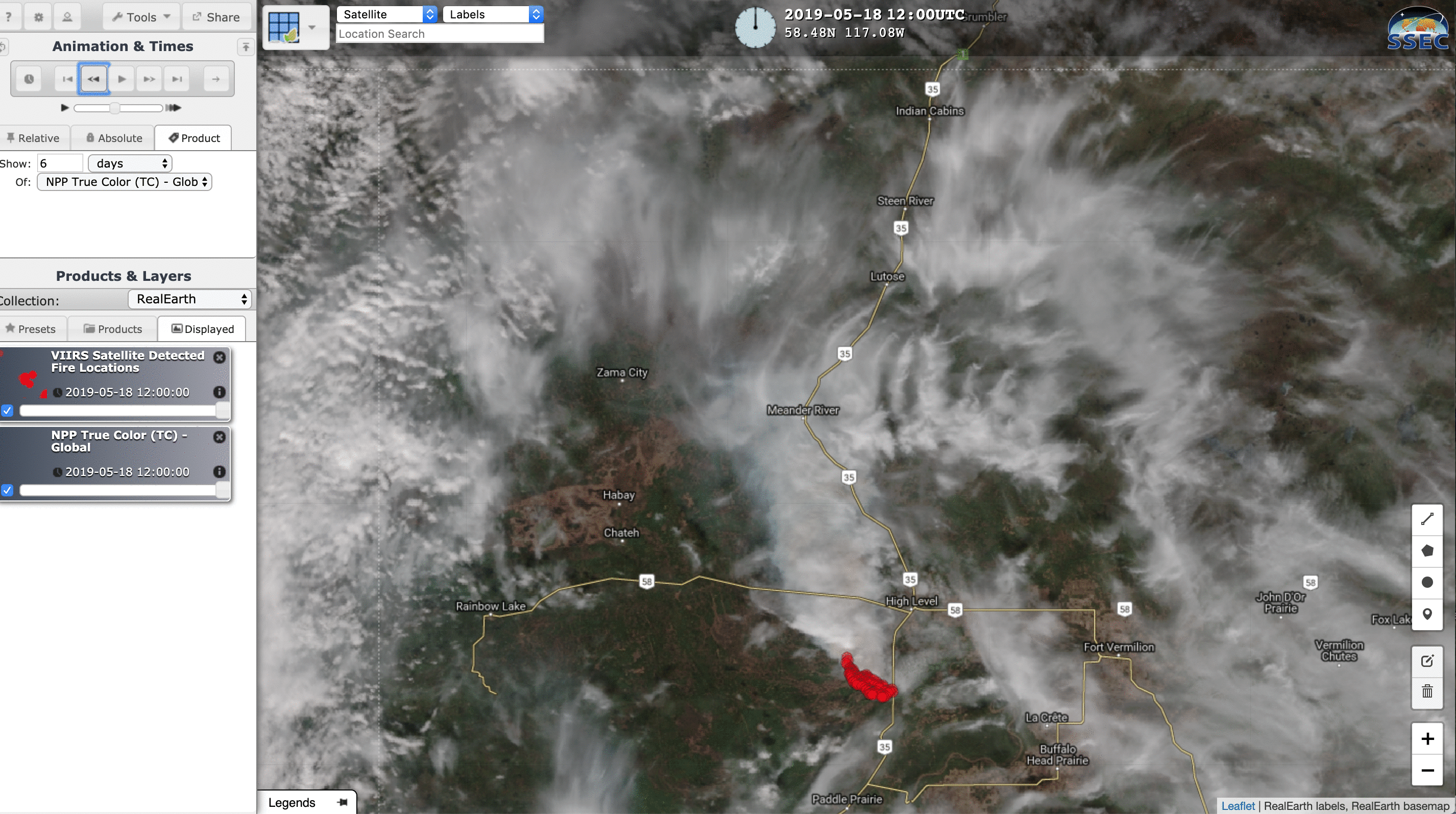
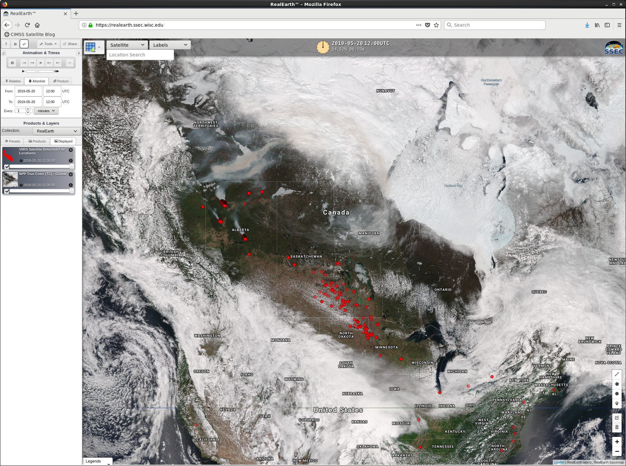
![Daily composites of Suomi NPP VIIRS True Color RGB images with Fire Detections, 18-22 May [click to play animation]](https://cimss.ssec.wisc.edu/satellite-blog/wp-content/uploads/sites/5/2019/05/190518_190522_suomiNPP_truecolor_Alberta_wildfire_smoke_anim.gif)
Daily composites of Suomi NPP VIIRS True Color RGB images with Fire Detections, 18-22 May [click to play animation]
![HYSPLIT model 72-hour back trajectories from 3 points off the Northeast US coast [click to enlarge]](https://cimss.ssec.wisc.edu/satellite-blog/wp-content/uploads/sites/5/2019/05/190522_12utc_Northeast_US_smoke_trajectories.gif)
HYSPLIT model 72-hour back trajectories from 3 points off the Northeast US coast
![6-hourly GFS 500 hPa analyses [click to enlarge]](https://cimss.ssec.wisc.edu/satellite-blog/wp-content/uploads/sites/5/2019/05/190518_190522_500hPa_analyses_anim.gif)
6-hourly GFS 500 hPa analyses, from 12 UTC on 18 May to 12 UTC on 22 May [click to enlarge]