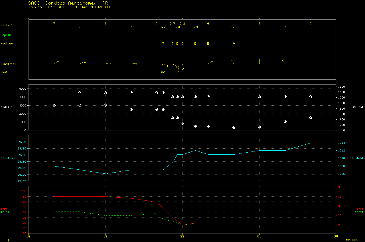
Severe thunderstorms in Argentina
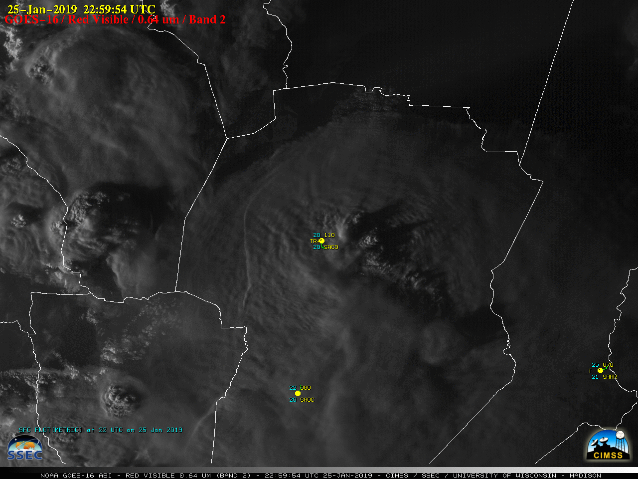
GOES-16 “Red” Visible (0.64 µm) images [click to play MP4 animation]
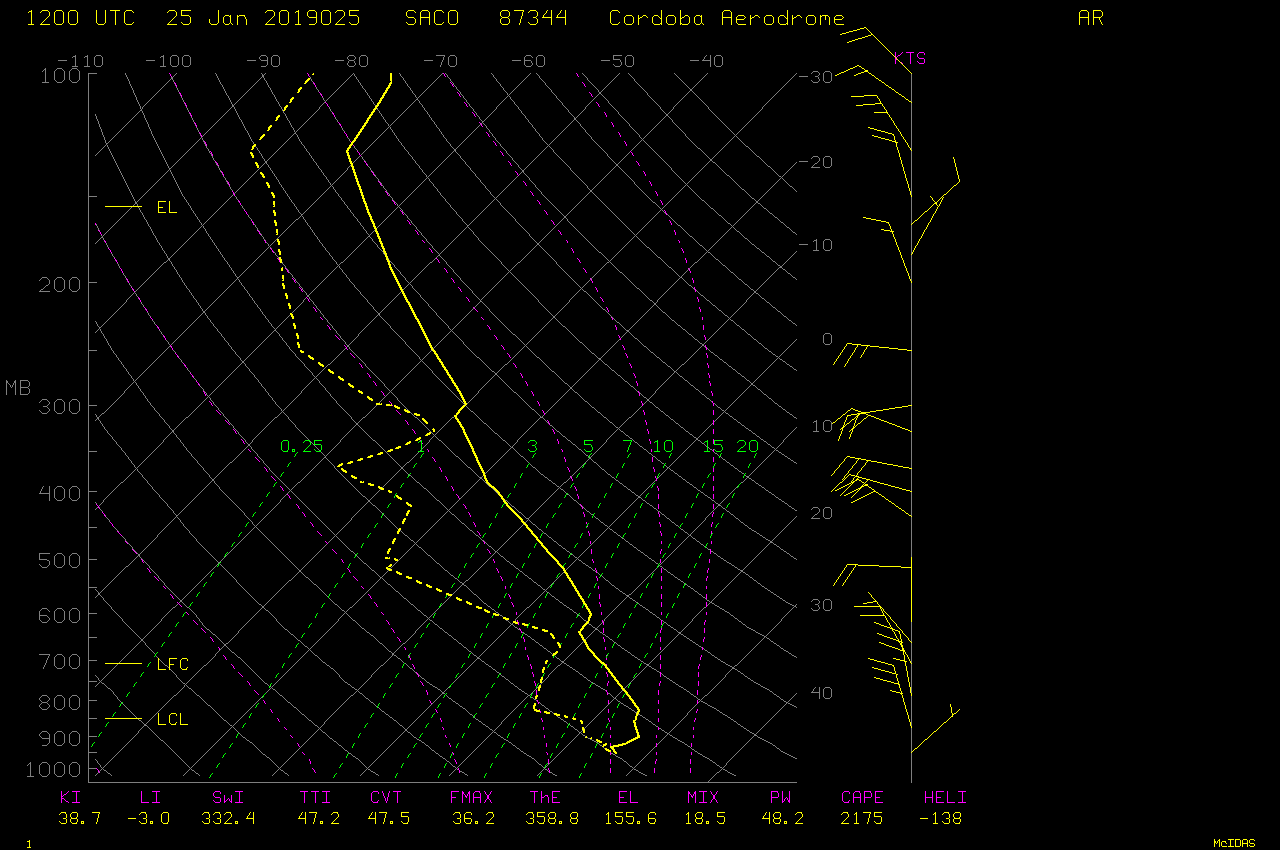
The corresponding GOES-16 “Clean” Infrared Window (10.3 µm) images (below) showed that infrared brightness temperatures of the pulsing thunderstorm overshooting tops were frequently -90ºC or colder (yellow pixels embedded within darker purple). This indicates a significant overshoot of the tropopause, which had an air temperature of -72.1ºC at an altitude of 15.2 km on 12 UTC rawinsonde data. Also note the development of a pronounced cold/warm thermal couplet over the core region of the storm, as an enhanced-V storm top signature formed.
![GOES-16 "Clean" Infrared Window (10.3 µm) images [click to play MP4 animation]](https://cimss.ssec.wisc.edu/satellite-blog/wp-content/uploads/sites/5/2019/01/G16_IR_ARGENTINA_25JAN2019_2019025_225954_GOES-16_0001PANEL.GIF)
GOES-16 “Clean” Infrared Window (10.3 µm) images [click to play MP4 animation]
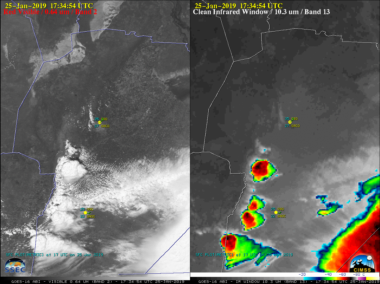
![GOES-16 "Red" Visible (0.64 µm, left) and "Clean" Infrared Window (10.3 µm, right) images [click to play MP4 animation]](https://cimss.ssec.wisc.edu/satellite-blog/wp-content/uploads/sites/5/2019/01/G16_VIS_IR_ARGENTINA_25JAN2019_2019025_225954_GOES-16_0002PANELS.GIF)
GOES-16 “Red” Visible (0.64 µm, left) and “Clean” Infrared Window (10.3 µm, right) images [click to play MP4 animation]
![NOAA-20 VIIRS True Color Red-Green-Blue (RGB) and Infrared Window (11.45 µm) images [click to enlarge]](https://cimss.ssec.wisc.edu/satellite-blog/wp-content/uploads/sites/5/2019/01/190125_1734utc_noaa20_viirs_truecolor_infrared_Argentina_anim.gif)
NOAA-20 VIIRS True Color RGB and Infrared Window (11.45 µm) images at 1734 UTC [click to enlarge]
We observed some of the deepest storms I’ve ever seen on ground-based radar near Córdoba, Argentina today – comparable to some of the strongest ever observed with TRMM @NSF_GEO @RELAMPAGO2018 pic.twitter.com/d0Te1BEPSl
— Steve Nesbitt (@70_dbz) January 25, 2019
URGENTE | Fuerte tormenta en Córdoba Capital
Ahora mismo se registra una fuerte tormenta con ráfagas de viento y fuertes lluvias en la ciudad de Córdoba. [Más información en: https://t.co/0573RLZtPS ] pic.twitter.com/2pwP5DdSrC
— TormentasDelLitoral (@TDLtiempo) January 25, 2019