Hurricane Lane in the eastern Pacific Ocean

NOAA-20 VIIRS Imagery at 1023 UTC on 17 August 2018. Day Night Band Visible (0.7 µm) and I05 Infrared (11.45 µm) imagery are shown (Click to enlarge)
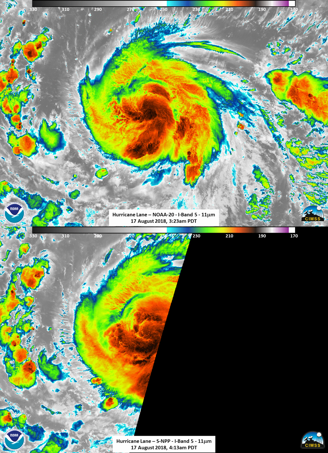
The active eastern Pacific Hurricane season continues, as Lane has formed. Suomi NPP and NOAA-20 overflew the system early on 17 August 2018. The toggle above, from NOAA-20’s VIIRS Instrument, shows both the Day Night Band 0.70 µm visible Image and the 11.45 µm infrared channels. Lack of lunar illumination means that only Earthglow is making clouds visible; a distinct eye is not present. The step animation below between the NOAA-20 11.45 µm infrared and, 50 minutes later, Suomi NPP’s 11.45 µm Infrared, right at the limb of the scan, also show no distinct eye.

VIIRS I05 11.45 µm Infrared Imagery from NOAA-20 (1023 UTC) and Suomi NPP (1113 UTC) on 17 August 2018 (Click to enlarge)
In fact, however, an eye was likely present at this time. As noted in the National Hurricane Center’s 0900 UTC Discussion (Link), “Recent microwave images show a well-defined low-level eye, but this feature is not yet apparent in geostationary satellite images.” AMSR-2 (Advanced Microwave Scanning Radiometer 2) estimates of Convective Precipitation and Surface Rainfall in the toggle below (data from 1003 UTC) show a distinct eye. AMSR-2 is a microwave instrument that flies on JAXA’s GCOM satellite; microwave views of tropical cyclones are able to penetrate the cirrus shield that is commonly present, revealing important information about the low-level structure of a developing system.
GCOM AMSR-2 estimates of convective precipitation and surface rainfall rates at 1003 UTC on 17 August 2018 (Click to enlarge)
Polar Orbit tracks are available here. For the latest information on Hurricane Lane, refer to the National Hurricane Center or to the CIMSS/SSEC Tropical Weather Website. Imagery from Polar Orbiters are available at this site that shows data from an antenna in Honolulu.
Thank you to William Straka, CIMSS, for the imagery.

