Alberto

GOES-16 ABI Band 10 (7.34 µm, low-level water vapor) Infrared imagery, 0822-1632 UTC on 25 May 2018 (Click to animate)
The National Hurricane Center has assigned the name ‘Alberto’ to region of low pressure that has persisted near the northwest Caribbean Sea for the past week. The low-level water vapor (7.34 µm) animation, above, shows abundant mid-tropospheric moisture to the east of the system. Dryer mid-level conditions are apparent west of Alberto: the storm structure is very asymmetric. Sheared systems such as this one typically do not strengthen quickly.
A plot of shear (from this site), below, shows Alberto in a region of westerly shear, with a forecast path towards a region that currently has higher shear — part of which is outflow. However, forecast models suggest the shear along the forecast path will decrease with time. Sea-surface temperatures are warm enough to support tropical cyclones, and the forecast path is towards warmer waters.
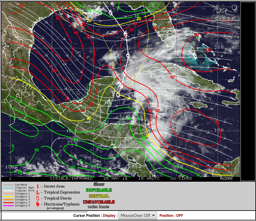
Shear Analysis and Satellite imagery at 1500 UTC on 25 May 2018 (Click to enlarge)
Visible imagery, below, shows one low-level circulation center (others may be masked by the convection to the east) that is south and west of the main convection over the Caribbean.

GOES-16 ABI Visible (0.64 µm) Imagery, 1137-1642 UTC on 25 May 2018 (Click to animate)
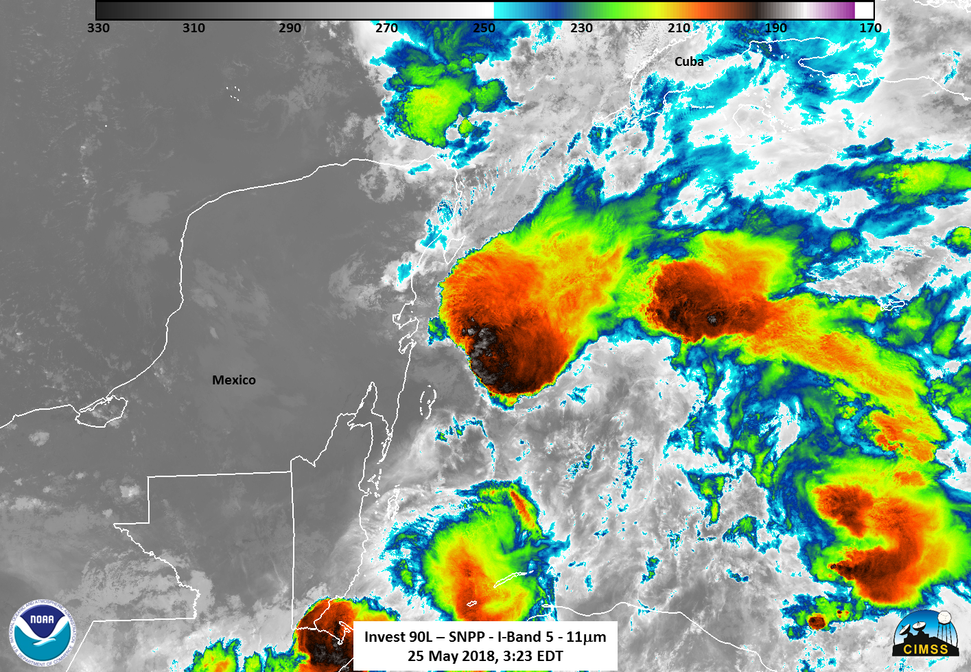
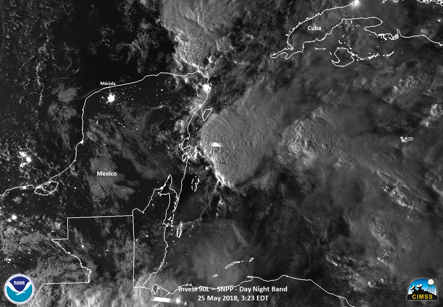
Suomi-NPP overflew this region at 0723 UTC, and a toggle between the Window Channel Infrared (11.45 µm) and the Day Night Band Visible (0.70 µm) imagery (courtesy William Straka) is shown below. The low-level circulation is apparent in the Day Night Band to the west of the deep convection over the northwest Caribbean.
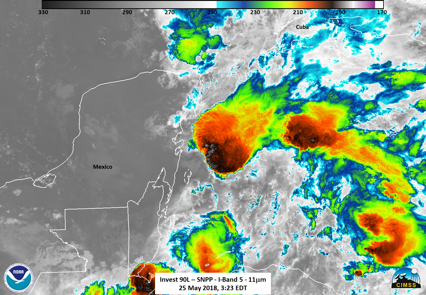
Suomi-NPP VIIRS Infrared (11.45 µm) and Day Night Band Visible (0.70 µm) Imagery at 0735 UTC on 25 May 2018 (Click to enlarge)
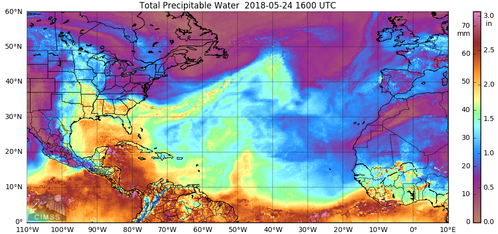
Total Precipitable Water, 1600 UTC on 24 May 2018 to 15 UTC on 25 May 2018 (Click to enlarge)
A MIMIC Total Precipitable Water animation, above, shows abundant moisture over the northwest Caribbean. As Alberto lifts to the north, that moisture will shift north as well, and flooding rains are possible over the southeastern United States. Flood Watches have been raised over Louisiana, Mississippi, Alabama and Georgia (below, from this site).
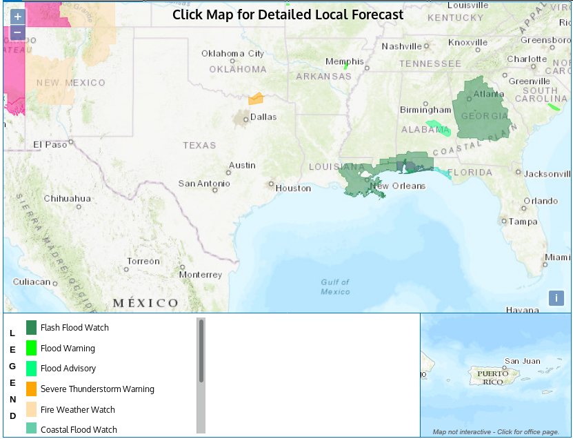
Hazards at 1700 UTC on 25 May 2018 (Click to enlarge)
The Geostationary Lightning Mapper (GLM) on GOES-16 observed lightning in the deep convection to the east of the system center. GLM is overlain on both infrared (top) and visible (bottom) imagery below (animations courtesy Dave Santek, CIMSS). The updating infrared animations are available here. GLM data for this system can also be viewed in RealEarth.
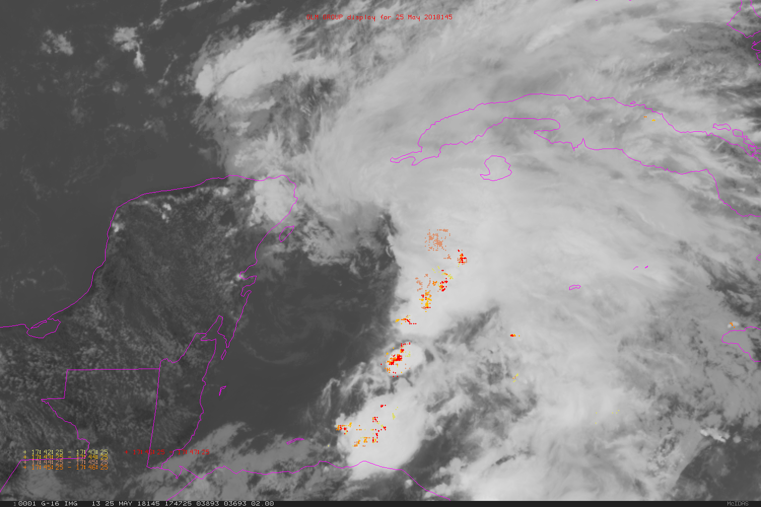
GOES-16 Infrared (10.3 µm) Imagery over Alberto at 5-minute time-steps, 1747 – 1832 UTC, along with GLM observations of group density plotted every minute (See legend in image for times of GLM plots) (Click to enlarge)
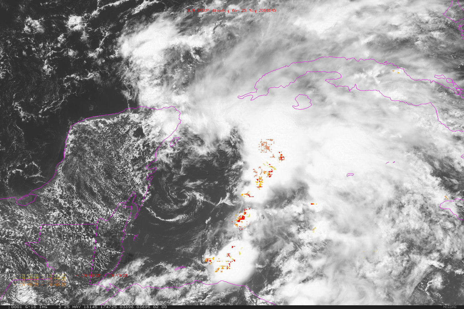
GOES-16 Visible (0.64 µm) Imagery over Alberto at 5-minute time-steps, 1747 – 1832 UTC, along with GLM observations of group density plotted every minute (See legend in image for times of GLM plots) (Click to enlarge)
Updates on this system are sent every six hours from the National Hurricane Center. You can find more information there, or at the CIMSS Tropical Weather Website.