Fires and blowing dust across the Upper Midwest and southern Manitoba
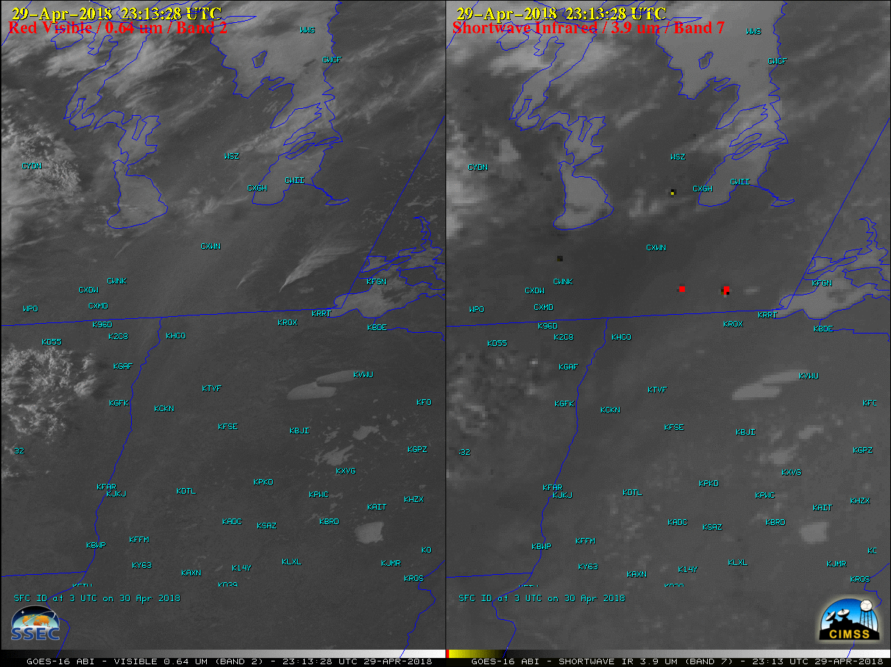
GOES-16 “Red” Visible (0.64 µm, left) and Shortwave Infrared (3.9 µm, right) images, with surface station identifiers plotted in cyan [click to play MP4 animation]
On the Visible images, also note the hazy signature of blowing dust that developed from the northern Red River Valley of North Dakota and Minnesota into southern Manitoba — with winds gusting in excess of 50 knots, the surface visibility dropped to 3 miles at Grafton ND (KGAF) and Winnipeg International Airport (located just northwest of station CXWN in southern Manitoba).
![Time series of surface observation data at Grafton, North Dakota [click to enlarge]](https://cimss.ssec.wisc.edu/satellite-blog/wp-content/uploads/sites/5/2018/04/180429_KGAF_SFCMG.GIF)
Time series of surface observation data at Grafton, North Dakota [click to enlarge]
![Time series plot of surface weather data at Winnipeg, Manitoba [click to enlarge]](https://cimss.ssec.wisc.edu/satellite-blog/wp-content/uploads/sites/5/2018/04/180429_CYWG_SFCMG.GIF)
Time series plot of surface observation data at Winnipeg, Manitoba [click to enlarge]
Dust storm pix taken this afternoon (Julie Helm) near Drayton ND. Wind Advisory continues thru 8pm. #ndwx #mnwx pic.twitter.com/IyksXL8dof
— NWS Grand Forks (@NWSGrandForks) April 29, 2018