A prescribed burn in Montana, as viewed from GOES-15, GOES-16 and GOES-13
![GOES-15 (left), GOES-16 (center) and GOES-13 (right) Shortwave Infrared (3.9 µm) images, with plots of hourly surface reports [click to play MP4 animation]](https://cimss.ssec.wisc.edu/satellite-blog/wp-content/uploads/sites/5/2018/01/G15_G16_G13_SWIR_MT_FIRE_02JAN20187_960x427_B272_2018002_184500_0003PANELS_00050.GIF)
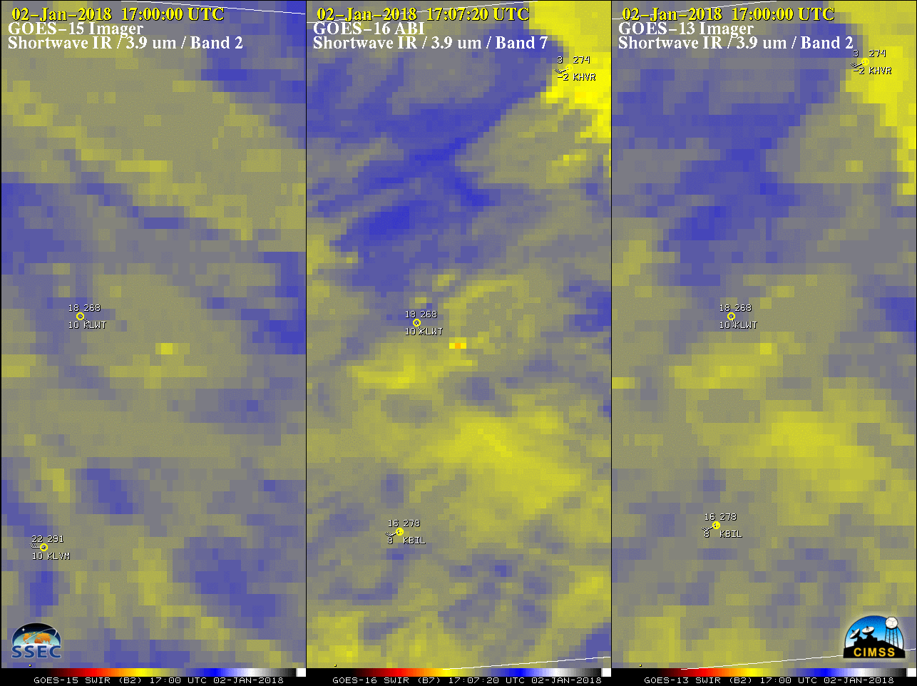
GOES-15 (left), GOES-16 (center) and GOES-13 (right) Shortwave Infrared (3.9 µm) images, with plots of hourly surface reports [click to play MP4 animation]
Due to the improved spatial resolution of the GOES-16 3.9 µm Shortwave Infrared band (2 km at satellite sub-point, vs 4 km for GOES-15 and GOES-13) and the more frequent image scans (routinely every 5 minutes over CONUS for GOES-16), an unambiguous thermal anomaly or fire “hot spot” was first evident on GOES-16 at 1707 UTC, just southeast of Lewistown (station identifier KLWT). The GOES-16 fire thermal signature was also hotter (black pixels) compared to either GOES-15 or GOES-13.