Contrails over Virginia
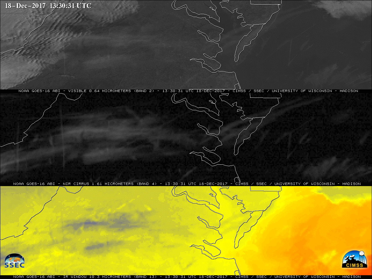
GOES-16 “Red” Visible (0.64 µm, top), Near-Infrared “Cirrus (1.38 µm, center) and “Clean” Infrared Window (10.3 µm, bottom) images [click to play animation]
A Cirrus band is also available on the MODIS instrument (aboard Terra and Aqua) as well as the VIIRS instrument (aboard Suomi NPP and NOAA-20) — a toggle between the Terra MODIS Cirrus (1.375 µm), Infrared Window (11.0 µm) and Visible (0.65 µm) images at 1607 UTC (below) again showed that contrails and other ice crystal cloud features were better highlighted on the Cirrus image.
![Terra MODIS Cirrus (1.375 µm), Infrared Window (11.0 µm) and Visible (0.65 µm) images [click to enlarge]](https://cimss.ssec.wisc.edu/satellite-blog/wp-content/uploads/sites/5/2017/12/171218_1607utc_terra_modis_Cirrus_InfraredWindow_Visible_anim.gif)
Terra MODIS Cirrus (1.375 µm), Infrared Window (11.0 µm) and Visible (0.65 µm) images [click to enlarge]
![Rawinsonde profile from Washington Dulles Airport in Virginia [click to enlarge]](https://cimss.ssec.wisc.edu/satellite-blog/wp-content/uploads/sites/5/2017/12/171218_12UTC_KIAD_RAOB.GIF)
Rawinsonde profile from Washington Dulles Airport in Virginia [click to enlarge]