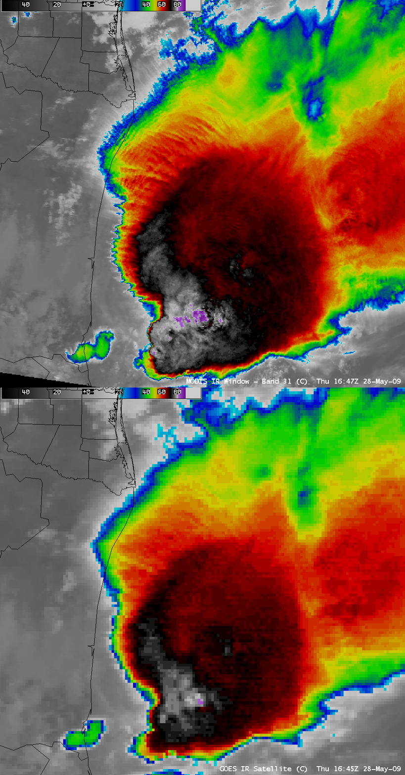
Convection in the Gulf of Mexico
AWIPS images of the 1-km resolution MODIS 11.0 µm and the 4-km resolution GOES-12 10.7 µm “IR window” channels (above) showed a cluster of very cold cloud top temperatures (-88º C on MODIS, and -82º C on GOES, violet colors) associated with deep convection over the northwestern Gulf of Mexico on 28 May 2009. Also of interest is the appearance of both transverse banding and an orthogonal gravity wave structure in the northwestern portion of the anvil edge (near the Mexico border).
A comparison of the MODIS 0.6 µm “visible channel”, 1.3 µm “cirrus detection channel”, 6.7 µm “water vapor channel”, and the 11.0 µm “IR window channel” (below) showed that the various satellite channels differed in their ability to detect the true western and northwestern extent of the cirrus anvil edge.


