Santa Ana winds in Southern California
![GOES-16 Land Surface Temperature product, with hourly surface reports plotted in white [click to enlarge]](https://cimss.ssec.wisc.edu/satellite-blog/wp-content/uploads/sites/5/2017/10/LST-VenturaCounty-Overnight.gif)
GOES-16 Land Surface Temperature product, with hourly surface reports plotted in white [click to enlarge]
The GOES-16 Land Surface Temperature product (above, courtesy of Jordan Gerth, CIMSS) revealed a dramatic increase in the land surface temperature (or surface “skin temperature”) following the onset of easterly/northeasterly Santa Ana winds in Southern California’s Ventura County during the overnight and early morning hours of 24 October 2017. Between 06-14 UTC (11 PM-7 AM local time), the surface air temperature increased from 66-91ºF at Oxnard (KOXR), 75-90ºF at Point Mugu (KNTD) and 77-91ºF at Camarillo (KCMA). Surface wind gusts of 32 mph were recorded at Camarillo during this period, although 64 mph was reported at South Mountain (elevation 2350 feet)..
A warming trend in that same area was also evident in the MODIS Land Surface Temperature product (below), during the time between the Terra (0539 UTC) and Aqua (0951 UTC) overpasses — LST values ranged from the low 60s F (lighter shades of yellow) to the upper 80s and low 90s F (darker shades of red) in the higher elevations.
A similar warming signature was seen over Ventura County on GOES-16 Shortwave Infrared (3.9 µm) images (below) — although an even more pronounced Santa Ana wind warming signal was evident farther to the southeast over Orange County (where winds gusted as high as 69 mph); note how the warmer orange-enhanced infrared brightness temperatures surged southwestward toward the coast. A number of record high temperatures resulted from this Santa Ana wind event:Final record highs for today across SW CA. Some record highs will be possible on Wed as well. #LAHeat #LAWeather #cawx #SoCal pic.twitter.com/gwalGarQmL
— NWS Los Angeles (@NWSLosAngeles) October 25, 2017

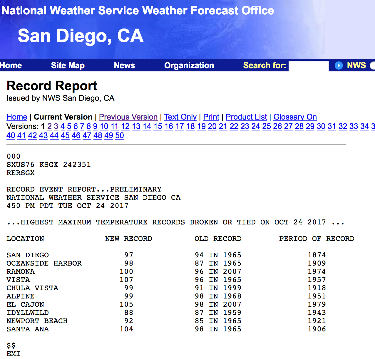
Record high temperatures in the San Diego, California area
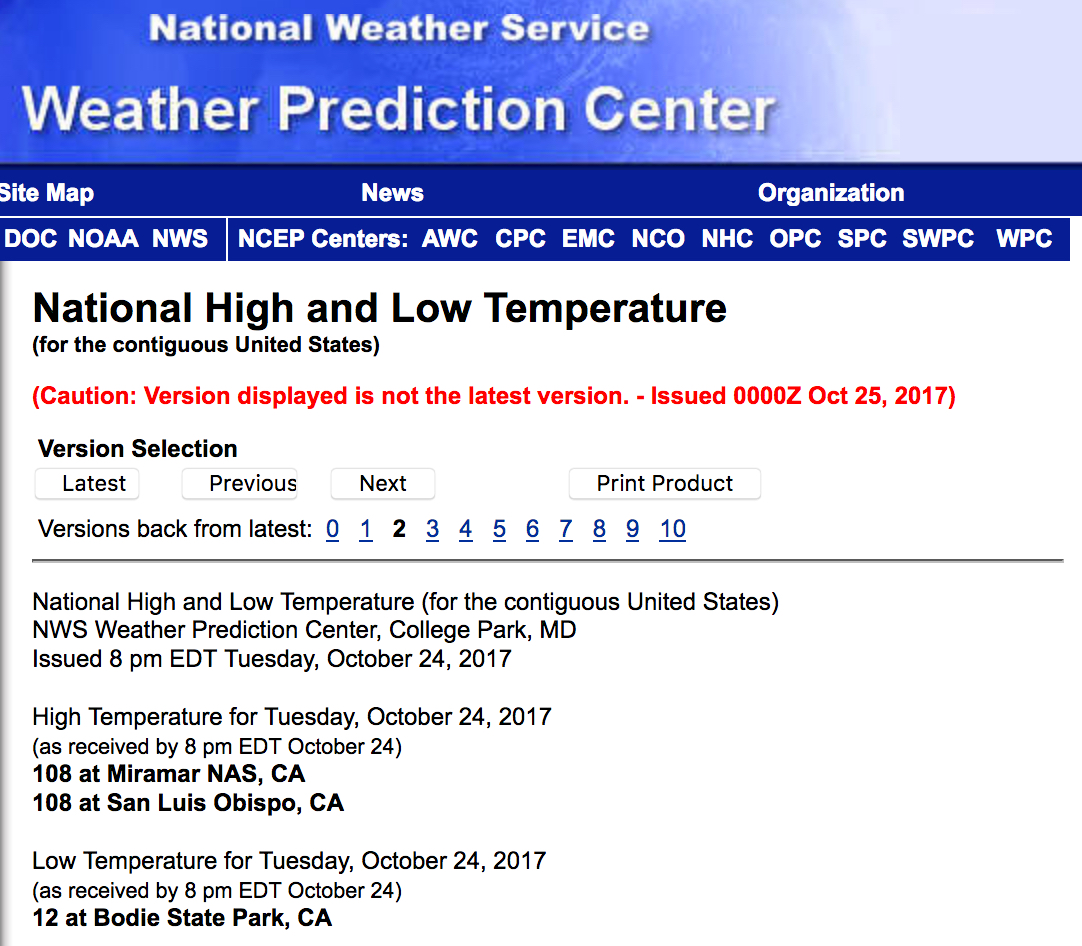
In fact, the highest temperature in the Lower 48 states that day was 108ºF at Miramar Naval Air Station and San Luis Obispo, California.

National Temperature extremes


![Terra and Aqua MODIS Land Surface Temperature product [click to enlarge]](https://cimss.ssec.wisc.edu/satellite-blog/wp-content/uploads/sites/5/2017/10/171024_modis_land_surface_temperature_SoCal_anim.gif)
![GOES-16 Shortwave Infrared (3.9 µm) images [click to play MP4 animation]](https://cimss.ssec.wisc.edu/satellite-blog/wp-content/uploads/sites/5/2017/10/SantaAna_B07_COU_CONUS_logos_800x1200_B7_2017297_080220_0001PANEL_00049_labels.gif)