Hurricane Ophelia
![GOES-13 Visible (0.63 µm, left) and Infrared Window (10.7 µm, right) images, with hourly surface reports (in metric units) plotted in yellow [click to animate]](https://cimss.ssec.wisc.edu/satellite-blog/wp-content/uploads/sites/5/2017/10/171014_goes13_visible_infrared_Ophelia_anim.gif)
GOES-13 Visible (0.63 µm, left) and Infrared Window (10.7 µm, right) images, with hourly surface reports (in metric units) plotted in yellow [click to animate]
#Ophelia has shattered the record for northeastern-most forming Cat 3 in the Atlantic and is the easternmost overall. League of its own. pic.twitter.com/sZrHap5z1f
— Brenden Moses (@Cyclonebiskit) October 14, 2017
A DMSP-17 SSMIS Microwave (85 GHz) image (below) also revealed a circular eye structure.
![DMSP-17 SSMIS Microwave (85 GHz) image [click to enlarge]](https://cimss.ssec.wisc.edu/satellite-blog/wp-content/uploads/sites/5/2017/10/171014_0858utc_dmsp17_ssmis_microwave_Ophelia.jpg)
DMSP-17 SSMIS Microwave (85 GHz) image [click to enlarge]
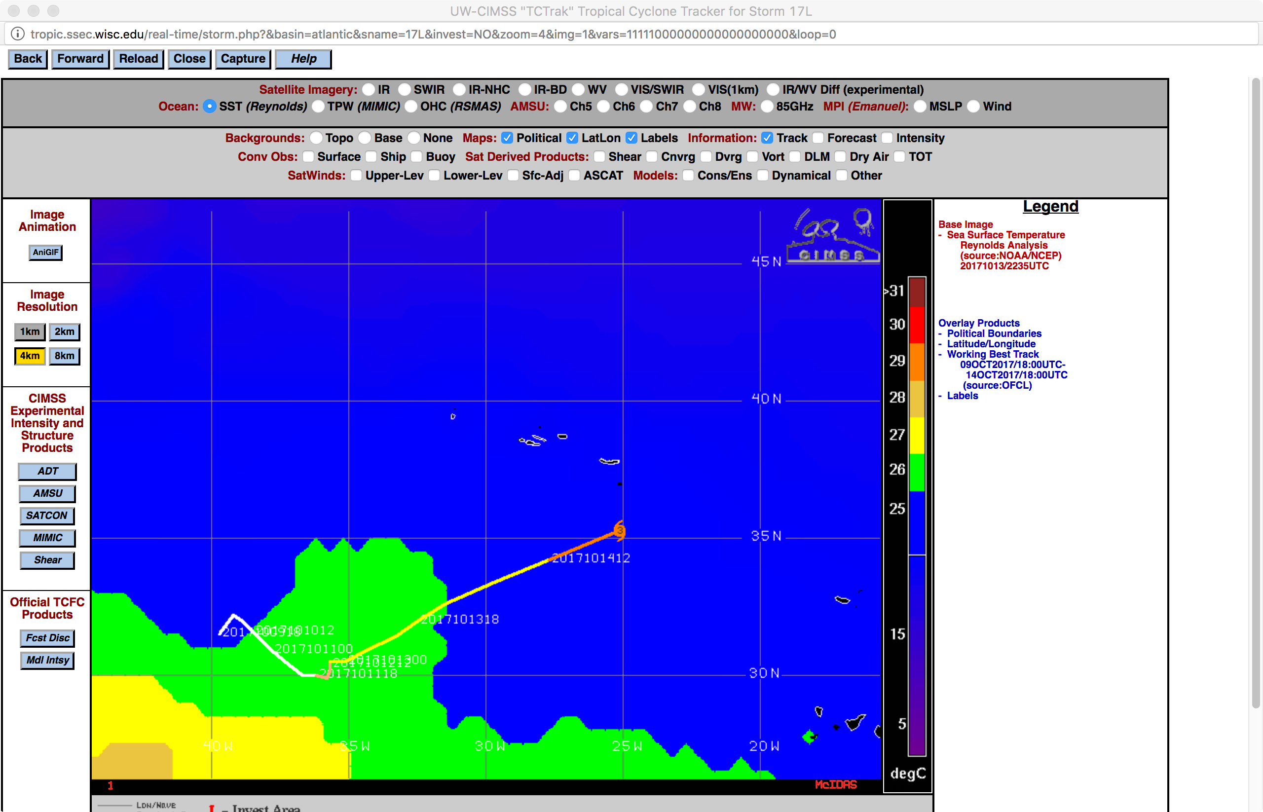
One factor that might have aided this increase of intensity was the recent passage of Ophelia through an environment of higher Maximum Potential Intensity (reference), where maximum wind speed values of 100 knots resided (below).
![Maximum Potential Instability wind speed plot from 13 October, with the track of Ophelia as of 18 UTC on 14 October [click to enlarge]](https://cimss.ssec.wisc.edu/satellite-blog/wp-content/uploads/sites/5/2017/10/171013_1300utc_mpi_wind_speed_Ophelia.jpg)
Maximum Potential Instability wind speed plot from 13 October, with the track of Ophelia as of 18 UTC on 14 October [click to enlarge]