Standing wave clouds over northeastern Minnesota
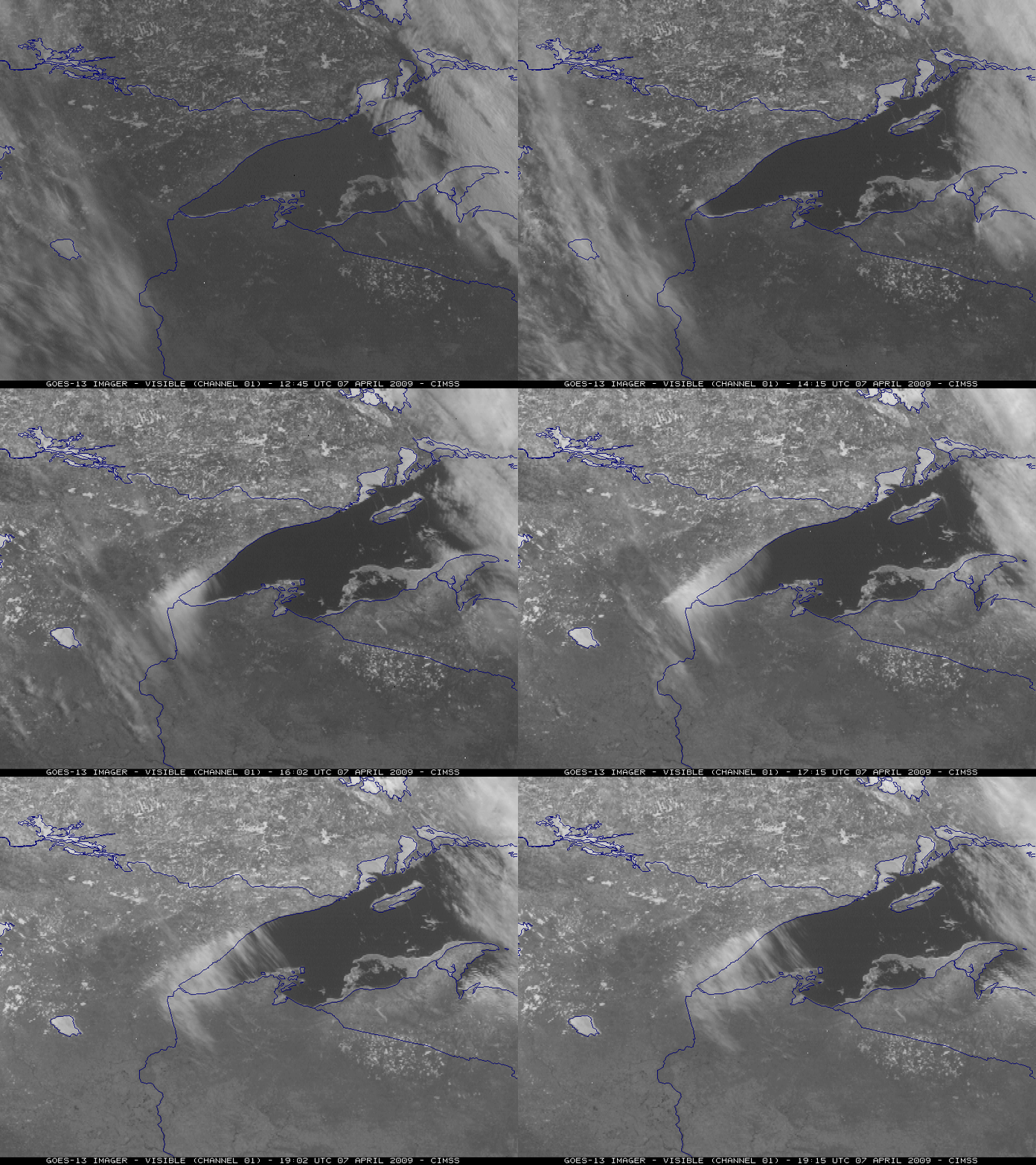
GOES-13 visible images (above) displayed the formation of a “standing wave” cloud feature along the Lake Superior shoreline of northeastern Minnesota on 07 April 2009. In addition to the wave cloud, note that you can also see the southeastward drift of lake ice toward the shoreline of the Upper Peninsula of Michigan, driven by strong northwesterly surface winds that persisted during the day (gusting as high as 29 knots at Hancock MI).
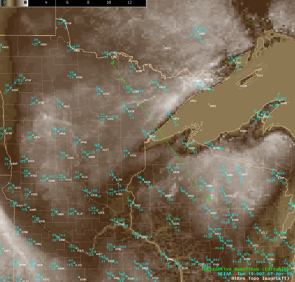
This standing wave cloud feature was formed by a vertically-propagating internal gravity wave that resulted from the interaction of the northwesterly flow with the topography of the shoreline (below) — the terrain quickly drops from an elevation of about 2000 feet above sea level (over northeastern Minnesota) to about 600 feet above sea level (over Lake Superior) in a very short distance.
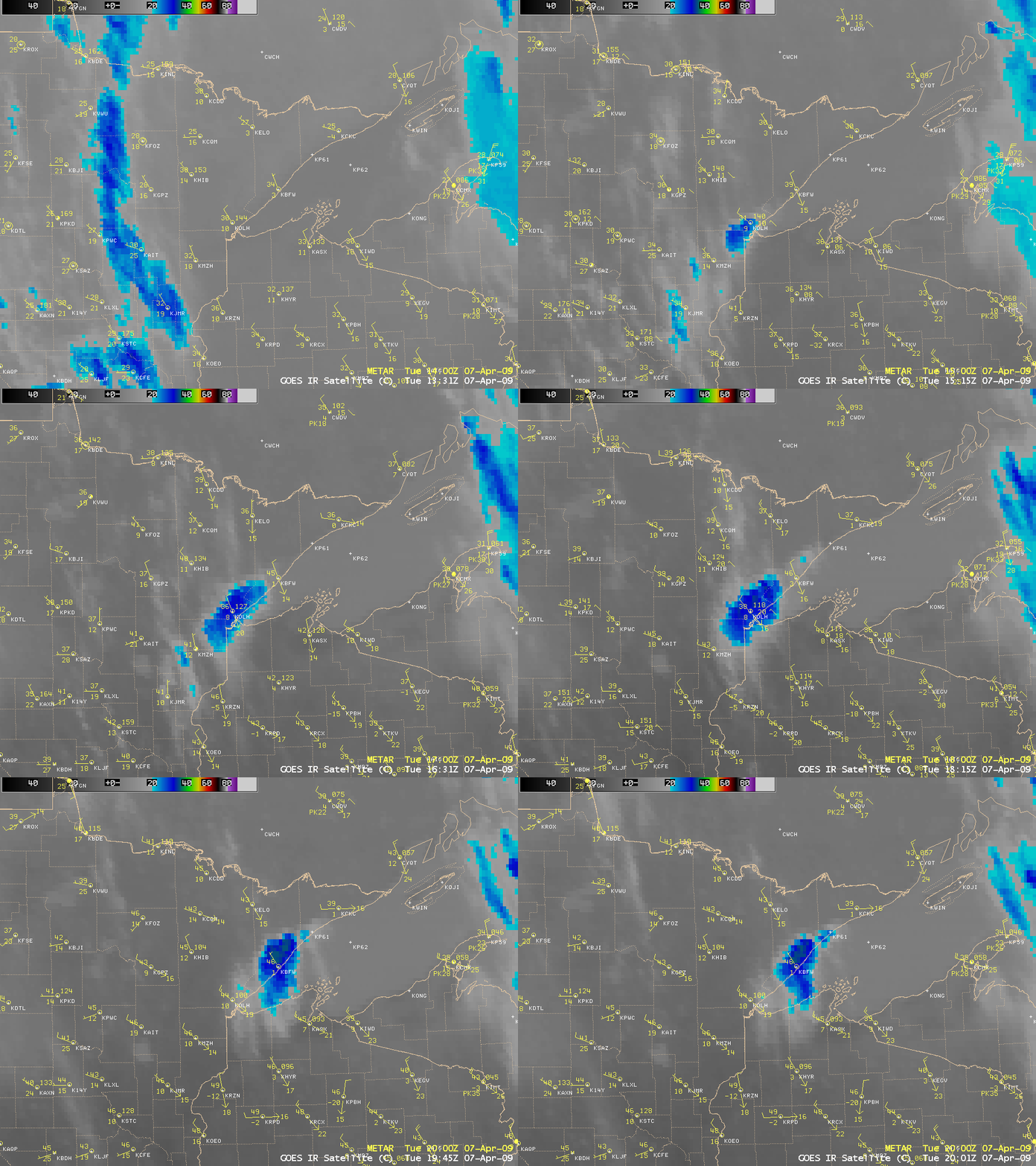
GOES-12 10.7 µm IR images (below) showed that the cloud top temperatures associated with this standing wave cloud feature quickly cooled into -20º to -30º C range (cyan to blue colors), getting as cold as -34º C at 19:31 UTC.
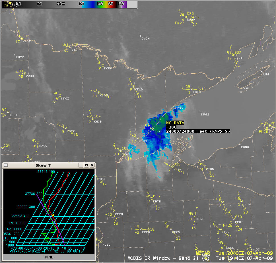
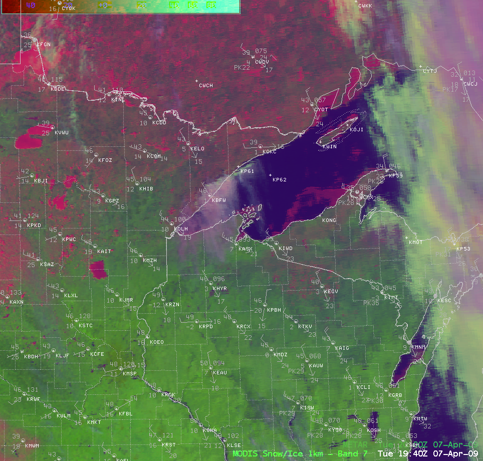
A 1-km resolution MODIS 11.0 µm IR image (below) displayed a minimum cloud top brightness temperature of -38º C at 19:40 UTC. This coldest IR temperature corresponded to an altitude of about 24,000 feet, according to rawinsonde data from International Falls, Minnesota (INL).
However, there appeared to be a veil of thin high-level cirrus clouds streaming southward off the top of the standing wave cloud band, which were likely at a much higher altitude than 24,000 feet — but the satellite was getting a strong thermal signal from the warmer surfaces and mid-level cloud tops that were located directly below the cirrus clouds, which was making the actual cirrus cloud top brightness temperatures appear significantly warmer on the IR image. A MODIS Red/Green/Blue (RGB) composite image — using the MODIS visible, near-IR “snow/ice channel”, and the “IR window channel” images –Â helps to get a better sense of the thin ice crystal cirrus clouds (lighter purple in color) that existed at higher altitudes compared to the thicker supercooled water droplet clouds (brighter white colors) that were right along the Minnesota / Lake Superior shoreline. Snow cover and/or frozen lakes appeared as brighter pink features on the RGB image.
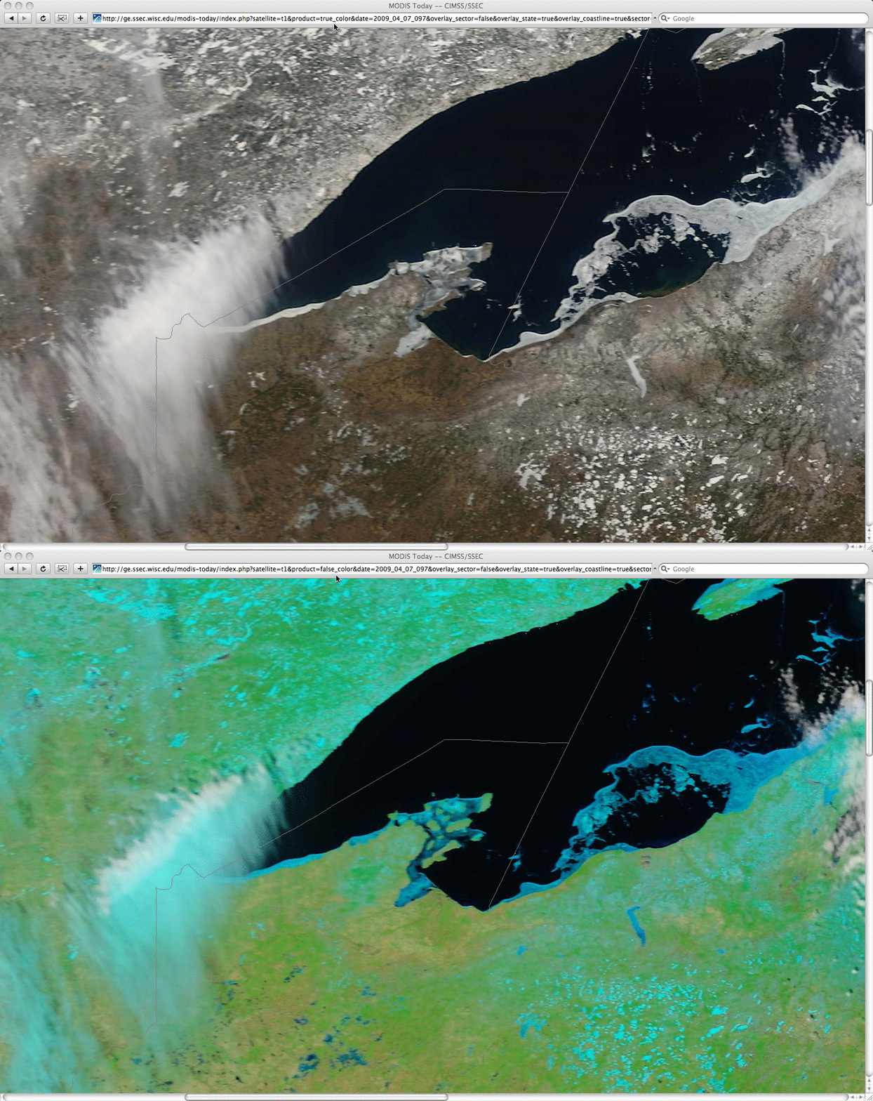
The higher-altitude cirrus clouds are even more obvious in a comparison of 250-meter resolution MODIS “true color” and “false color” images from the SSEC MODIS Today site (below). On the false color image, snow cover, ice, and ice crystal clouds appear as varying shades of cyan (while supercooled water droplet clouds appear as brighter white features).
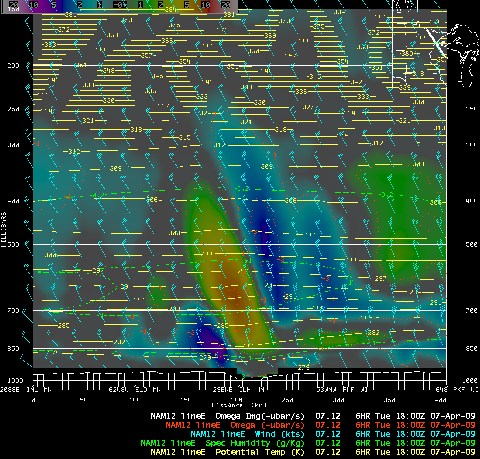
A northwest-to-southeast oriented cross section of NAM12 model fields depicted a deep pocket of positive Omega (upward vertical motion, yellow to orange colors) that corresponded to the cloud band along the Minnesota Lake Superior shoreline (below). Note that this Omega feature was vertically tilted in an “upshear” direction, and extended upward to around the 400 hPa pressure level.
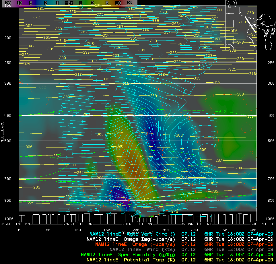
Another slice of NAM12 model fields along that same NW-SE cross section line showed a distinct region where there was a strong upward component of the ageostrophic vertical circulation (below), which was likely the initial forcing leading to the formation of the standing wave cloud band seen on satellite imagery.


