Why 1-minute data matters: Beavertails
GOES-14 Visible (0.6263 µm) Imagery, 04 June 2015. 1-minute imagery on the left, 5-minute imagery on the right (click to play animation)
Beavertails are ephemeral cloud features that form in the inflow of supercell thunderstorms. They are horizontally long and roughly parallel to the inflow warm front. Its appearance (and presence) is affected by and influences inflow into the storm, and by inference, it affects radar returns. That is — a change in the Beavertail cloud can precede a change in radar. Accurate detection of this cloud type, then, aids the understanding of evolving storm morphology. The animation above shows a severe convective system over southeastern Wyoming, viewed at 1-minute intervals (Left) and at 5-minute intervals. Beavertails that form persist for about 30 minutes, so 5-minute imagery will resolve them; however, the resolution of the 1-minute data is far better to monitor the small changes in size and shape that are related to storm inflow.
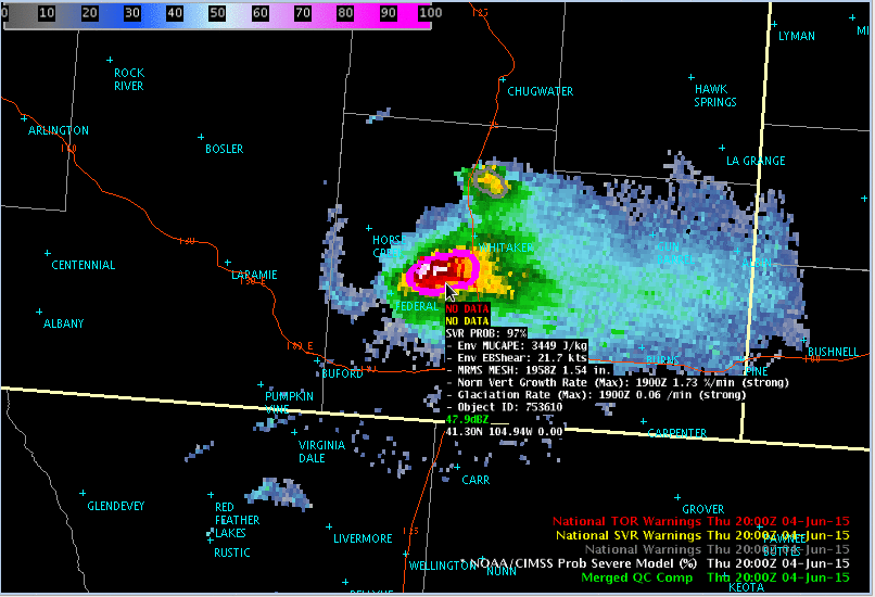
Do beavertail changes affect the radar? The animation below shows the ProbSevere product readout from 2000-2220 UTC (Courtesy John Cintineo, CIMSS) (Click here for a slow animation). (Click here for an animation (from 1918-2058 UTC) that includes warning polygons). The increases and decreases in the MRMS MESH appear unrelated to the formation/decay of the various beavertails.
This storm was captured by different chasers. This YouTube video from Scott Longmore shows the evolution of the convective system from the ground. Hat/tip to Jennifer Laflin, NWS EAX and Chad Gravelle, OPG, for alerting us to this case.


