Warm and cold conveyor belts

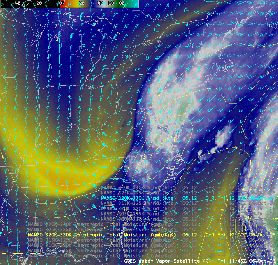
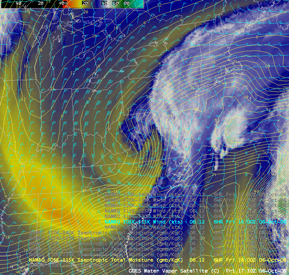
A deep cyclone was intensifying over the Mid-Atlantic states on 06 October; this storm was eventually responsible for heavy rains and high winds that caused flooding over parts of Virginia. The AWIPS GOES water vapor channel image at 11:45 UTC (above) showed the warm conveyor belt as a plume of moist southwesterly flow within the 320-330 K isentropic layer. The water vapor image 6 hours later (at 17:30 UTC, below) reveals the cold conveyor belt emerging at lower altitudes (within the 305-315 K isentropic layer) and moving westward as the cyclone deepened (11 MB QuickTime animation).


