Strong winds over the Upper Midwest region
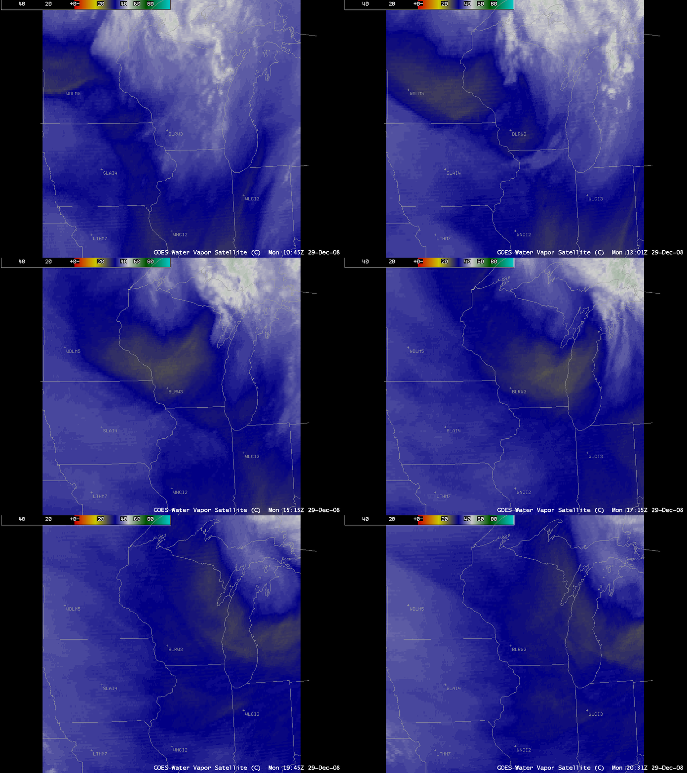
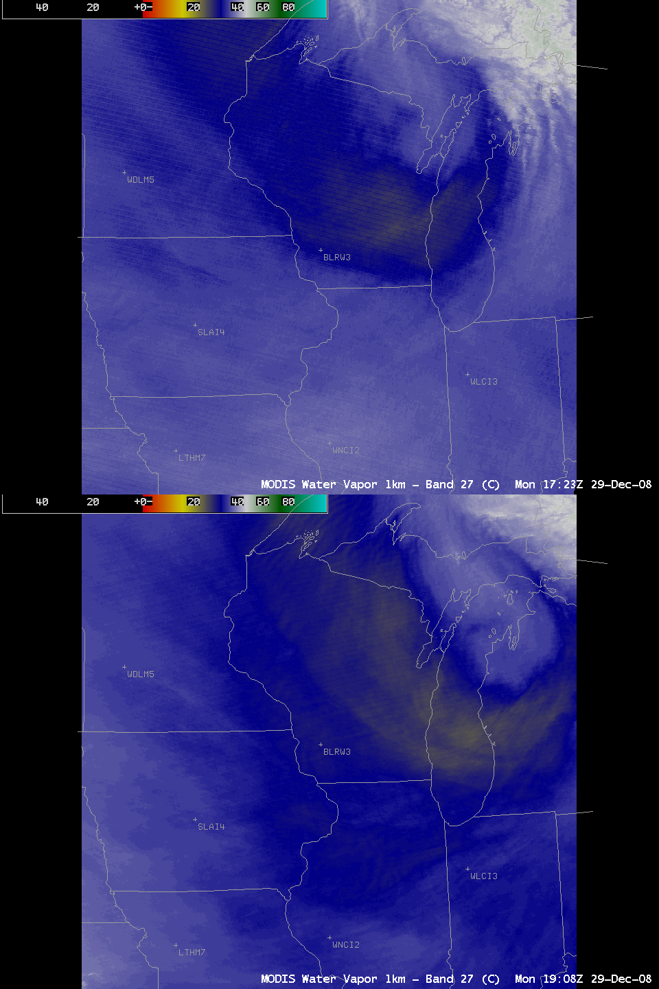
A potent shortwave trough was propagating eastward across the Upper Midwest region on 29 December 2008, and AWIPS images of the GOES-13 6.5 µm “water vapor channel” (above) showed a well-defined signature of mid-level dry air (yellow colors) moving rapidly east-southeastward over parts of Minnesota, Wisconsin, and Lower Michigan during the morning and afternoon hours. MODIS 6.7 µm water vapor channel images from consecutive overpasses of the Terra and Aqua satellites (below) showed a similar signature, albeit with a slightly larger areal coverage of the “dry air” pocket.
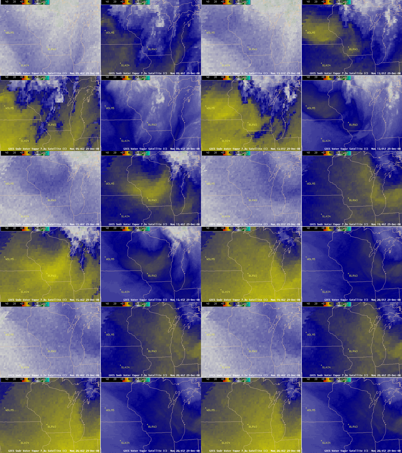
A comparison of the three GOES-13 Sounder water vapor channels (6.5 µm, 7.0 µm, and 7.4 µm) with the GOES-13 Imager 6.5 µm water vapor channel (below) revealed that a more distinct “dry air signature” (indicated by the brighter yellow colors) was evident when examining the Sounder 7.0 µm and 7.4 µm channel imagery — those water vapor channel’s weighting functions peak at lower altitudes than either the Sounder 6.5 µm or the Imager 6.5 µm water vapor channels.
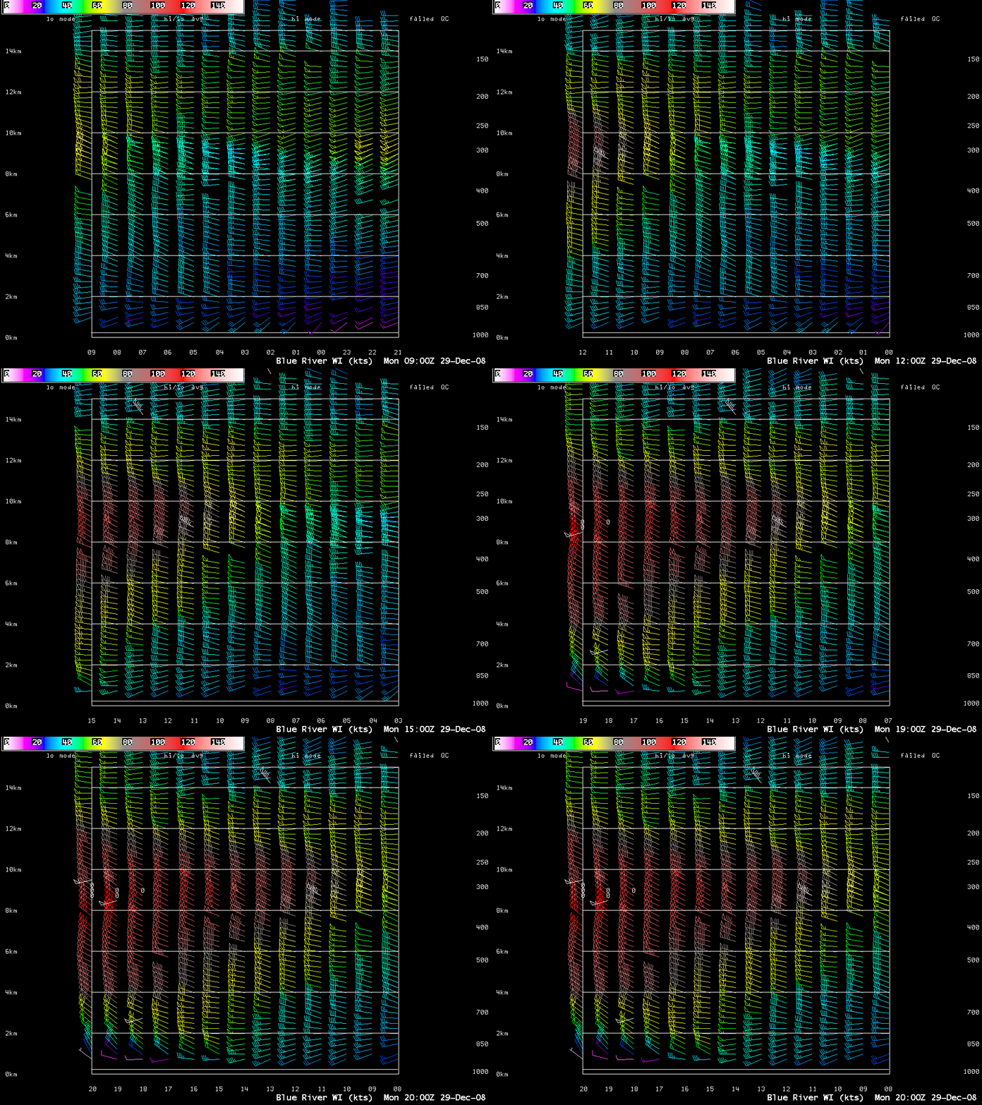
Note that the core of this dry air pocket appeared to have moved over the NOAA Wind Profiler site at Blue River in southwestern Wisconsin (station identifier BLRW3) after about 15:00 UTC — and the wind profiler data at that site (below) revealed a nice “descending jet” signature from the late morning into the early afternoon hours, with wind speeds of 100 knots and higher (red colors) deepening and moving downward from around the 10 km altitude at 13:00 UTC to near the 4-6 km altitude by 20:00 UTC. As the high momentum aloft (associated with the fast-moving mid-tropospheric dry air seen on the water vapor imagery) was gradually transferred downward to lower altitudes, the surface winds gusted to 51 mph at Austin in southern Minnesota (at 15:15 UTC), 47 mph at Sheboygan in eastern Wisconsin (at 18:24 UTC), and 65 mph at Charlevoix in northern Lower Michigan (at 00:25 UTC).
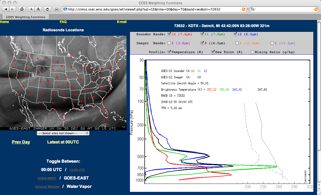
The core of the mid-tropospheric dry air had moved over southern Lower Michigan by late afternoon, and the GOES-13 Sounder and Imager water vapor channel weighting functions calculated using the 00:00 UTC rawinsonde data from Detroit (below) indicated that the layer of radiation being detected by the Sounder 7.4 µm channel was peaking at a very low altitude (red plot), with a significant component of that radiation likely coming from the surface.
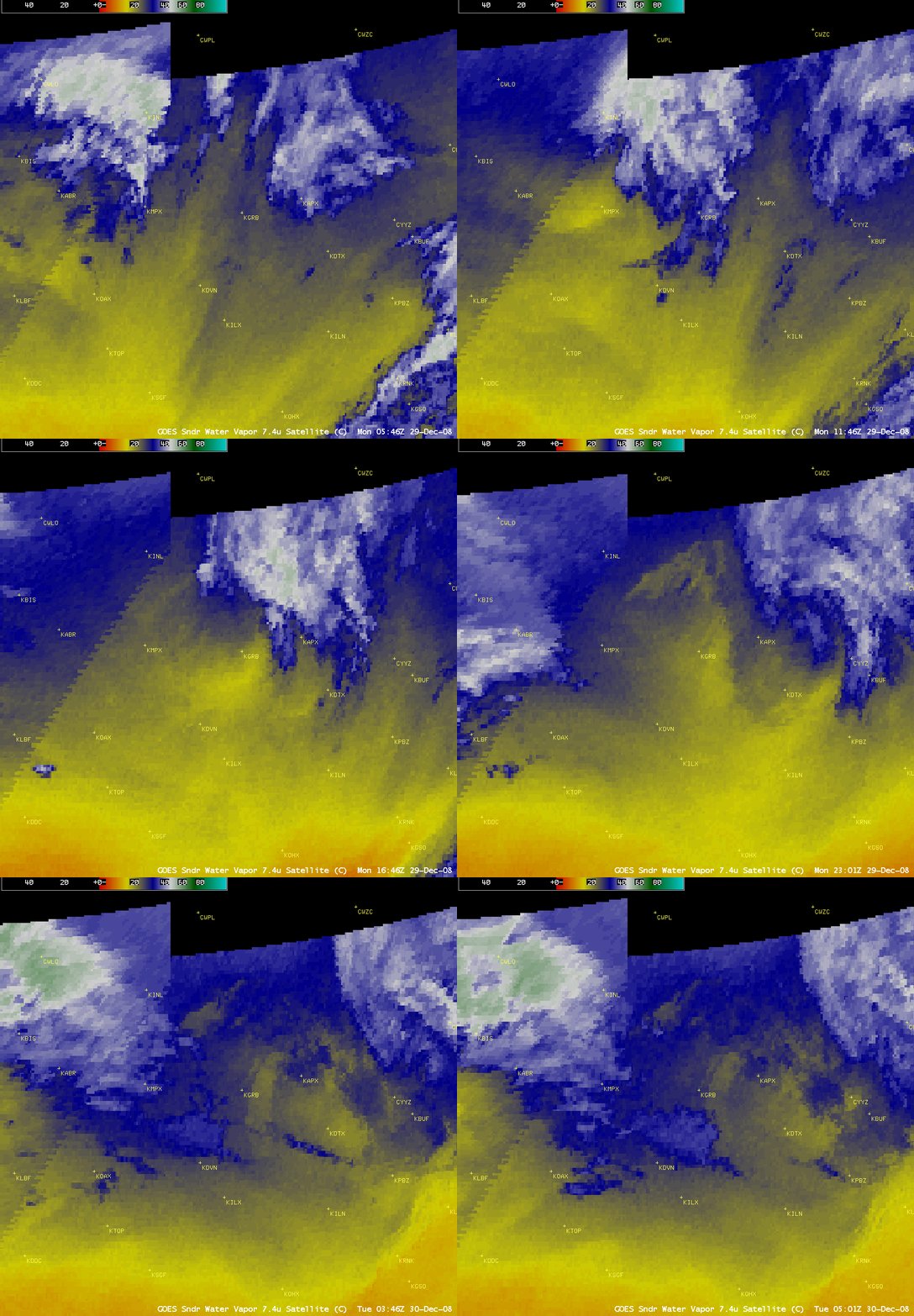
It is interesting to note that an animation of the GOES-13 Sounder 7.4 µm water vapor channel imagery with the map overlay removed (below) displayed a clear signature of the outline of portions of Lake Superior and Lake Michigan after the driest air had moved over the region — the strong thermal signature of the “cold land / warmer water” surface boundary was able to reach the satellite, since there was very little middle and upper tropospheric water vapor present to attenuate the signal.


