Reno, Nevada radar dome failure
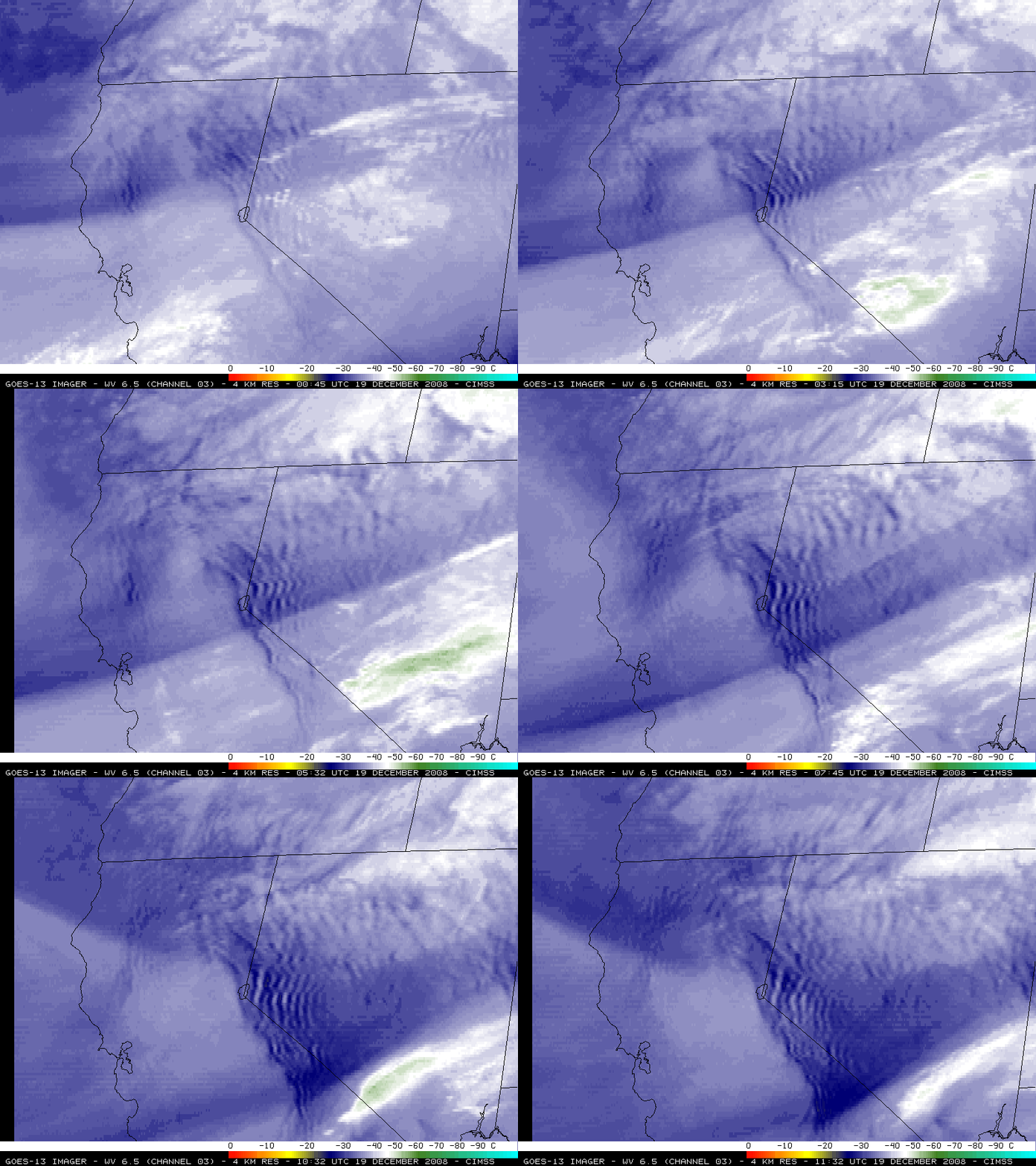
Strong winds gusting to around 140 mph (63 m s-1) caused damage to the Reno/Virginia Peak radar in western Nevada at around 10:30 UTC on 19 December 2008. GOES-13 images of the 4-km resolution 6.5 µm “water vapor channel” (above) revealed a large area of “lee waves” immediately downwind of the Sierra Nevada Range — intense vertical motions associated with these lee waves were producing strong bands of subsidence (indicated by the darker blue to yellow color enhancement on the water vapor imagery), which were likely contributing to the strong wind gusts at the surface.
The National Weather Service forecast office at Reno captured an AWIPS image of the 1-km resolution MODIS 6.7 µm water vapor channel (below) about 4 hours prior to the time of the radar damage. Reno is one of the NWS forecast offices that receives the MODIS product suite that CIMSS distributes in AWIPS format.
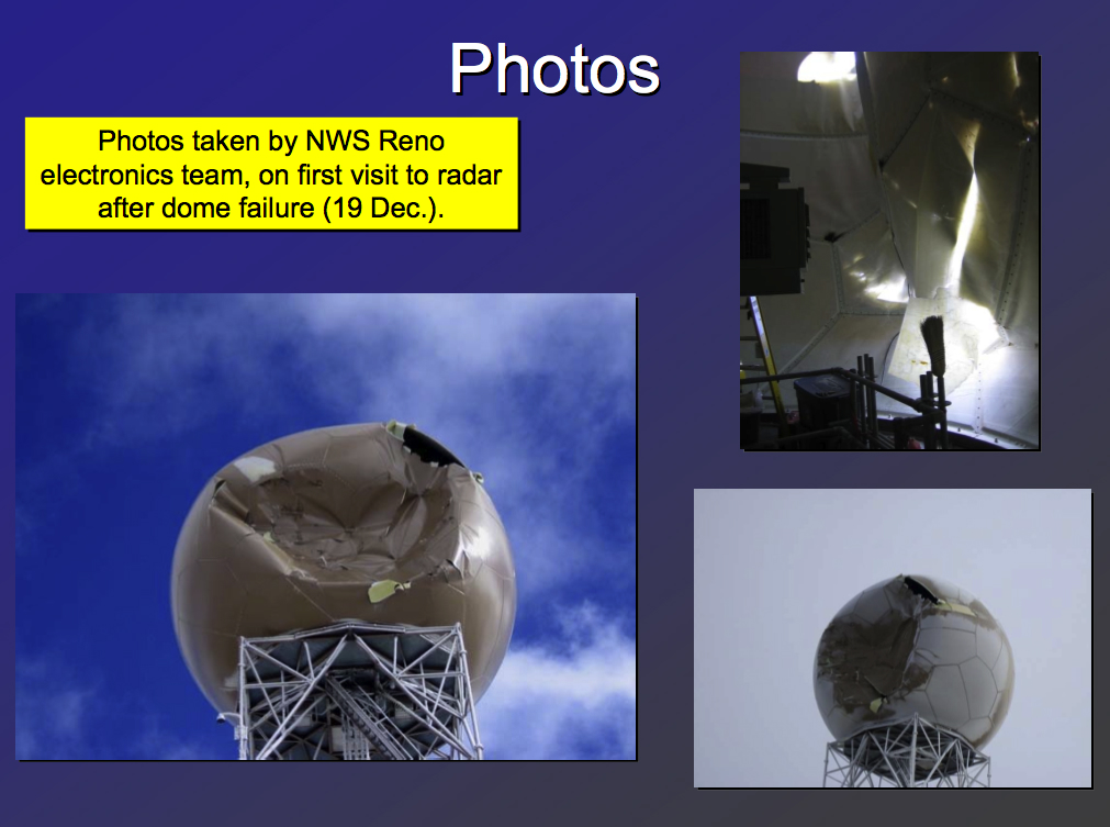
The photos below (from the National Weather Service forecast office at Reno) show the damage suffered by the radome that encloses the radar antenna.
— 25 DECEMBER UPDATE —
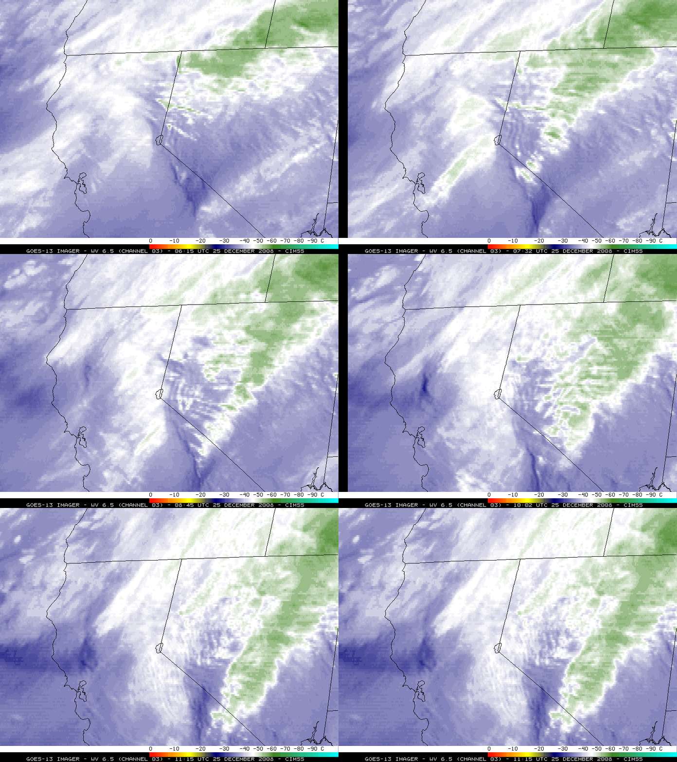
Another round of strong winds brought gusts to 95 mph on 25 December 2008, which caused even more damage to the radome and the actual radar antenna structure. GOES-13 water vapor images (below) again showed the presence of lee waves in the region for several hours prior to the period of the peak winds (which occurred around 10:15 UTC) — however, the arrival of dense cirrus clouds eventually masked the lee wave signature around the time of the additional radar damage.


