“Lake-effect clouds” in Montana and North Dakota
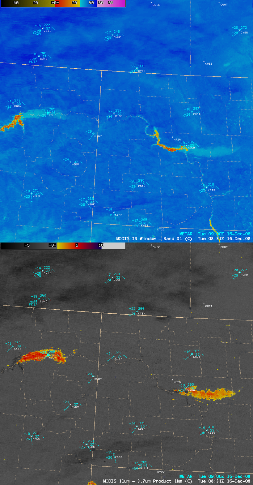
Even though very cold arctic air had invaded much of the north-central US (minimum temperatures on the morning of 15 December were -33º F at Havre, Montana and -28º F at Bottineau, North Dakota), the deeper man-made lakes (created by dams) along the Missouri River remained unfrozen on 16 December 2008. AWIPS images of the MODIS fog/stratus product and the 11.0 µm IR window (above) revealed long plumes of supercooled water droplet clouds (MODIS Cloud Phase product) streaming eastward from the relatively warm lakes — the cloud plumes were enhanced with yellow to orange colors on the fog/stratus product image, and the warm lakes were enhanced with yellow to orange colors on the IR window image.
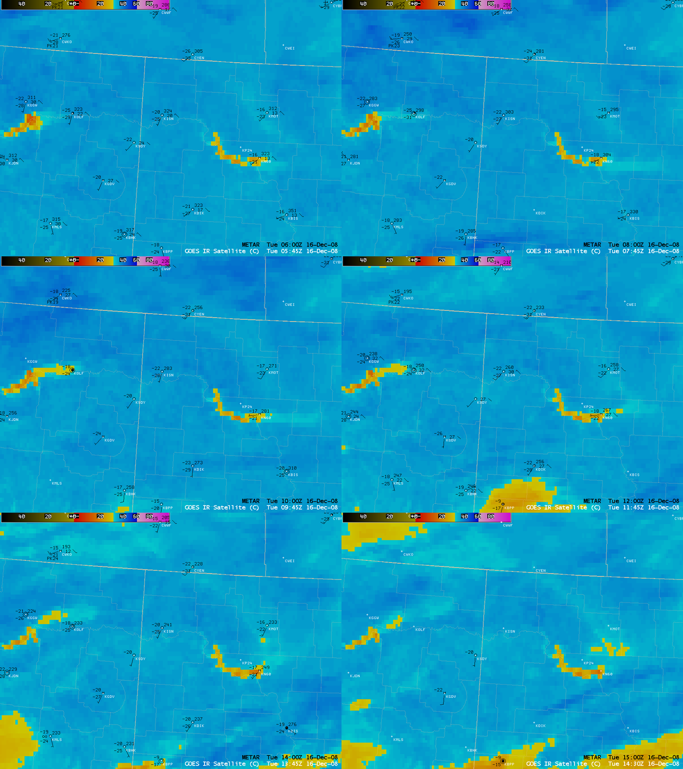
GOES-12 10.7 µm IR images (below) showed the evolution of these “lake-effect cloud plumes” during the night-time and early morning hours on 16 December. While winds at the surface were fairly light, the winds higher aloft (at the 925 hPa or 3000 ft level) were advecting the cloud material eastward.
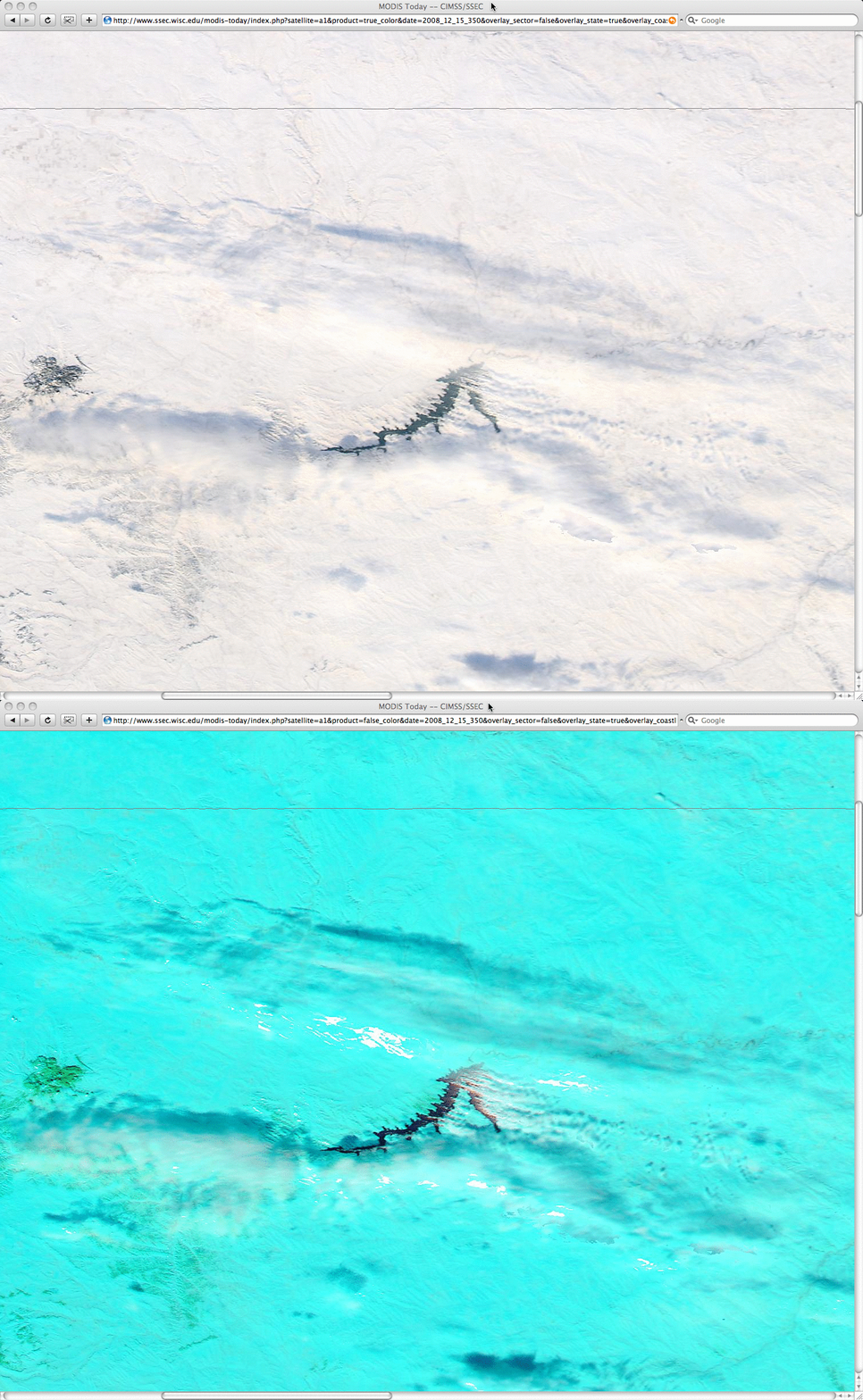
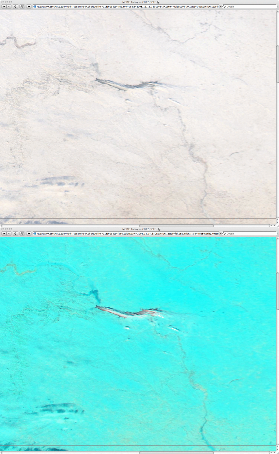
250-meter resolution MODIS true color and false color Red/Green/Blue (RGB) imagery from the SSEC MODIS Today site (below) showed a closer view of Fort Peck Lake in northeastern Montana and Lake Sakakawea in western North Dakota on the previous day (15 December). Small plumes of lake-effect clouds could be seen beginning to stream southeastward off the unfrozen lakes at that time — these supercooled water droplet clouds exhibited a brighter white appearance on the false color images, in contrast to the cyan snow-covered ground.


