Unusual snowfall event in Louisiana and Mississippi
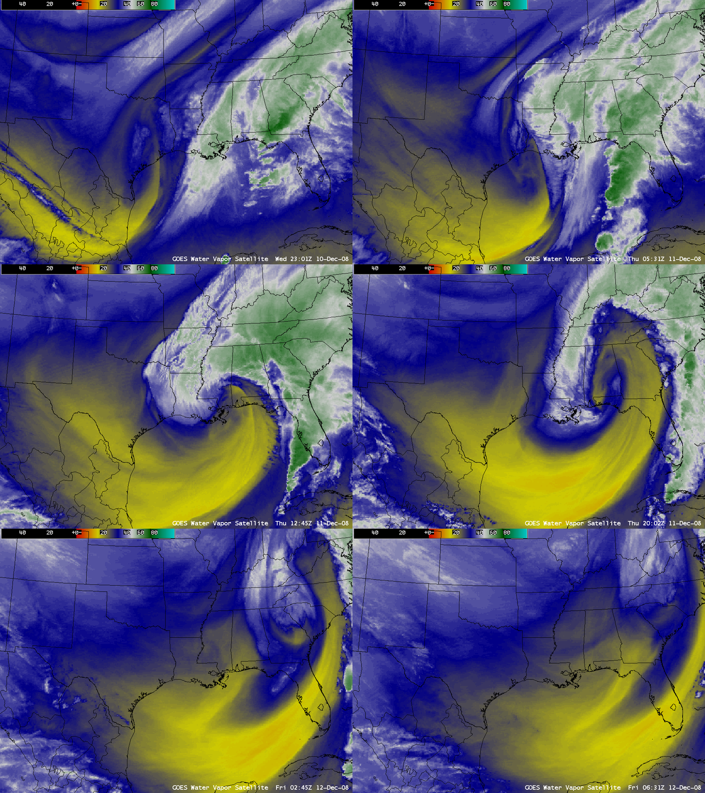
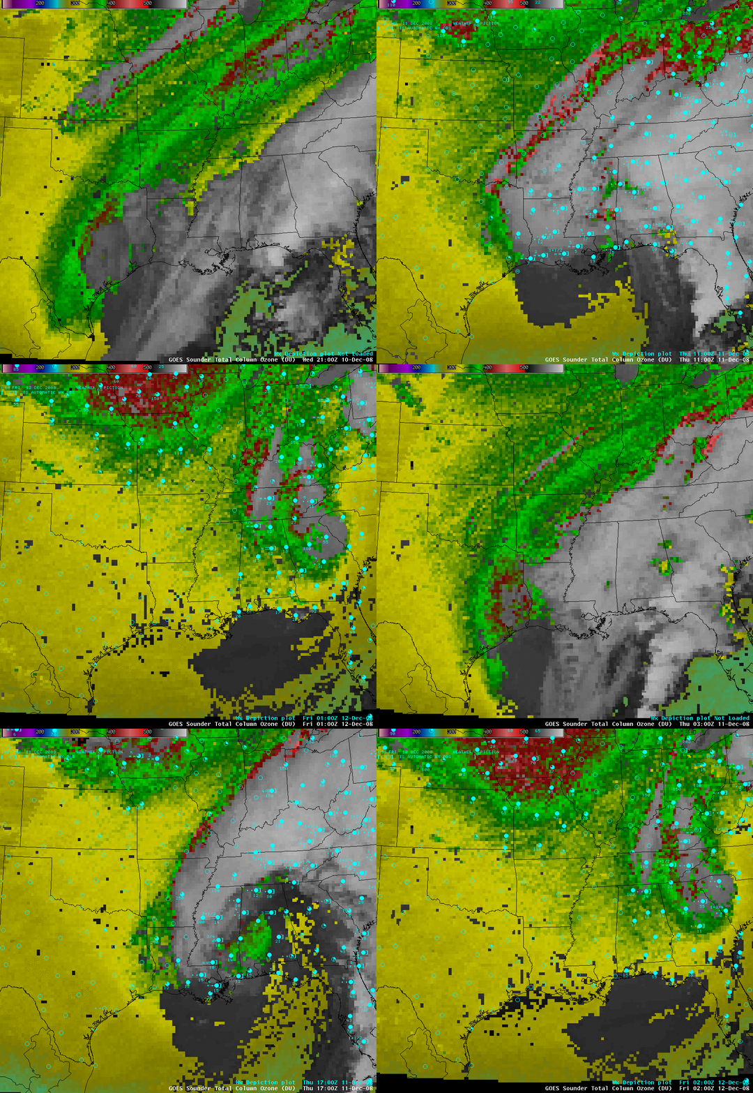
An unusually-early snowfall event occurred in parts of Louisiana and Mississippi on 11 December 2008. AWIPS images of GOES-12 6.5 µm water vapor images (above) revealed a well-defined axis of a deformation zone pivoting over the region that received the heaviest snowfall. The GOES sounder Total Column Ozone product (below) showed values in the 350-400 Dobson Unit range (bright green to red colors), indicative of the lowering dynamic tropopause associated with the intensifying disturbance.
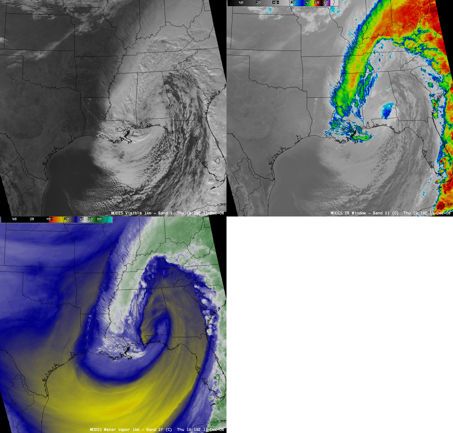
MODIS visible, 11.0 µm IR, and 6.7 µm water vapor images at 19:19 UTC (below) showed a narrow banding structure in place over the area where moderate to heavy snowfall was falling at the time.
SSEC MODIS Today true color imagery from the following day (below, displayed using Google Earth) displayed a large area where snow remained on the ground. The highest snowfall accumulations included 9 inches at New Hebron in Mississippi and 8 inches at Amite in Louisiana. For locations such as Beaumont/Port Arthur in Texas and Lake Charles, Baton Rouge and New Orleans in Louisiana, this was the earliest snowfall on record.


