Powerful early October storm: blizzard conditions, and severe thunderstorms
GOES-13 Water Vapor (6.5 µm) images, with hourly plots of surface weather type [click to play animation]
GOES-15 (left) and GOES-13 (right) Visible (0.63 µm) images, with hourly plots of surface reports [click to play animation]
GOES-15 (left) and GOES-13 (right) Infrared Window (10.7 µm) images, with hourly plots of surface reports [click to play animation]
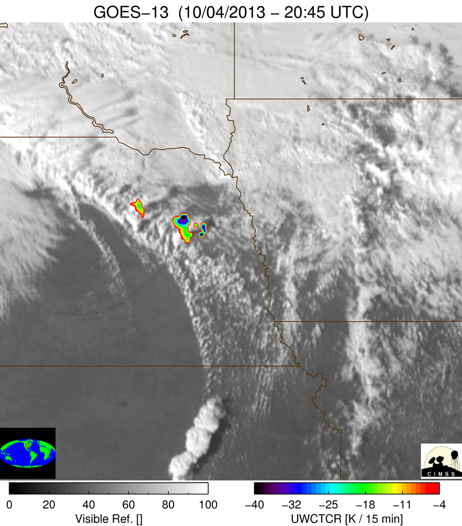
GOES-13 0.63 µm visible channel images with overlays of the corresponding University of Wisconsin GOES-13 IR Cloud Top Cooling Rate (CTCR) product (below) indicated that CTCR values exceeded 30 degrees Kelvin per 15 minutes (darker blue color enhancement) at 20:45 UTC as the thunderstorm that produced the Wayne tornado was rapidly developing in northeastern Nebraska.
===== 07 October Update =====
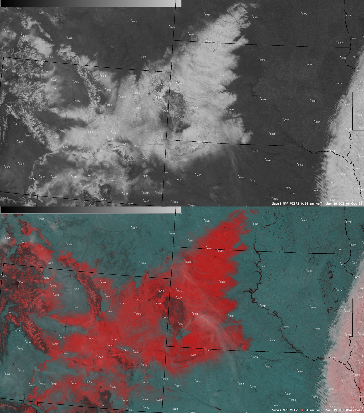
High spatial resolution imagery from Low Earth Orbit (LEO) or “polar-orbiting” satellites can be useful for post-case analysis — with this particular storm, helping to determine the areal coverage of the resulting snowfall, and identifying a tornado damage path.

Suomi NPP VIIRS 0.64 µm visible channel and false-color Red/Green/Blue (RGB) images [click to enlarge]
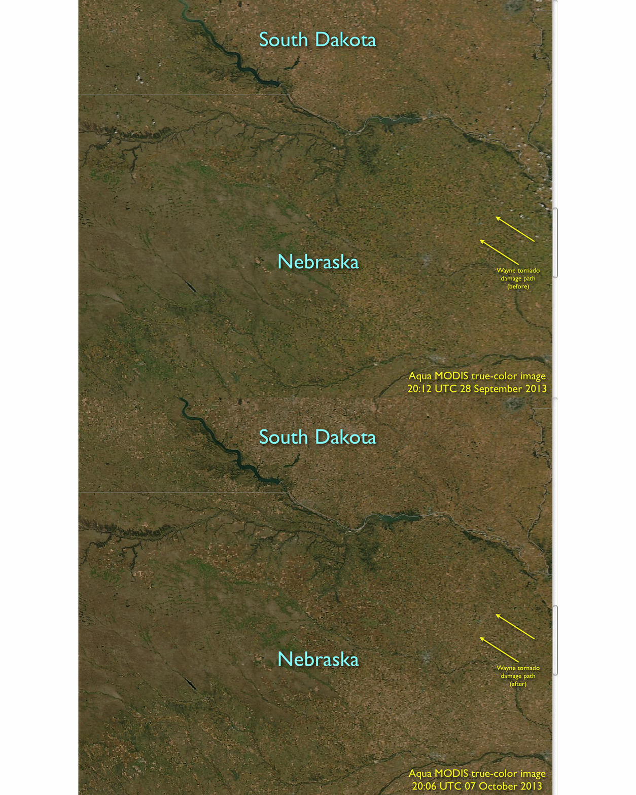
In addition, a comparison of before (28 September) and after (07 October) 250-meter resolution MODIS true-color RGB images from the SSEC MODIS Today site (below) revealed the southwest-to-northeast oriented damage path from the large tornado which produced EF-4 damage in the Wayne, Nebraska area (NWS Omaha news story).


