Severe thunderstorms over eastern Colorado
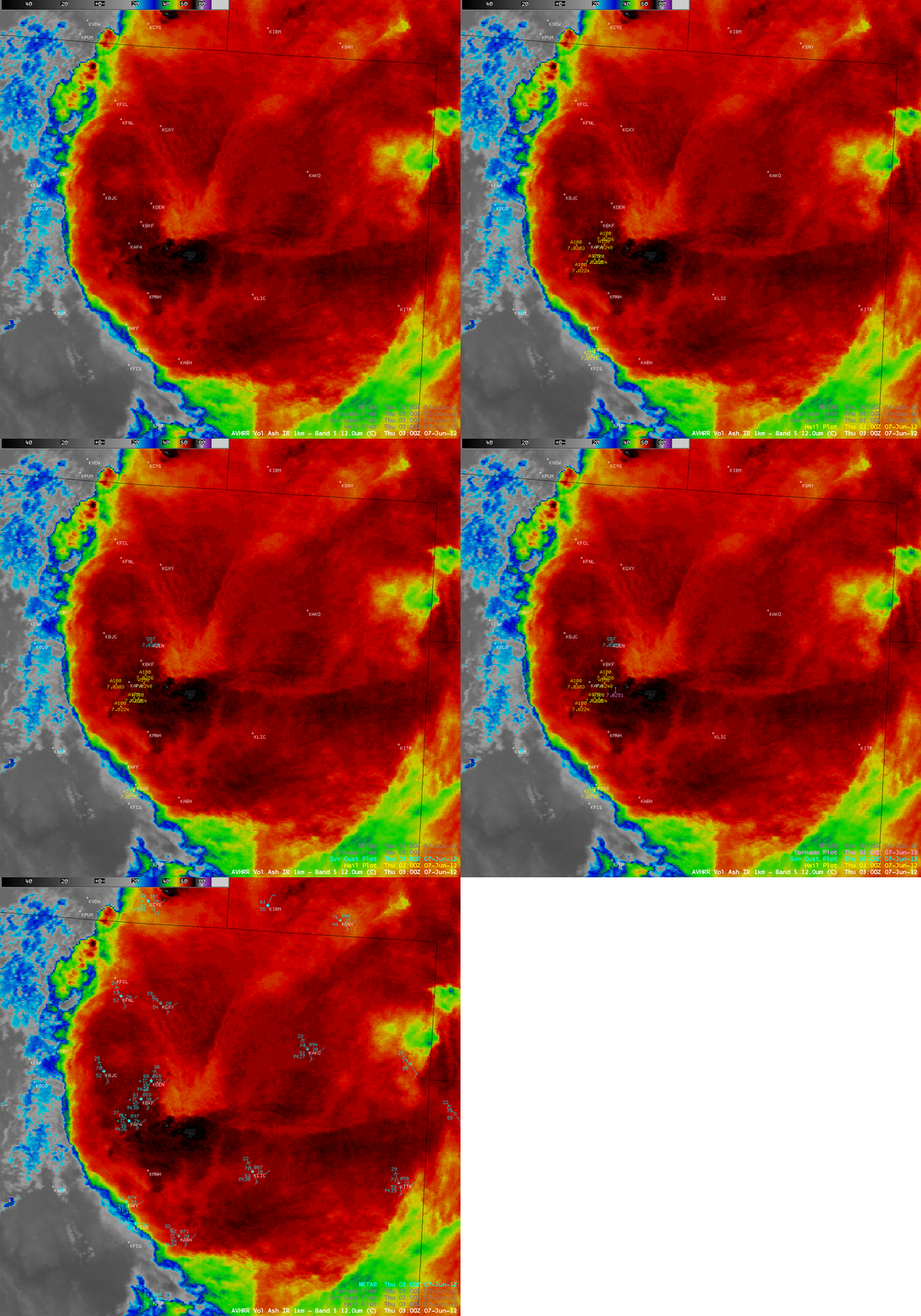
Severe thunderstorms developed during the afternoon hours over eastern Colorado on 06 June 2012, which were responsible for a number of tornadoes in addition to widespread large hail and damaging winds (SPC storm reports). An AWIPS image of 1-km resolution POES AVHRR 12.0 µm IR channel data (above) showed a very pronounced “enhanced-V” storm top signature, with many of the severe weather reports located near the vertex of the enhanced-V.
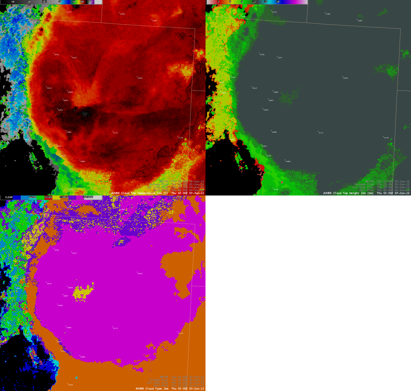
A comparison of 1-km resolution POES AVHRR Cloud Top Temperature (CTT), Cloud Top Height (CTH), and Cloud Type products is shown below. The CTT cold/warm thermal couplet associated with the enhanced-V signature was -74 C/-55 C; the CTH values for the majority of the cirrus canopy were 13 km (12 km within the “warm spot” region of the enhanced-V); and the Cloud Type for the majority of the cirrus canopy was Overshooting (violet color enhancement), with the “Thick Ice” classification (yellow enhancement) within the warm region of the enhanced-V.
A comparison of the 1-km resolution POES 12.0 µm IR image with the corresponding 4-km resolution GOES-15 10.7 µm IR image (below) demonstrated the advantage of improved spatial resolution for detecting the more subtle aspects of the enhanced-V feature. Also note that the enhanced-V feature is displaced to the north and east on the GOES-15 image, due to the problem of parallax associated with the large viewing angle from the GOES-West satellite.
The GOES-15 satellite was placed into Super Rapid Scan Operations (SRSO) mode, providing images as frequently as every 1 minute (see the VISIT Meteorological Interpretation Blog).


