Record-setting Nor’easter
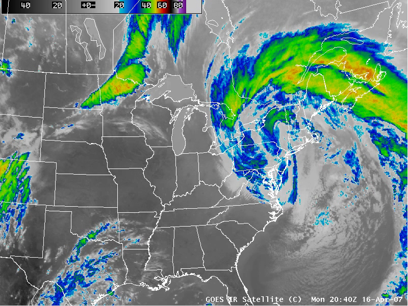
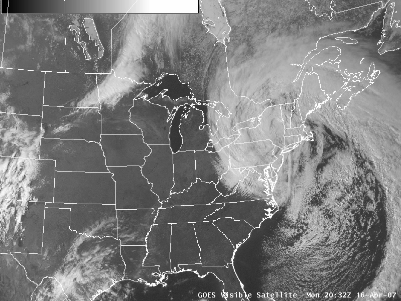
A record-setting Nor’easter storm system intensified over the eastern and northeastern US on 15 April / 16 April 2007 — this storm produced several tornadoes (including a fatal EF3 tornado near Mulberry, South Carolina), winds of 70-80 mph with a gust to 156 mph (Mount Washington, New Hampshire), waves to 33 feet (Buoy 44025), snowfall up to 23 inches (Locke, New York), 9.30 inches of rainfall (Riverdale, New Jersey), and widespread coastal flooding. QuickTime animations of GOES IR, water vapor, and visible channel imagery from AWIPS reveal the unusually large size of the cloud and water vapor fields associated with this powerful Nor’easter.
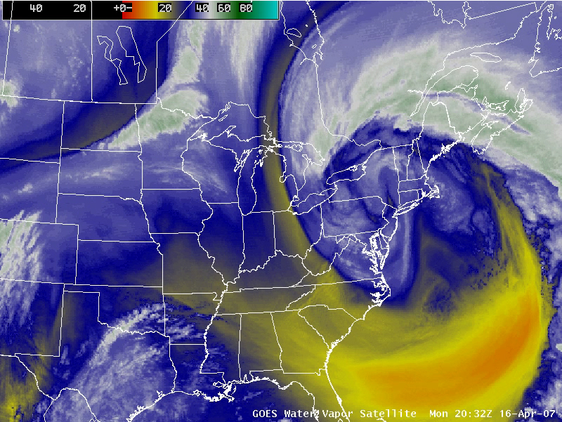
________________________________________________________________________________
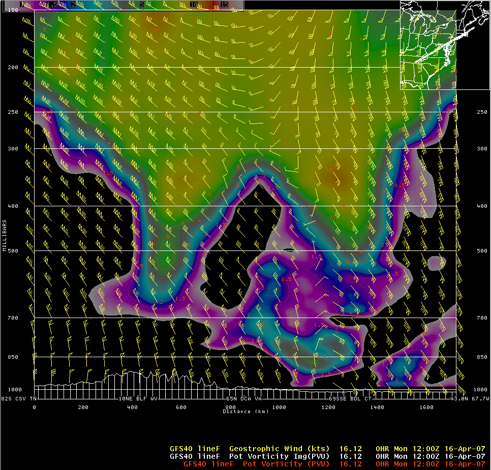
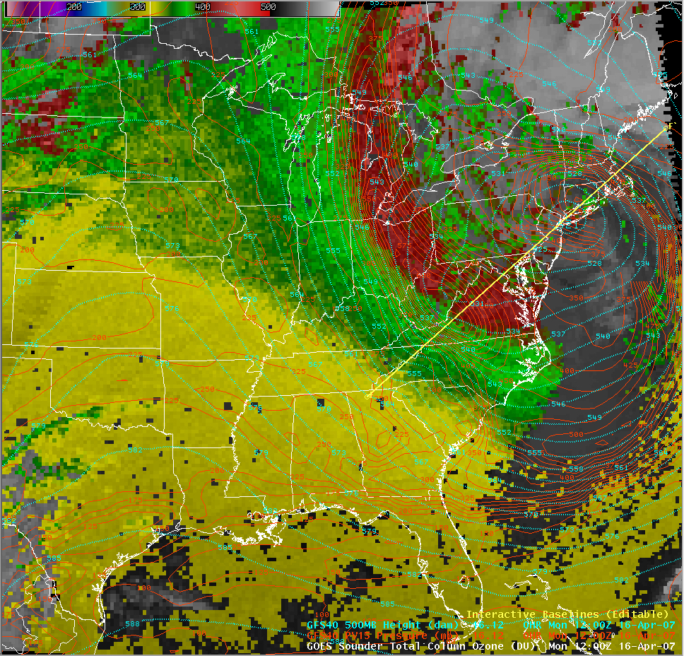
The GOES sounder-derived total column ozone product (above) depicted very high ozone values (400-450 Dobson units, red enhancement) along the western periphery of the storm. A southwest-to-northeast cross section through the storm using GFS model fields (below) show that the dynamic tropopause — assumed to be the 1.5 Potential Vorticity Units (PVU) surface — extended below the 600 hPa pressure level in both the high ozone feature (across northwestern Virginia) and also the core of the 500 hPa low (near Long Island, New York).
