Freezing drizzle in Colorado
A cold and moist upslope (northeasterly) flow had pushed up against the Front Range of the Rocky Mountains in Colorado during the pre-dawn hours on 20 November 2008 — a comparison of AWIPS images of the MODIS Fog/Stratus product and the topography (above) showed that the western edge of the stratus deck was backed up against the highest terrain that runs north-south across central Colorado.
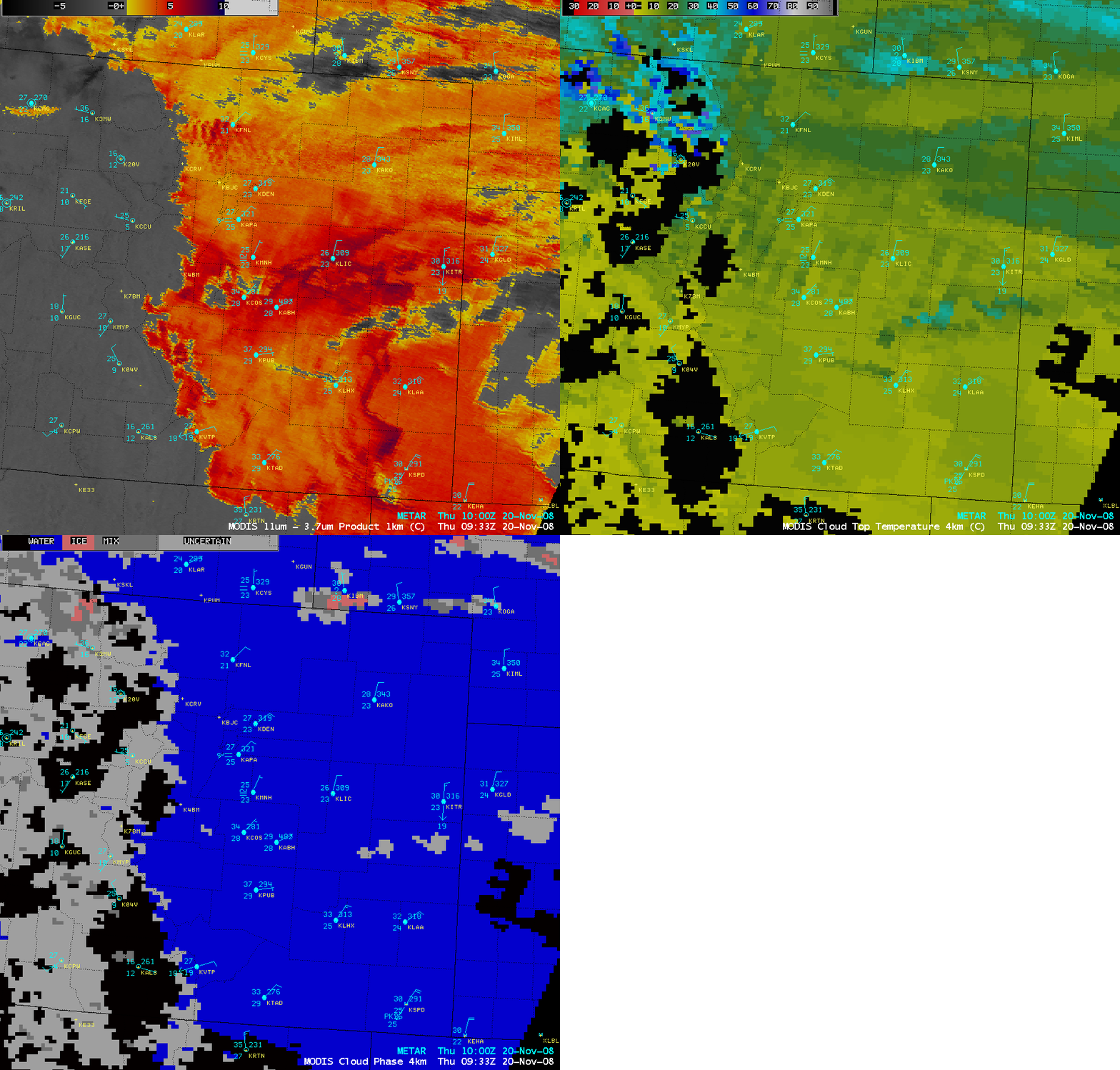
AWIPS images of the MODIS Fog/Stratus product, Cloud Top Temperature (CTT) product, and Cloud Phase product (below) indicated that CTT values were generally in the -8 to -15º C range, with the Cloud Phase product indicating that the cloud was composed of supercooled water droplets. Without the presence of ice crystals in the clouds, the resulting precipitation type across parts of eastern Colorado was freezing drizzle at locations whose surface air temperature had dropped below freezing, as was seen at Denver/Centennial Airport (KAPA) and Elbert Mountain (KMNH) at 10:00 UTC (4 AM local time). Winter Weather Advisories were issued for a number of counties, due to the freezing drizzle causing roadway icing.
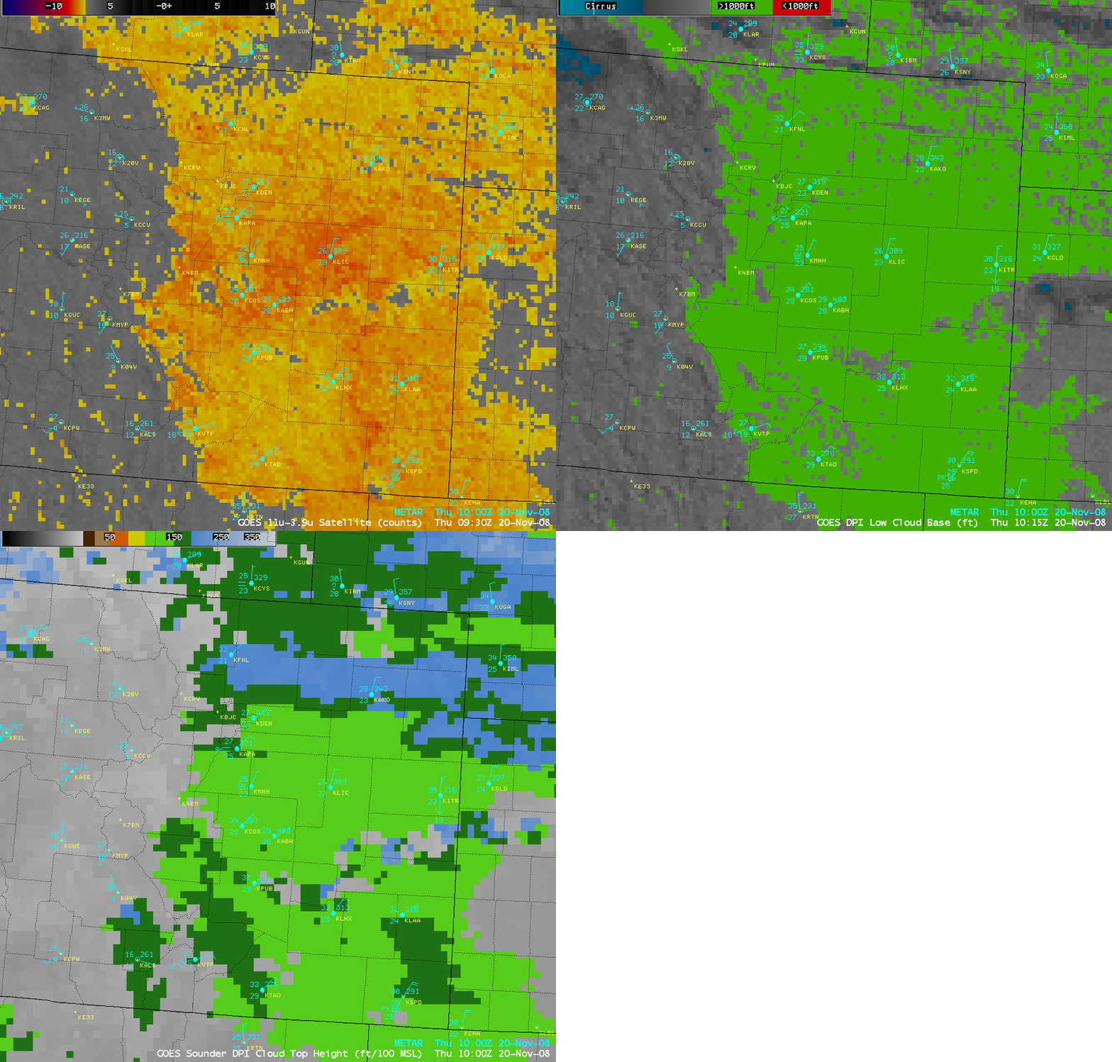
This extensive stratus cloud deck could be further characterized by examining the GOES-12 Fog/Stratus product in conjunction with the Low Cloud Base product and the sounder-derived Cloud Top Height product (below) — the cloud bases were all below 1000 feet (green color enhancement), while the cloud tops were generally in the 12,000-15,000 foot range (light green to dark green color enhancement). Using the AWIPS “Sample Cloud Heights/Radar Skew-T” functionality, the cloud top height in the Elbert Mountain area (where the MODIS IR brightness temperature was around +9ºC) was placed at around 11,000 feet, in close ‘agreement with the GOES Sounder Cloud Top Height product.
Finally, it is interesting to point out the improved accuracy of the 1-km resolution MODIS Fog/Stratus product compared to the 4-km resolution GOES-12 Fog/Stratus product (below). In particular, note how the MODIS imagery displayed a “hole” in the stratus deck in the area of Pike’s Peak (located just to the west of Colorado Springs, KCOS), directly where the higher terrain would have extended above the top of the stratus cloud layer — on the GOES-12 Fog/Stratus product, the “hole” in the stratus deck was incorrectly placed a bit farther to the west.


