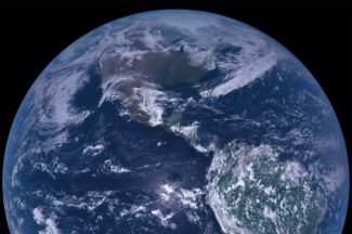
Visualization and software
Research Categories | All Research Projects
Our researchers develop tools and software to help users more easily process, analyze and visualize data. These new tools and software allow a variety of users, including the public and educators, to transform the data into powerful information and visuals.
-
Community Satellite Processing Package (CSPP) Geo
The Community Satellite Processing Package (CSPP) Geo is free open source software developed to support Direct Broadcast (DB) users with processing geostationary satellite data to generate geophysical products.
Website:
http://cimss.ssec.wisc.edu/csppgeo/Contact:
Graeme Martin, Ray GarciaCategories:
Geostationary Satellites, Visualization and softwareSponsors:
NOAA -
Community Satellite Processing Package (CSPP) Leo
The Community Satellite Processing Package (CSPP) Leo is free open source software developed to support Direct Broadcast (DB) users with processing polar-orbiting satellite data for regional products and applications.
Website:
http://cimss.ssec.wisc.edu/cspp/Contact:
Liam Gumley (PI), Kathy StrabalaCategories:
Low-Earth Orbiting Satellites, Visualization and software -
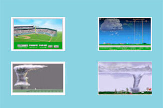
Educational Software
Learn more about weather and climate through these educational applets.
Website:
https://cimss.ssec.wisc.edu/wxfest/Contact:
Tim WagnerCategories:
Visualization and software -
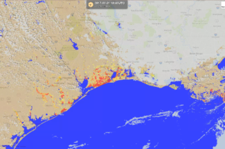
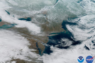
Flood Research
Through a collaboration with scientists at George Mason University, researchers at SSEC and CIMSS routinely generate flood detection products from a suite of satellites including polar (SNPP & NOAA-20) and geostationary (GOES-East, GOES-West, and AHI-8) satellites in near realtime.
Contact:
Jay HoffmanCategories:
Hazards, Visualization and softwareSponsors:
NOAA -
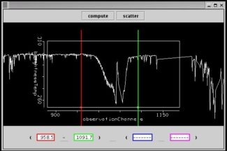
Hyper-spectral Viewer for Development of Research Applications (HYDRA)
HYDRA software allows for the analysis and visualization of multispectral and hyperspectral data acquired from weather satellites.
Website:
http://www.ssec.wisc.edu/hydra/Contact:
Thomas RinkCategories:
Visualization and softwareSponsors:
NOAA -
Infusing satellite Data into Environmental Applications – International (IDEA-I)
The Infusing satellite Data into Environmental Applications – International (IDEA-I) develops satellite-based aerosol forecasting, visualization, and data synthesis tools for use by the international air quality forecasting community.
Contact:
Brad Pierce (PI)Categories:
Atmospheric Composition, Visualization and software -

Man Computer Interactive Data Access System (McIDAS-V)
McIDAS-V is a free, Java-based, open-source software package that allows for visualization and analysis of data retrieved from weather satellites.
Contact:
Dave Santek, Becky SchafferCategories:
Visualization and softwareSponsors:
NOAA -
Science Investigator-led Processing System (SIPS)
The Atmosphere Science Investigator-led Processing System (SIPS) processes VIIRS data from the Suomi NPP satellite to produce Level 2 cloud and aerosol products, including cloud height, cloud phase, cloud properties, and aerosol optical thickness.
Website:
http://sips.ssec.wisc.edu/Contact:
Liam GumleyCategories:
Visualization and softwareSponsors:
NASA -
Tropical Cyclone ML/AI Research (TC ML/AI)
CIMSS scientists have been investigating how they can use AI to improve short-term forecasts of hurricanes, and in particular their intensity.
Contact:
Tony Wimmers, Sarah Griffin