Modeling and data assimilation
Research Categories | All Research Projects
We develop models and satellite data assimilation techniques to better understand and predict changes in the atmosphere. Advances in these areas lead to improved prediction of severe weather, air quality, tropical cyclones, atmospheric rivers, and winter storms.
-
Data Assimilation
SSEC scientists conduct research to improve satellite data assimilation techniques in operational weather forecast models.
Contact:
Agnes Lim, Zhenglong LiCategories:
Modeling and data assimilationSponsors:
NOAA -
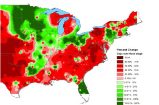
Hazus-MH Based Project Support
Hazus-MH, created in partnership with the Federal Emergency Management Administration (FEMA), uses Geographic Information Systems (GIS) technology to estimate physical, economic, and social impacts of disasters such as earthquakes, hurricane winds, and floods.
Contact:
Shane Hubbard (PI)Categories:
Hazards, Modeling and data assimilationSponsors:
FEMA -

High Performance Computing Data Processing: NOAA ASSISTT Enterprise
Researchers will work with NOAA to support the transition of algorithms to operations.
Contact:
Ray Garcia, William StrakaCategories:
Modeling and data assimilationSponsors:
NOAA -
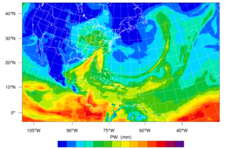
Morphed Integrated Microwave Imagery at CIMSS – Total Precipitable Water (MIMIC-TPW)
MIMIC-TPW is a technique that combines microwave observations from polar orbiting satellites to create near-seamless hourly imagery of global total precipitable water (TPW).
Contact:
Tony WimmersCategories:
Modeling and data assimilation, Tropical CyclonesSponsors:
NOAA -
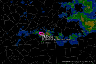
ProbSevere
ProbSevere is a statistical model that predicts the likelihood of a storm producing severe weather within the next 60 minutes.
Contact:
John Cintineo, NOAA, Lena Heuscher-StewartCategories:
Hazards, Modeling and data assimilationSponsors:
NOAA -
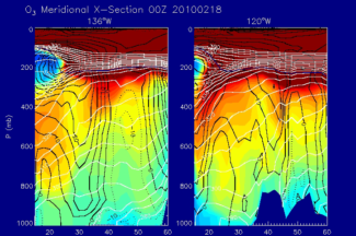
Real-time Air Quality Modeling System RAQMS
The Real-time Air Quality Modeling System (RAQMS) is an online system for assimilating and forecasting global, ambient chemicals, and aerosols in the stratosphere and troposphere.
Website:
http://raqms-ops.ssec.wisc.edu/Contact:
Brad Pierce (PI)Categories:
Atmospheric Composition, Modeling and data assimilation -
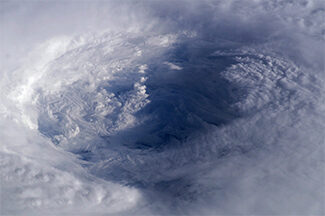
Tropical Cyclone ML/AI Research (TC ML/AI)
CIMSS scientists have been investigating how they can use AI to improve short-term forecasts of hurricanes, and in particular their intensity.
Contact:
Tony Wimmers, Sarah Griffin