Station Fire in southern California
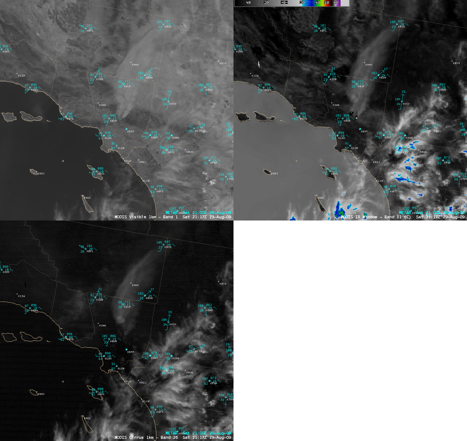
A wildfire (named the “Station Fire”) had been burning for several days in the Angeles National Forest in central Los Angeles county — and this fire then grew quickly in size from 5500 acres to 35,200 acres during the 29 August – 30 August 2009 period. AWIPS images of the MODIS visible and the MODIS 2.1 µm near-IR “snow/ice” channels (above) showed the smoke plume which was drifting northward during the afternoon on 29 August, in addition to the cluster of very hot pixels (appearing brightest white on the near-IR snow/ice channel image) around the periphery of the fire complex.
The smoke plume — as well as the patches of cirrus clouds farther to the southeast — did not stand out very well against the surrounding bright, sandy desert soils of the southern California region. However, the 1-km resolution MODIS images below demonstrate that the edges of the smoke feature were easier to identify using either the MODIS 11.0 µm IR window channel image (where the IR brightness temperature values of the smoke plume were about 25º C colder, making it appear as a lighter gray feature) or the MODIS 1.3 µm near-IR cirrus detection channel image (where the smoke appeared as a brighter feature, due to the efficient scattering properties of the smoke particles).
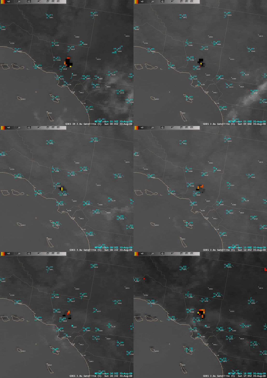
As the fire burned into the night and on into the morning of 30 August, 4-km resolution GOES-11 3.9 µm shortwave IR images (below) displayed a large cluster of very hot pixels. A number of the hottest pixels had IR brightness temperatures exceeding the maximum allowable AWIPS IR value of 54.5º C, so AWIPS displayed those hottest pixels as dark black.
This fire was rather anomalous, in that it was not driven by strong winds (as is usually the case with most fires in southern California). However, dry vegetation and a hot, dry air mass helped to create a situation that was favorable for rapid fire growth.
===== 31 AUGUST UPDATE =====
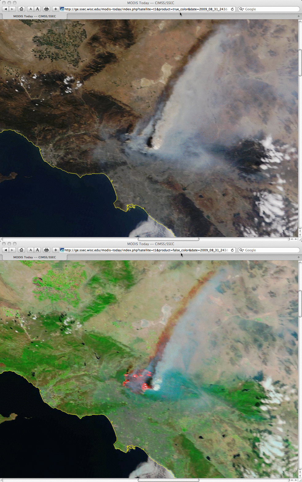
The fire continued to grow quickly on 31 August, reportedly reaching a size of 105,000 acres. 250-meter resolution MODIS true color and false color images from the SSEC MODIS Today site (below) showed a large pyrocumulus cloud and smoke plume associated with the hottest fire that was actively burning in the eastern portion of the fire complex, along with several other active fires (appearing pink to white on the false color image) along the periphery of the burn area.
===== 01 SEPTEMBER UPDATE =====
The thick plume of smoke could be seen moving northeastward from the Station Fire on 30 August, drifting over the Las Vegas valley region of southern Nevada during the late afternoon and early evening (below). Observe the appearance of a wave structure to the top of the smoke cloud as it moved downwind of the Spring Mountains and the 11,918 foot (3633 meter) peak of Mt. Charleston.
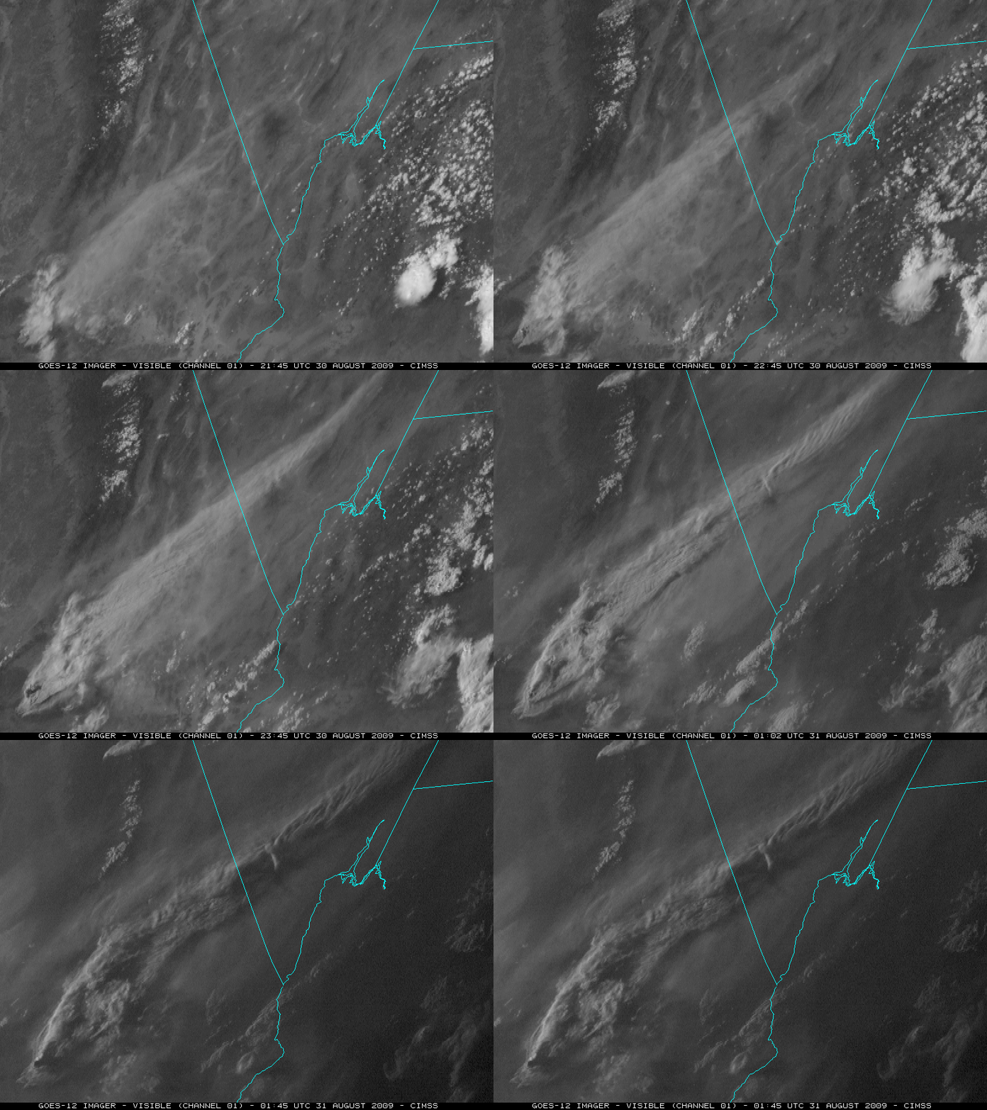
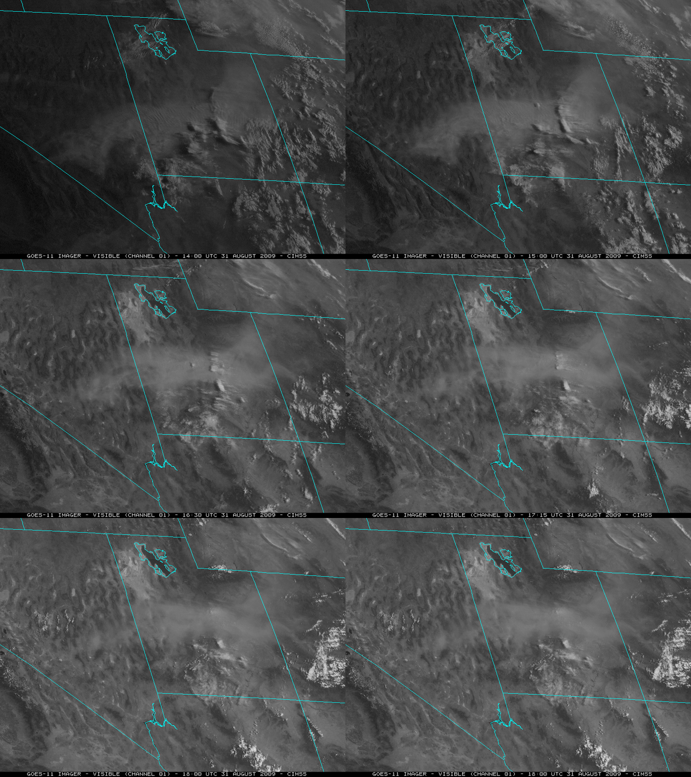
The following morning of 31 August, the thick smoke pall had drifted as far to the northeast as Nevada and Utah, and was now beginning to move eastward over southern Wyoming and western Colorado (below). Several pilot reports in the region placed the top of the smoke at 17,000-24,000 feet. Note that the smoke was very apparent on GOES-11 (GOES-West) imagery during the later hours of the day (above), and very apparent on GOES-12 (GOES-East) imagery during the earlier hours of the day (below) — this is due to a favorable forward scattering angle (when the sun-smoke-satellite viewing angle approaches 180 degrees), which helps to highlight the airborne smoke layer on the GOES visible imagery.
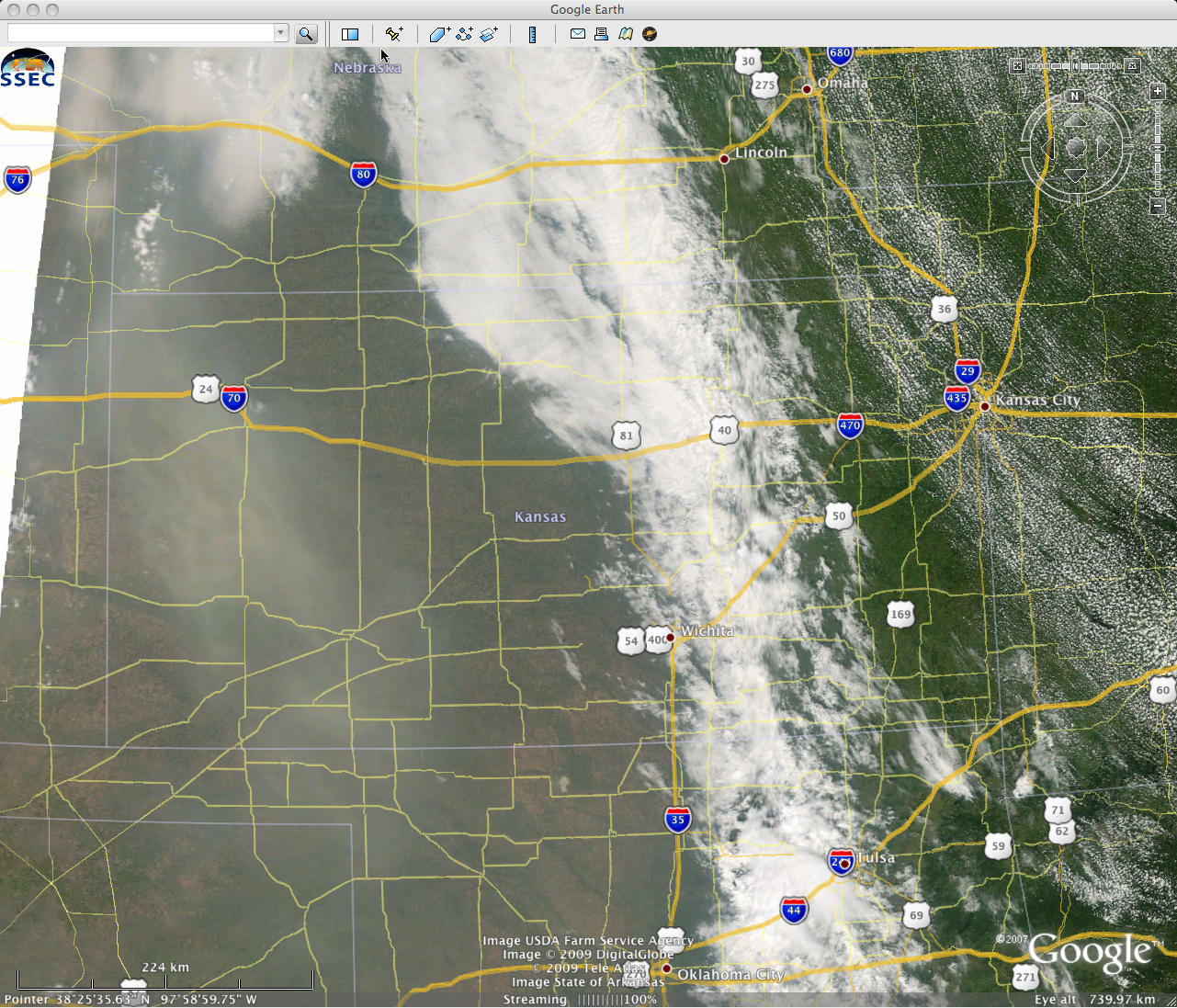
On the morning of 01 September, a portion of the thick smoke cloud had subsided over the Front Range of Colorado, restricting surface visibilities to 3-5 miles at places like Denver, Boulder, and Fort Collins in Colorado and Cheyenne in Wyoming. Late-morning MODIS true color imagery (below, viewed using Google Earth) showed that the smoke had then begun to drift eastward over parts of Nebraska, Kansas, and the panhandle regions of Oklahoma and Texas .
===== 03 SEPTEMBER UPDATE =====
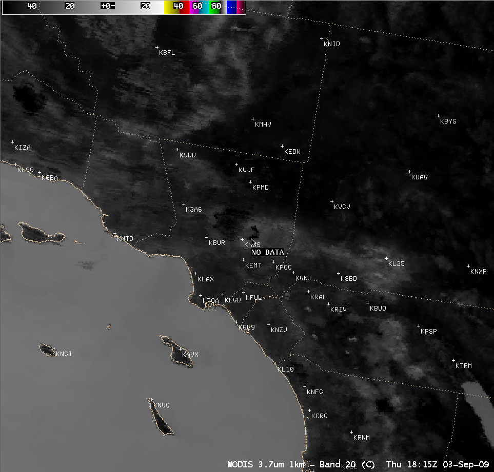
By 03 September, the Station Fire had burned 148,000 acres, making it the largest fire in Los Angeles County history. Firefighters had made significant progress on controlling the western portions of the blaze, but active fires remained along the eastern periphery of the fire complex. An AWIPS image of the MODIS 3.7 µm shortwave IR channel (above) displayed an arc of very hot fire pixels (darkest black pixels) in the far eastern portion of the fire, located to the north/northeast of El Monte (station identifier KEMT). However, interrogating the 3.7 µm shortwave IR image using AWIPS cursor sampling reported “NO DATA” for the hottest fire pixels, since the brightness temperatures there were above the maximum AWIPS IR threshold. So where were the hottest fire pixels located at that time?
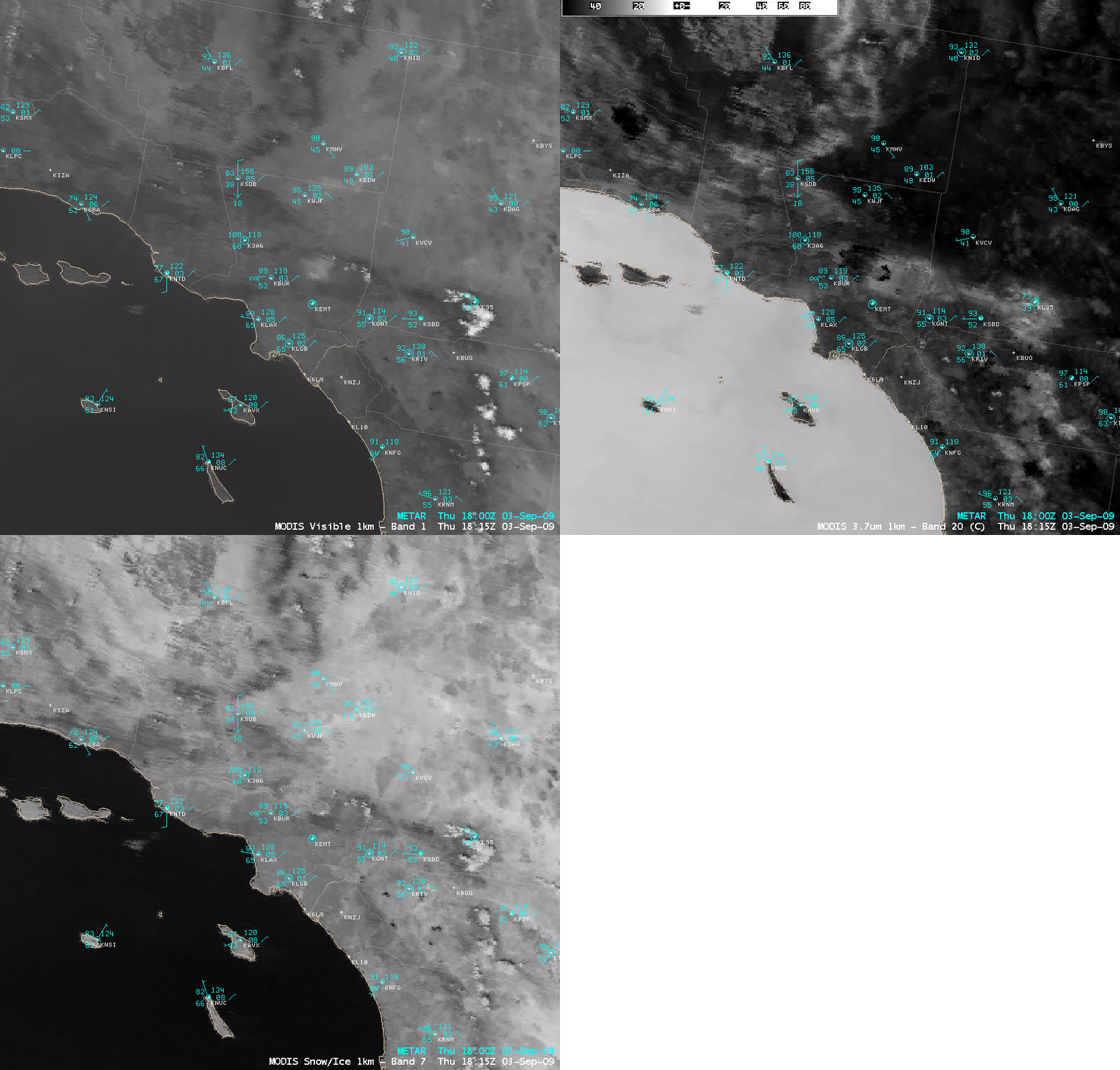
A comparison of the MODIS visible, 3.7 µm shortwave IR, and 2.1 µm near-IR “snow/ice” channels (below) demonstrated that the near-IR “snow/ice” channel imagery could be used in such a case to pinpoint the location of the hottest fires (which show up as the brightest white pixels on the snow/ice channel image).
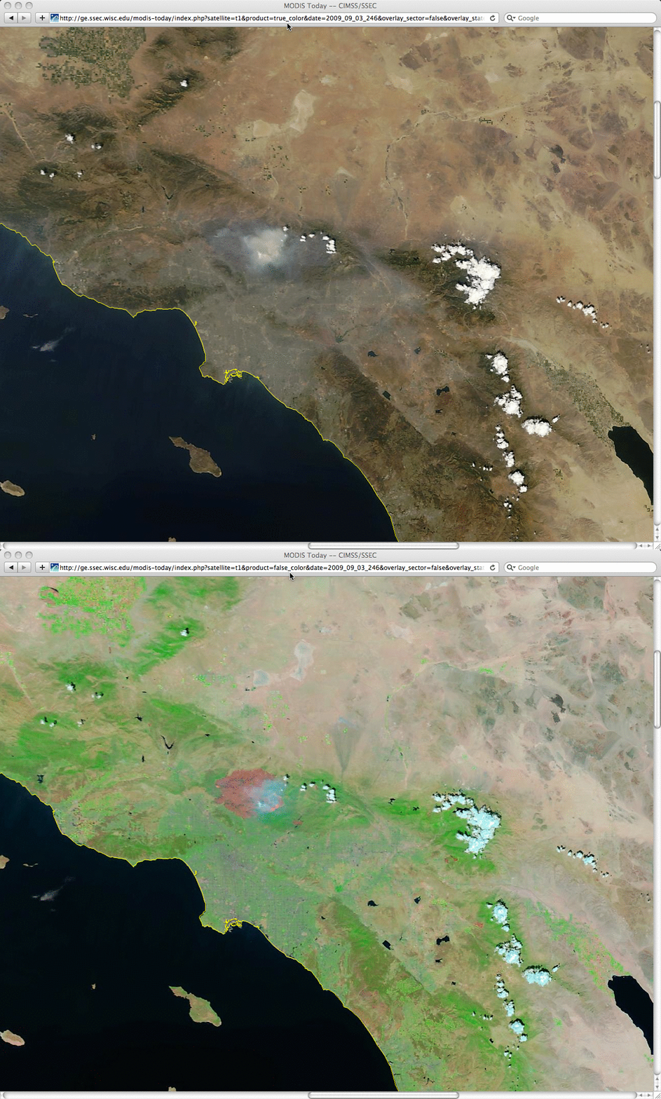
250-meter resolution MODIS true color and false color images from the SSEC MODIS Today site (below) show the size of the Station Fire burn scar (the large red-colored patch located to the west of the smoke feature), in addition to the brighter pink active fire hot spots on the southeastern periphery of the burn area.
Other AWIPS examples of MODIS imagery of the Station Fire can be found on the SPoRT blog from 01 September and from 03 September.


