Meteorology » Aviation Weather
Test your ability to indentify aviation hazards by working through the following activities:
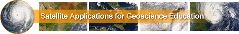
 1. Identifying aviation hazards on satellite images
Click on the image to test your ability to identify mountain waves, thunderstorms and upper level low pressure systems on IR satellite images
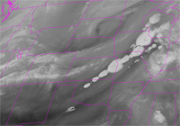
 2. Volacnic Ash
Enjoy this striking image while identifying the ash cloud over Chile from the Puyehue volcano which erupted in June 2011. Click on the image to the right to begin the activity and test your skills.