This website works best with a newer web browser such as Chrome, Firefox, Safari or Microsoft Edge. Internet Explorer is not supported by this website.

Archive: Oct 2012

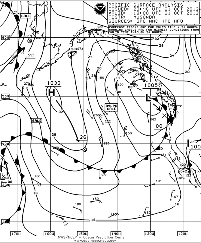
Hurricane Sandy moves north of the Bahamas

SRSO-R operations continue today with GOES-14, allowing for very high temporal resolution imaging of a sheared Hurricane Sandy as it moves away from the Bahamas. The exposed low-level circulation is apparent in the imagery, as well as strong convection north and west of the low-level center. A closer view of... Read More

Hurricane Sandy

Hurricane Sandy became the tenth hurricane of the 2012 Atlantic Basin tropical cyclone season on 24 October 2012. McIDAS images of GOES-13 10.7 µm IR data (above; click image to play animation) showed the fairly rapid formation of an eye as the storm approached the eastern portion of the island... Read More