Category: Other Satellites

Indonesian Volcano Mount Lewotobi Laki-laki Erupts Multiple Times
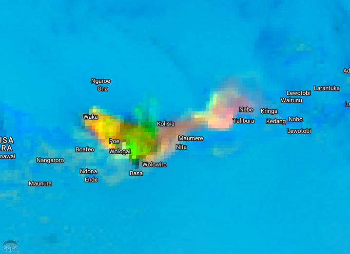
Within 24 hours, a volcano on the Indonesian island of Flores erupted three times, with reports of an ash plume penetrating 18 km into the atmosphere. Mount Lewotobi is a twin volcano consisting of a pair of peaks, Perempuam and Laki-laki. It is this later peak that has been active... Read More
Welcome to Space, Meteosat 13!
At 5:04 PM local time (2104 UTC) on 1 July 2025, the newest member of the geostationary ring was launched into orbit. The MTG-S1 satellite (to be renamed Meteosat 13 upon commissioning) represents a first for EUMETSAT: a hyperspectral sounder in geostationary orbit. While EUMETSAT has long supported hyperspectral sounders... Read More
Barbara and Cosme in the eastern Pacific Ocean
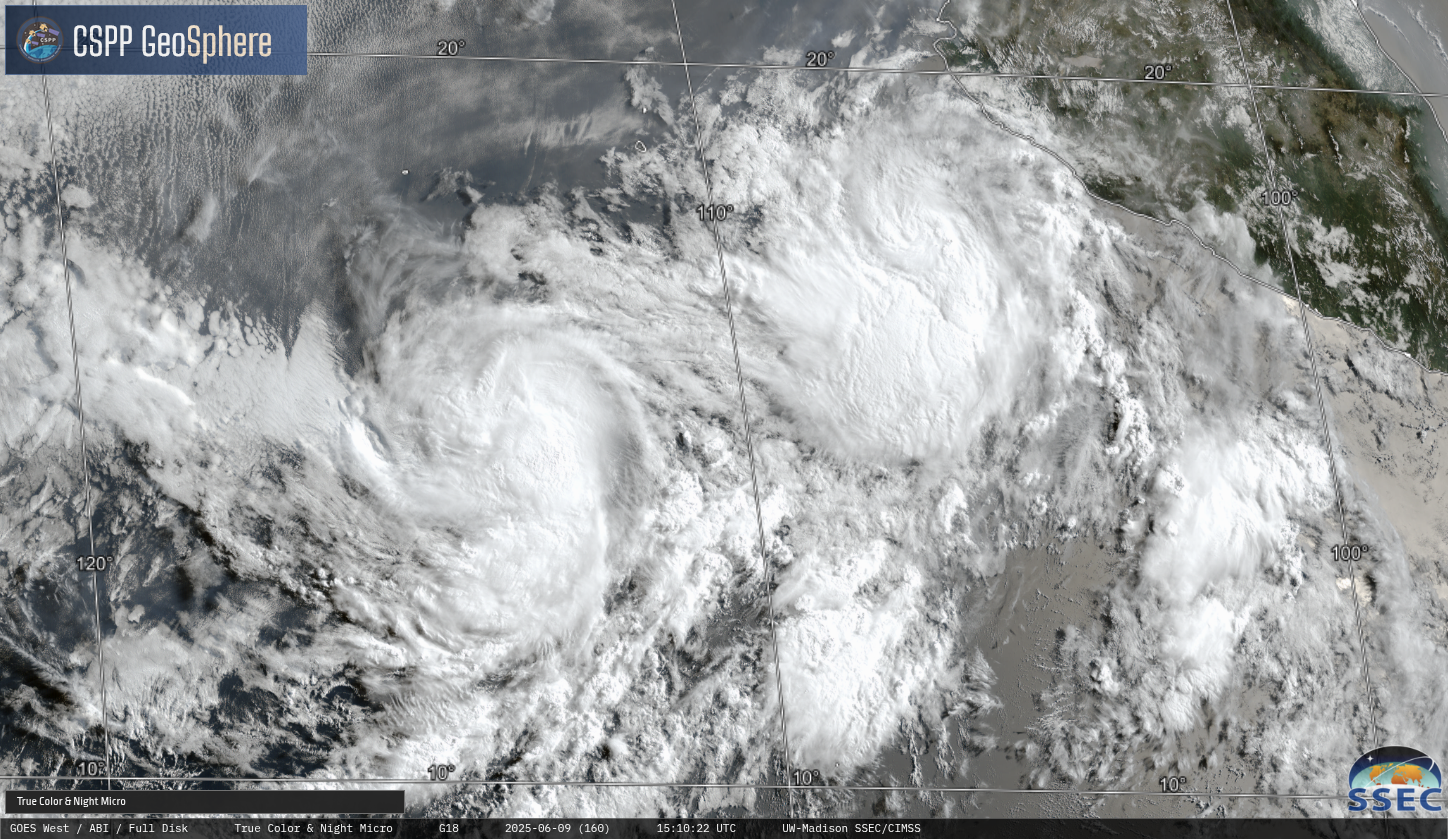
GOES-West true color imagery, above, from the CSPP Geosphere site (link), shows Hurricane Barbara northeast of Tropical Storm Cosme in the eastern Pacific. Active convection is apparent over both storm centers during the course of the day. What does the future hold for these storms? MIMIC Total Precipitable Water (source),... Read More
