Flooding along the Ohio River
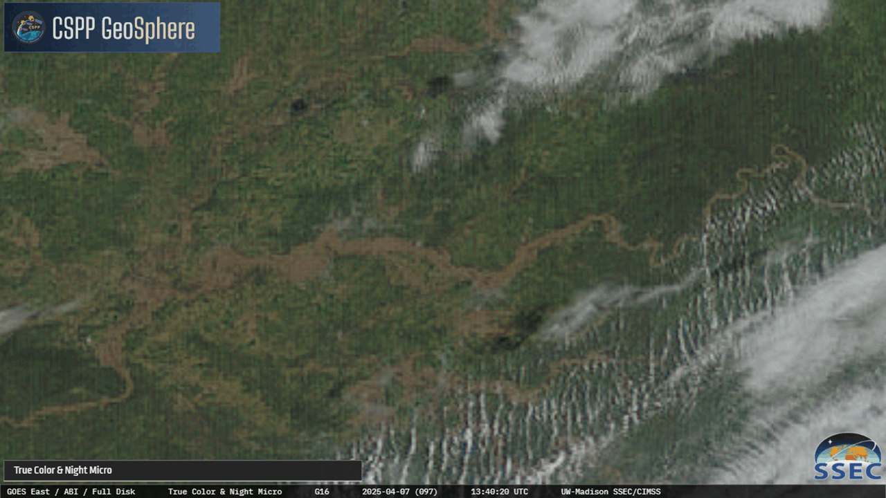
Heavy rains during the first week of April have led to significant flooding along the Ohio (and other) Rivers. The slider above compares True-Color imagery from CSPP Geosphere on 24 March — long before the rains — and on the morning of 7 April 2025 — during the floods. The expansion of the Ohio River, a sinuous brown in the image, is apparent, as is the general greening up of the background as Spring progresses. (Click here for an annotated image from 7 April that includes local geography, and here for the same annotation from 24 March).
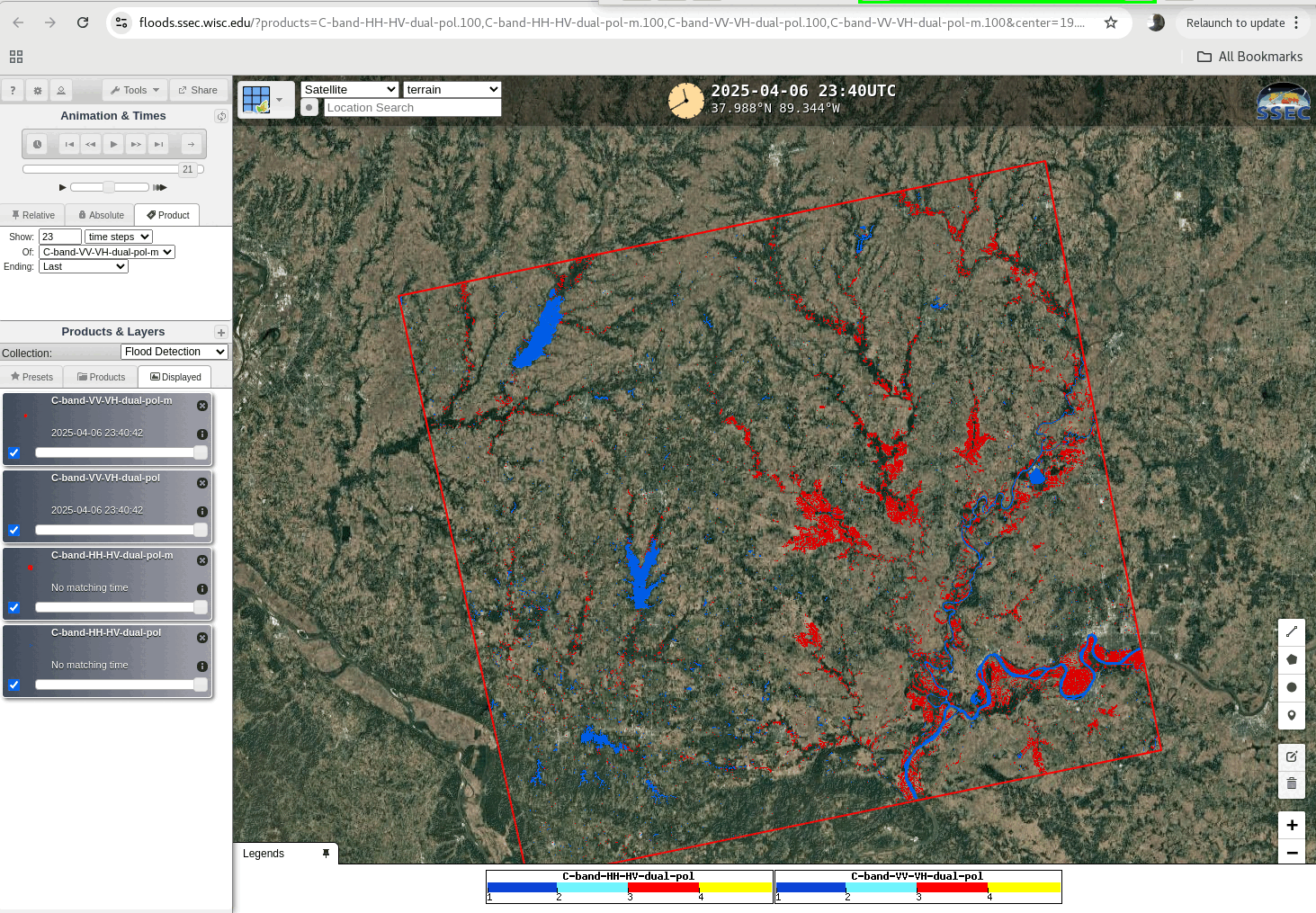
Cloud cover after a rain event can make flood detection from satellites a challenge. SAR data can be used to detect floods underneath clouds (or at night) and imagery is available at this RealEarth-powered website. RadarSat imagery from late on 6 April 2025, below, shows the extent of the flooding over southern Illinois and southwestern Indiana. Regions where SAR data suggests flooding is occurring are shown in red.
Clear Skies over the Ohio River valley on 8 April allowed for excellent coverage from a multitude of satellites that can assess the horizontal extent of flooding. For example, False-color imagery from Sentinel-2 (at this link), toggled below with a ‘before’ image from 22 March 2025, shows the obvious increase in flood waters.

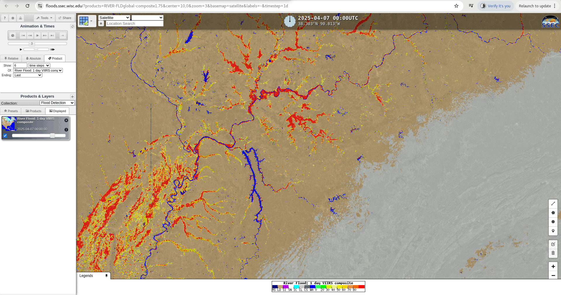
Sentinel-2A horizontal coverage doesn’t cover the entire flooded region — but clear skies on 8 April allowed the VIIRS flood product to create information over the Ohio River Valley and mid-Mississippi River Valley, as shown in the image below (taken from this website).
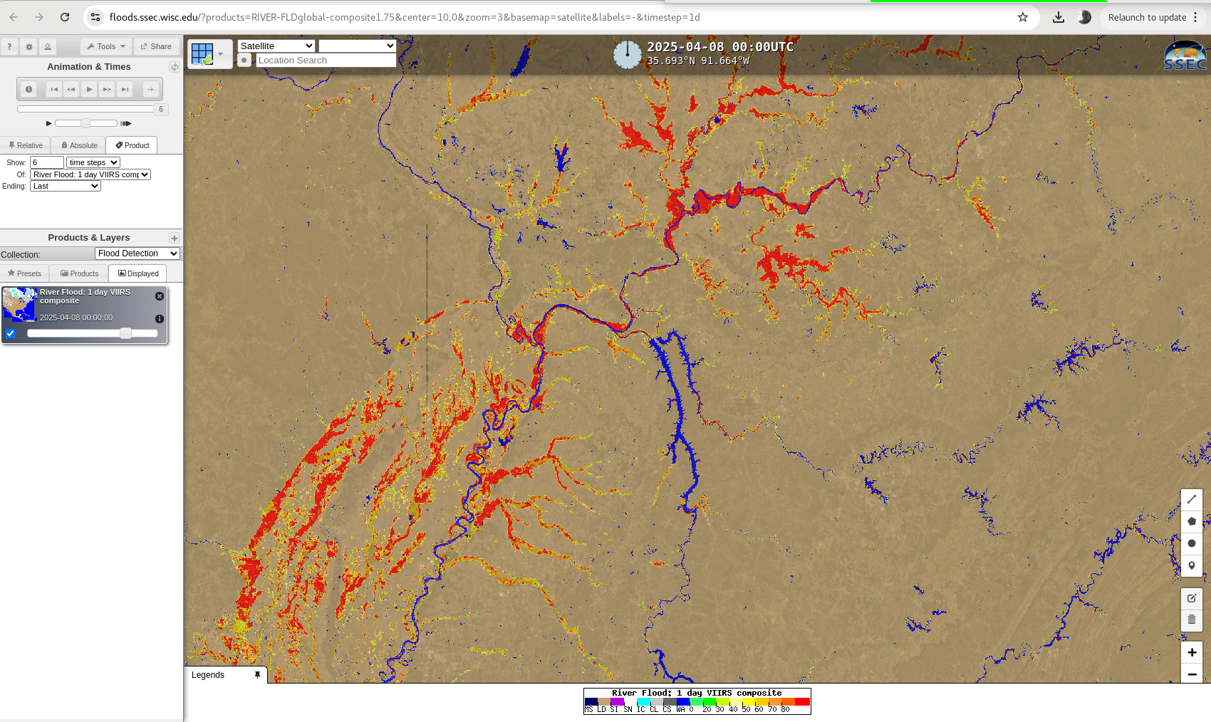
Added, 11 April 2025, below: The CIMSS Flood Product (1-day VIIRS Composites, source) during the 4 mostly clear days from 7-10 April 2025 is shown below. Memphis is at the southern edge of the image, where the Mississippi takes a long and lazy southerly to westerly curve. Some of the flooded tributaries of the Mississippi in western Tennessee show decreasing flood waters over these 4 days.