Twin Typhoons in the western Pacific
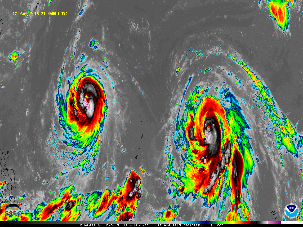
Himawari-8 captured the trek of Typhoons Goni (on the left) and Atsani (on the right) as they moved across the central Pacific Ocean on Monday 17 August 2015 (animation also available here as an mp4). Goni has passed through the northern Mariana Islands and is forecast to fluctuate in intensity... Read More