First full day of Summer: snow in the Brooks Range of Alaska
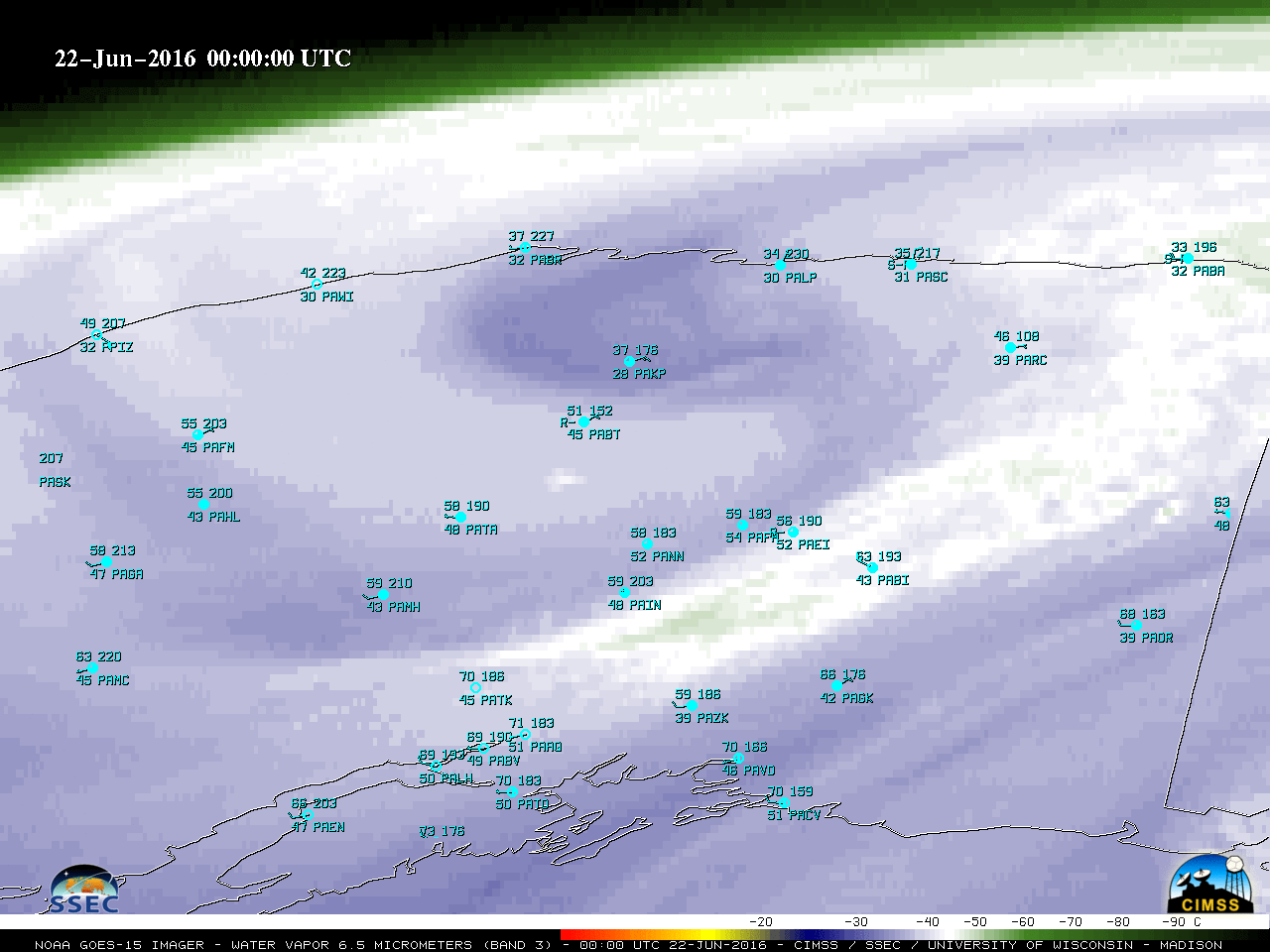
GOES-15 (GOES-West) Water Vapor (6.5 µm) images (above) showed the southeastward migration of an upper-level low across the North Slope and the eastern Brooks Range of Alaska during the 21 June – 22 June 2016 period. A potential vorticity (PV) anomaly was associated with this disturbance, which brought the dynamic... Read More
