The 50th Anniversary of the Wreck of the Edmund Fitzgerald: A New Perspective on an Old Storm
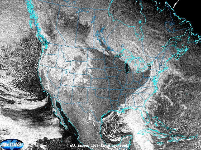
November 10, 2025 marks the 50th anniversary of one of the most-remembered weather-related disasters of all time: the sinking of the Edmund Fitzgerald. This ship was an ore freighter that sailed the Great Lakes, ferrying taconite pellets from the ports along the western edge of Lake Superior to the many... Read More


