Outbreak of severe weather in the southern Great Plains region of the US
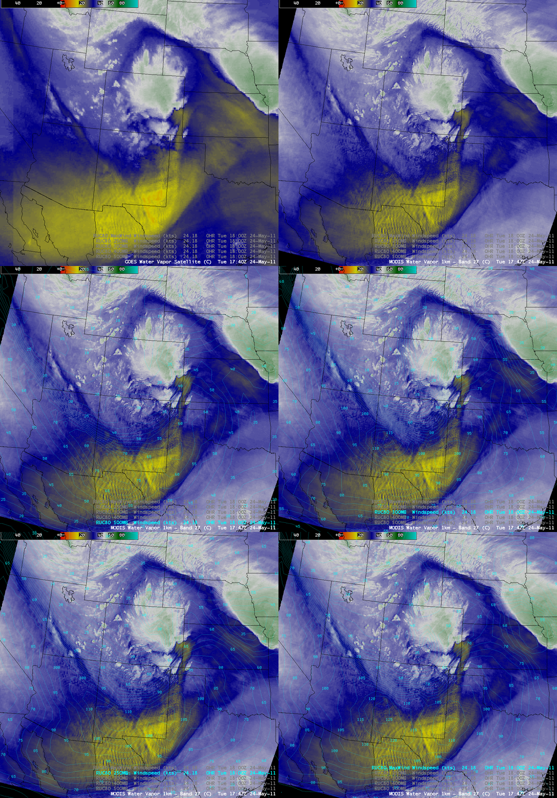
GOES-13 and MODIS water vapor images + RUC model wind speeds at 500 hPa, 400 hPa, 300 hPa, 250 hPa, and MaxWind levels
A major outbreak of severe weather (SPC storm reports) occurred across much of the southern Great Plains region of the US on 24 May 2011. One of the ingredients for this severe weather scenario was the approach of a strong jet stream, which was rounding the base of a broad upper level trough located over the Rocky Mountains. Due to these strong winds, a prominent mountain wave signature was seen on AWIPS images of 4-km resolution GOES-13 6.5 µm and 1-km resolution MODIS 6.7 µm “water vapor channel” data (above). Overlays of the RUC80 model isotachs at the 500 hPa, 400 hPa, 300 hPa, 250 hPa, and Maximum Wind levels showed the magnitude of these jet stream winds.
Strong winds were also found at the surface, and McIDAS images of GOES-13 0.63 µm visible channel data (below; click image to play animation) showed several large plumes of blowing dust (along with some smoke plumes from a few wildfires) which streamed eastward and northeastward behind the dryline that acted as the focus for the development of the severe thunderstorms. The haziness seen across the southeastern half of Texas was due to smoke which had been transported northward from fires burning in the Yucatan Peninsula region of Mexico.
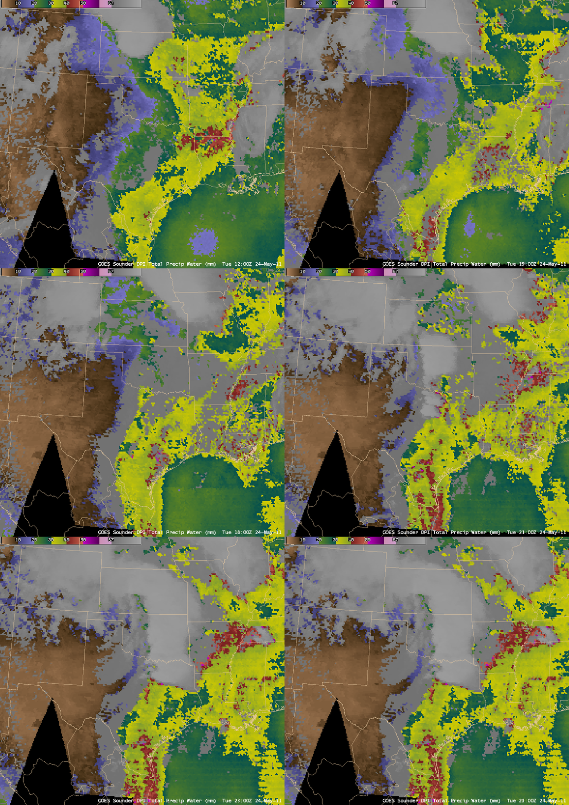
GOES-13 sounder Total Precipitable Water (TPW) derived product images (below) revealed that TPW values in excess of 30 mm or 1.2 inches (yellow color enhancement) began to stream northward from Texas into Oklahoma by 18:00 UTC. This moisture helped to fuel the development and maintenance of the deep convection across the region.
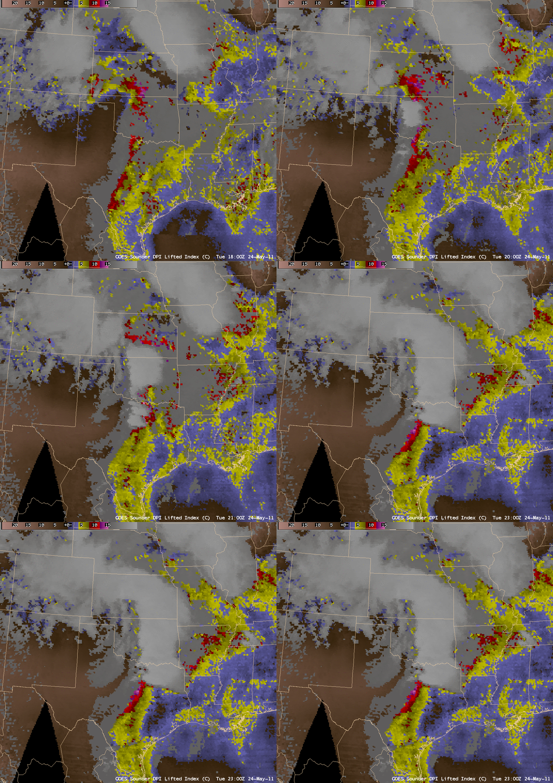
The 12 UTC rawinsonde report from Norman, Oklahoma revealed a classic “loaded gun” type of profile, which would lead to a very unstable airmass once strong surface heating took place during the morning and early afternoon hours. GOES-13 sounder Lifted Index (LI) derived product images (below) showed LI values of -10 to -13 C (red to violet color enhancement) just ahead of the dryline, where the atmosphere had indeed become very unstable.
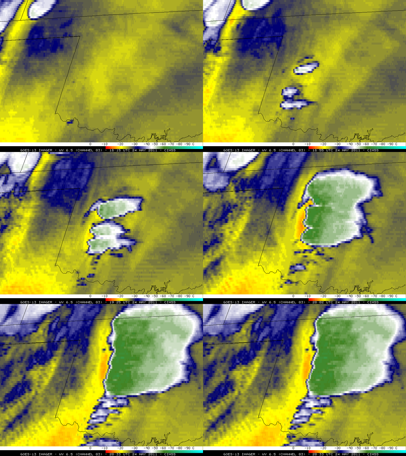
Once the severe thunderstorms began to form across western Oklahoma after 18:15 UTC, GOES-13 6.5 µm water vapor channel images (below) displayed a pronounced warm/dry signature (orange color enhancement) immediately behind the thunderstorms — a signature of strong subsidence in the wake of the convection.
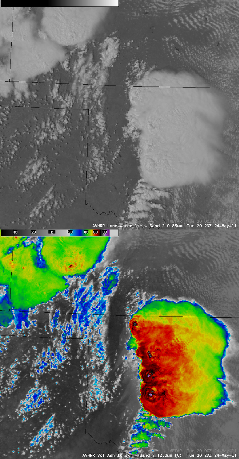
AWIPS images of 1-km resolution POES AVHRR 0.86 µm visible channel and 12.0 µm IR channel data at 20:32 UTC (below) revealed distinct overshooting tops on the visible image, with corresponding cloud top IR brightness temperatures as cold as -85ºC (violet color enhancement). Note that large swaths of rain-cooled ground could be seen on the IR image, which exhibited a lighter gray appearance immediately behind the thunderstorms.
For more information on this severe weather outbreak, see the National Weather Service websites at Norman OK, Tulsa OK, Dodge City KS, and Wichita KS.
===== 26 May Update =====
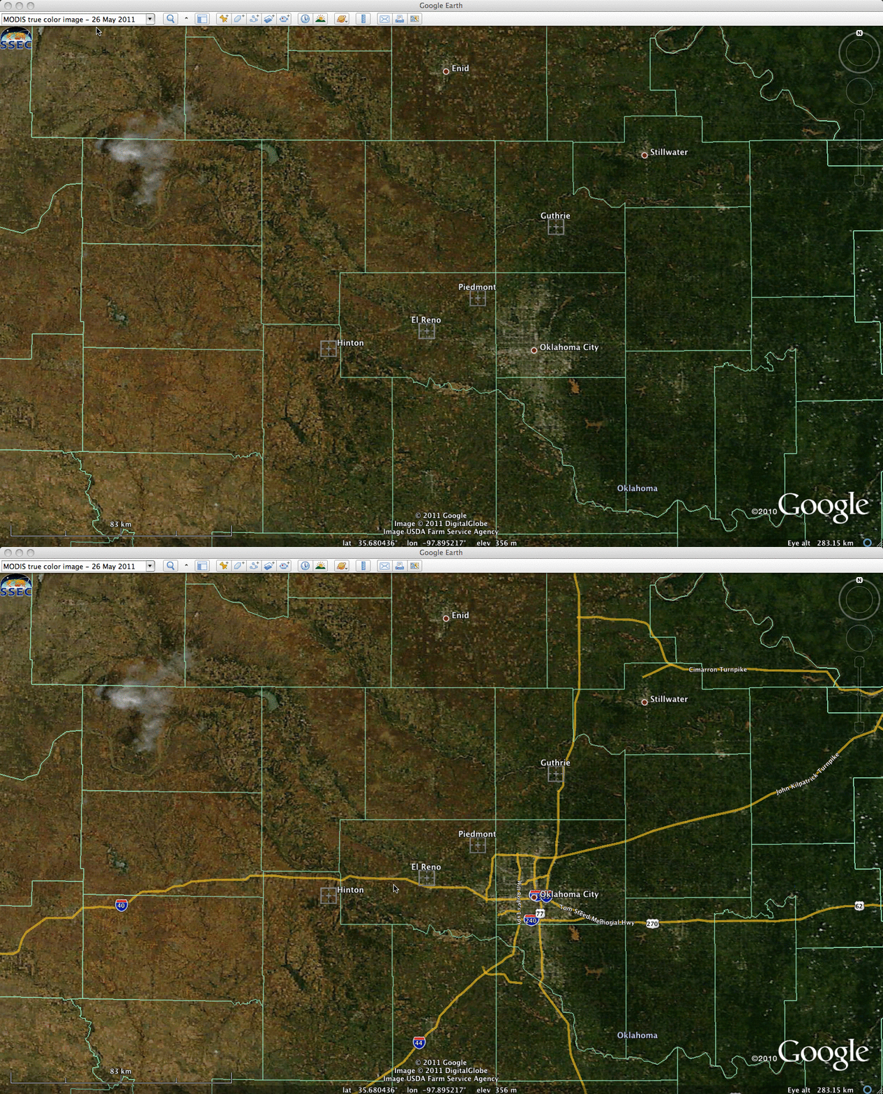
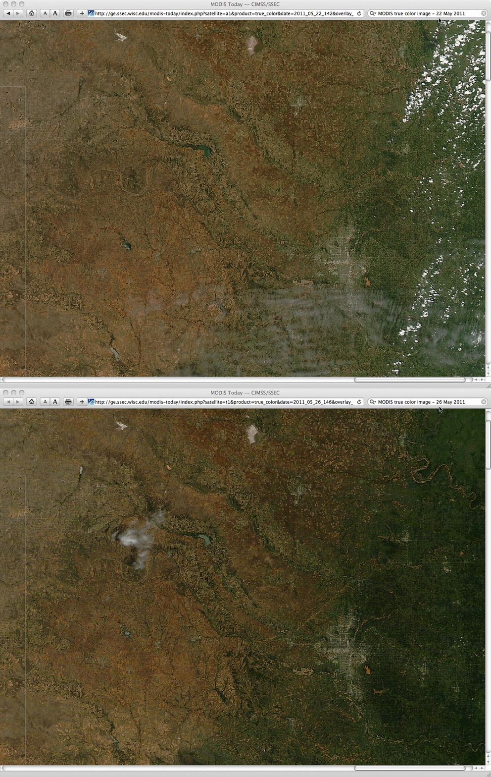
A 250-meter resolution MODIS true color Red-Green-Blue (RGB) image from the SSEC MODIS Today site (above; viewed using Google Earth) revealed one of the 24 May tornado damage tracks (oriented from southwest to northeast) which was located just to the northwest of Oklahoma City. Early in its life cycle, the tornado crossed Interstate 40, overturning a number of vehicles.
A comparison of before (22 May 2011) and after (26 May 2011) MODIS true color images (below) showed that the tornado damage path was not present on the 22 May image,


