EF-4 tornado strikes the St. Louis, Missouri area
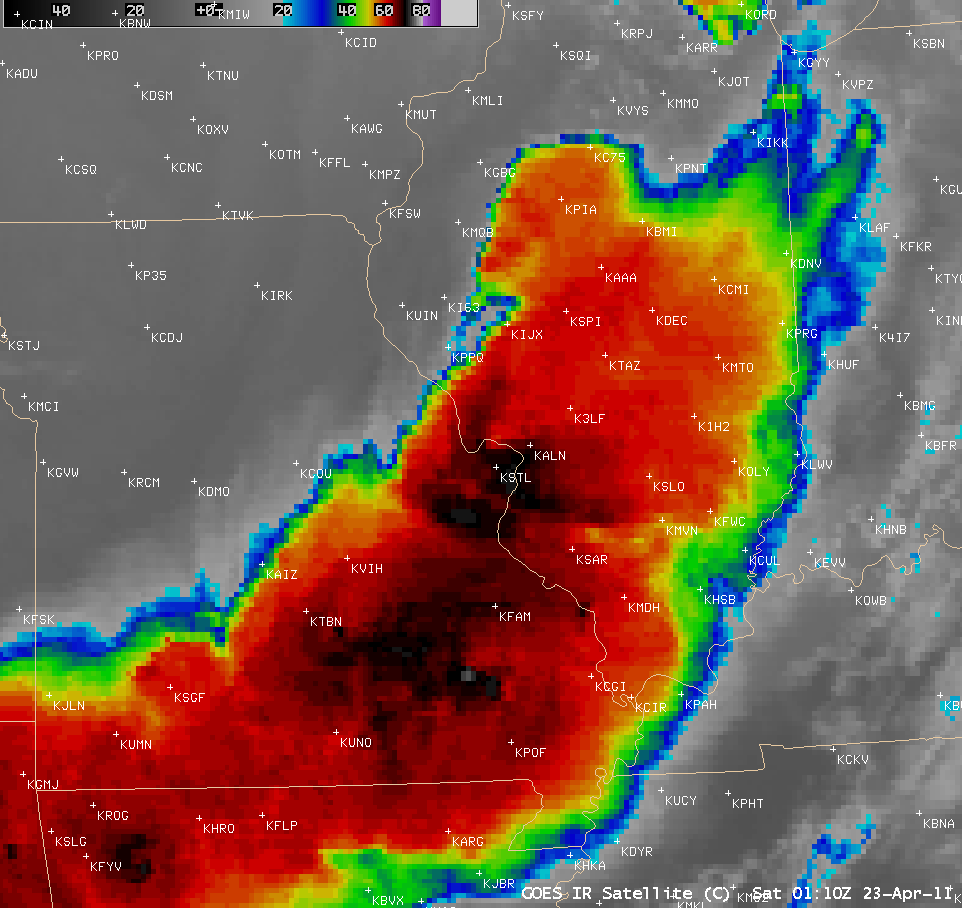
AWIPS images of GOES-13 10.7 µm IR data (above; click image to play animation) showed a large line of severe thunderstorms that moved eastward across the middle Mississippi River Valley region during the evening of 22 April 2011. This storm produced a significant number of large hail, damaging wind, and tornado reports (including one that did damage to the St. Louis airport). The initial storm damage survey has found EF-4 damage in the northern St. Louis county area.
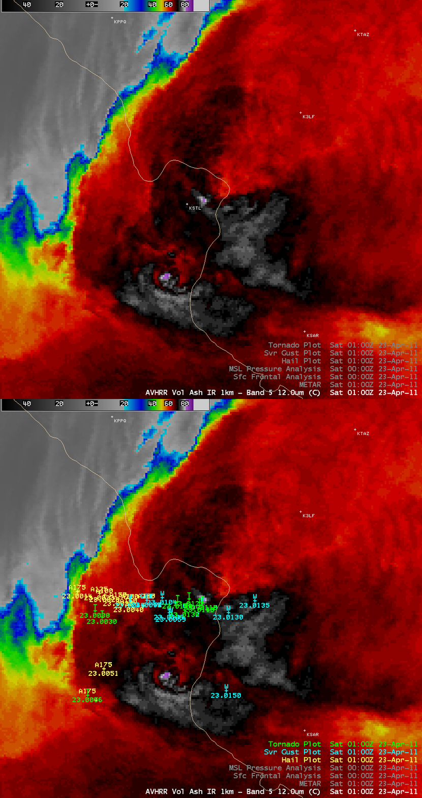
A 1-km resolution POES AVHRR image very close to the time that the tornado was moving through the St. Louis area is shown below, with an overlay of the SPC hail, damaging winds, and tornado reports. Though the time stamp of the AWIPS image was “01:00 UTC”, the actual time that the NOAA-16 satellite was making its overpass of that region was about 01:12 UTC. Note that the storm exhibited a very well-defined “enhanced-v” signature near St. Louis (with a minimum cloud top IR brightness temperature of -83º C) — this enhanced-v IR storm top signature is often observed with areas of strong convection that are producing (or are about to produce) either large hail, damaging winds, or tornadoes.
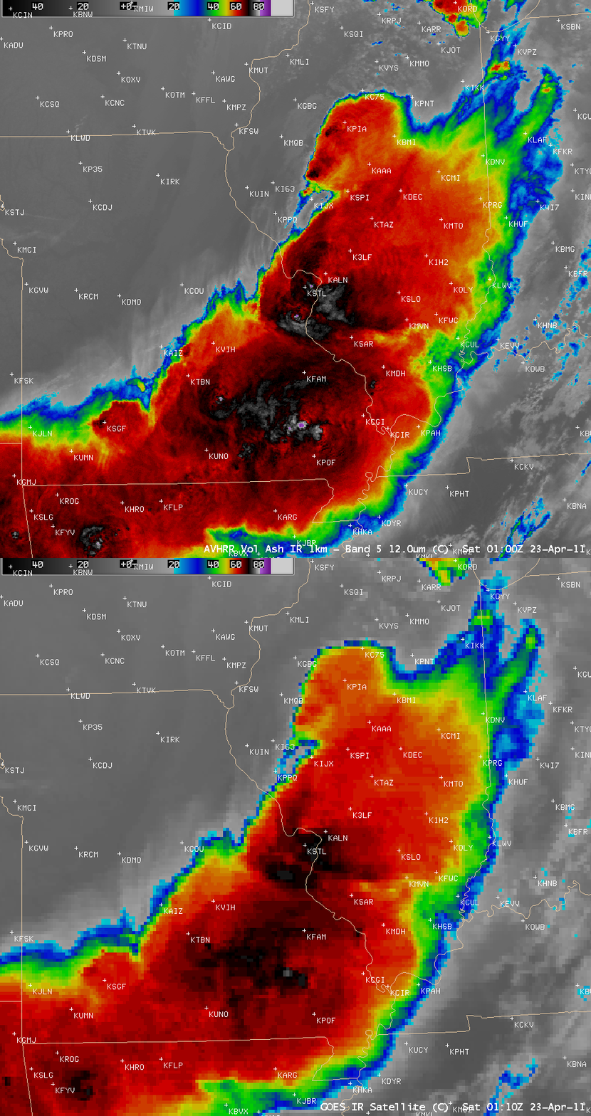
On a larger-scale view, a comparison of the 1-km resolution POES AVHRR 12.0 µm IR image with the corresponding 4-km resolution GOES-13 10.7 µm IR image (below) demonstrated two things: (1) how an improvement in spatial resolution can aid in the detection of small-scale cloud top features and signatures, and (2) the parallax shift of the high cloud top features on the GOES-13 image (features are shifted farther to the northwest compared to the POES AVHRR image, due to the large viewing angle from GOES-13). In spite of the AWIPS time stamps of the 2 images being different, the times of the images are actually about the same: the GOES image began scanning southward from southern Canada at 01:10 UTC, while the Miami ground station began to receive to NOAA-16 AVHRR image over the Gulf of Mexico at 01:00 UTC. Both images are scanning the St. Louis region around 01:12 UTC.
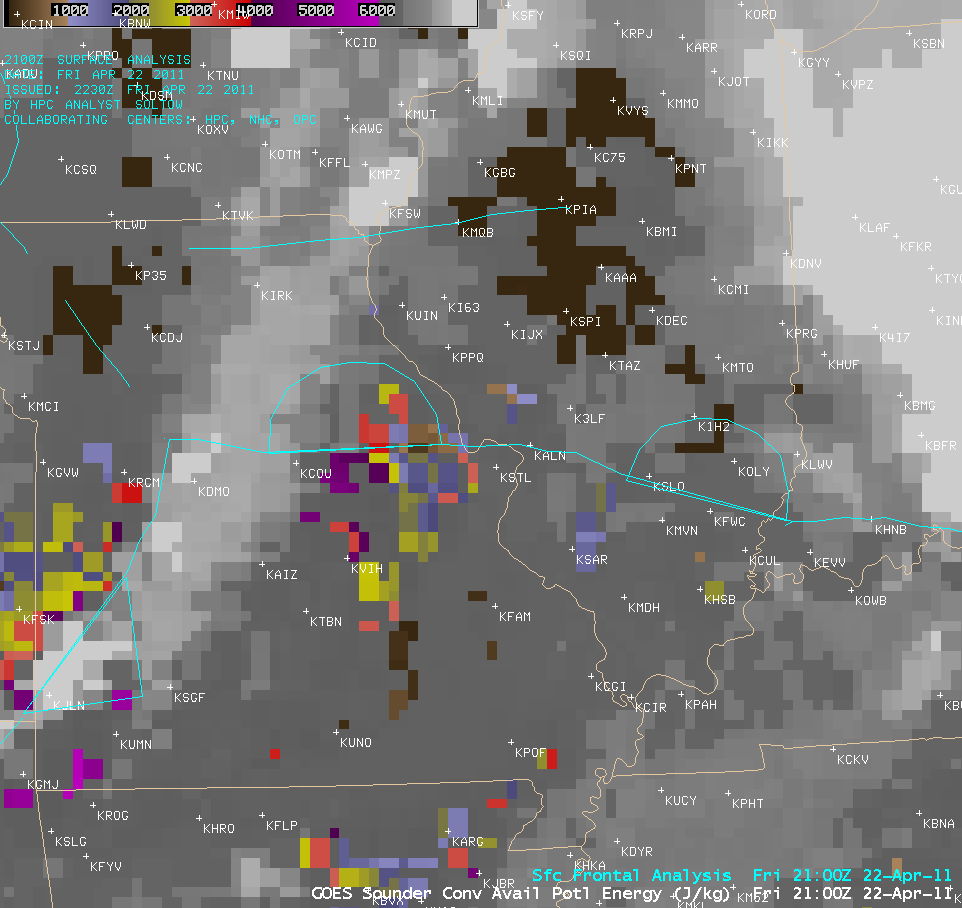
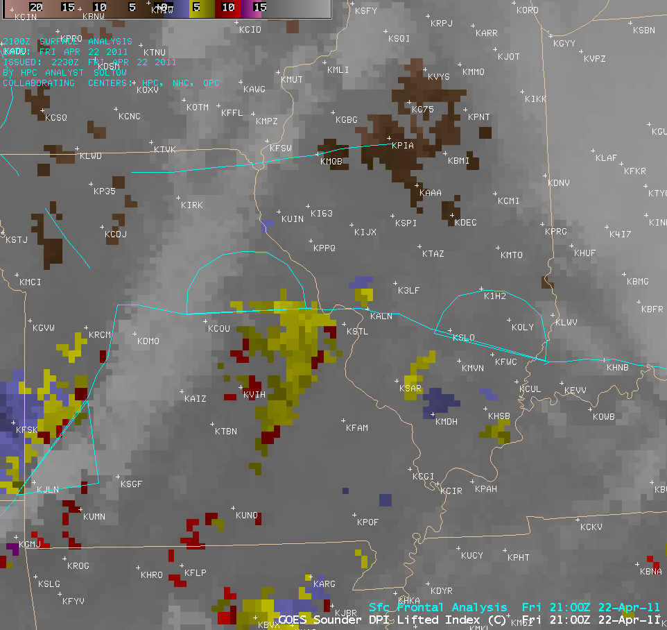
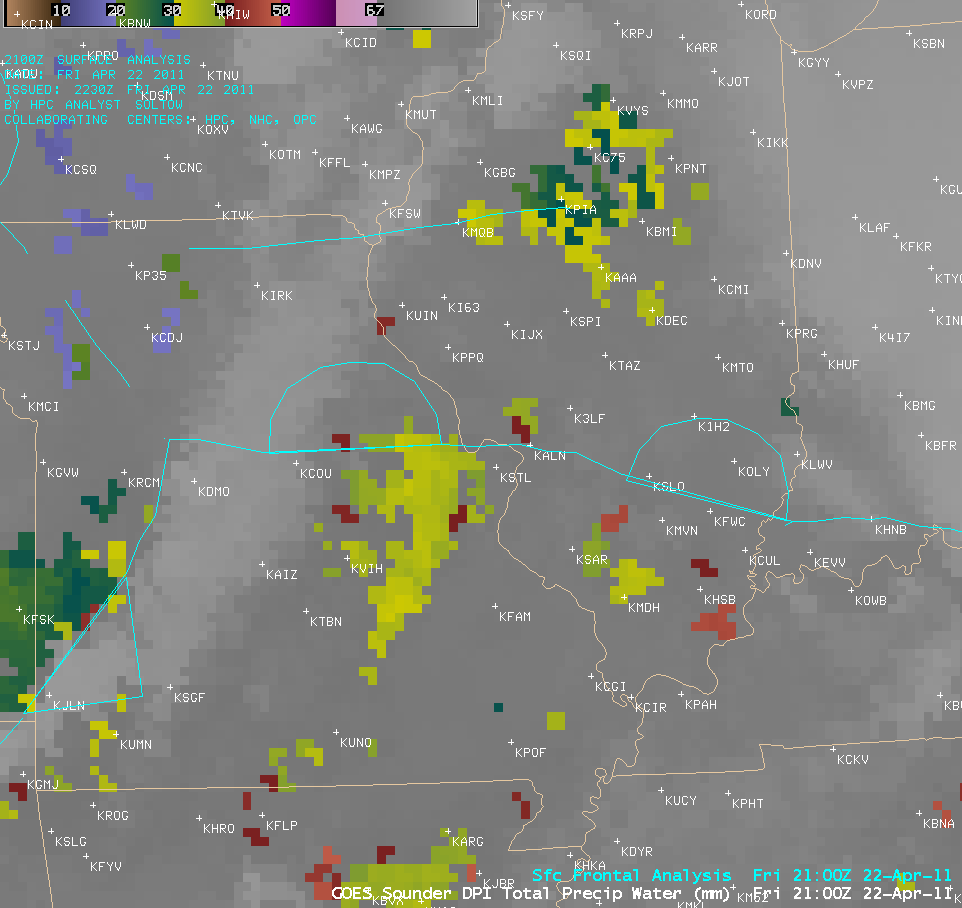
As the line of convection was organizing across western Missouri during the afternoon hours, GOES-13 sounder derived product images (below) of Convective Available Potential Energy (CAPE), Lifted Index (LI), and Total Precipitable Water (TPW) showed that the air mass south of the warm frontal boundary across eastern Missouri was moist (TPW values of 30-40 mm or 1.2 to 1.6 inches) and unstable (CAPE values exceeding 4000 J/kg and LI values of -5 to -9 C).


