Fire activity in California
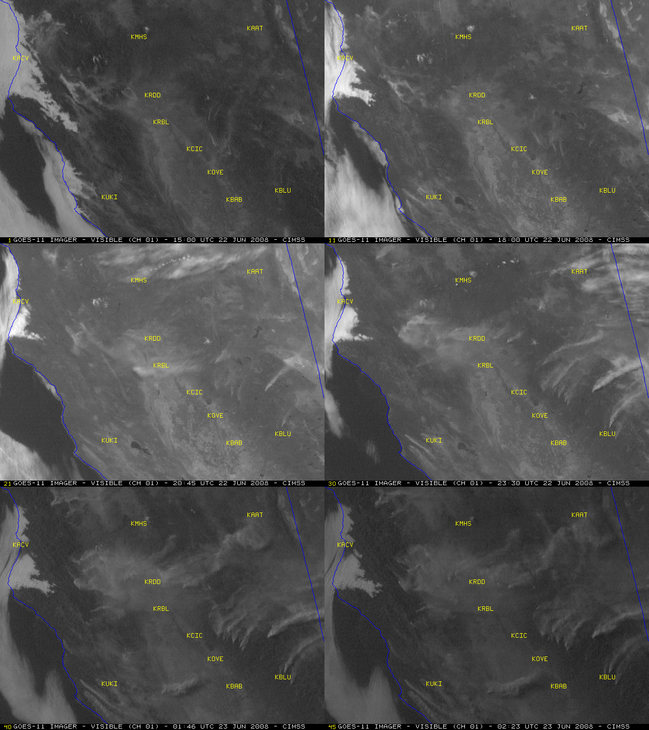
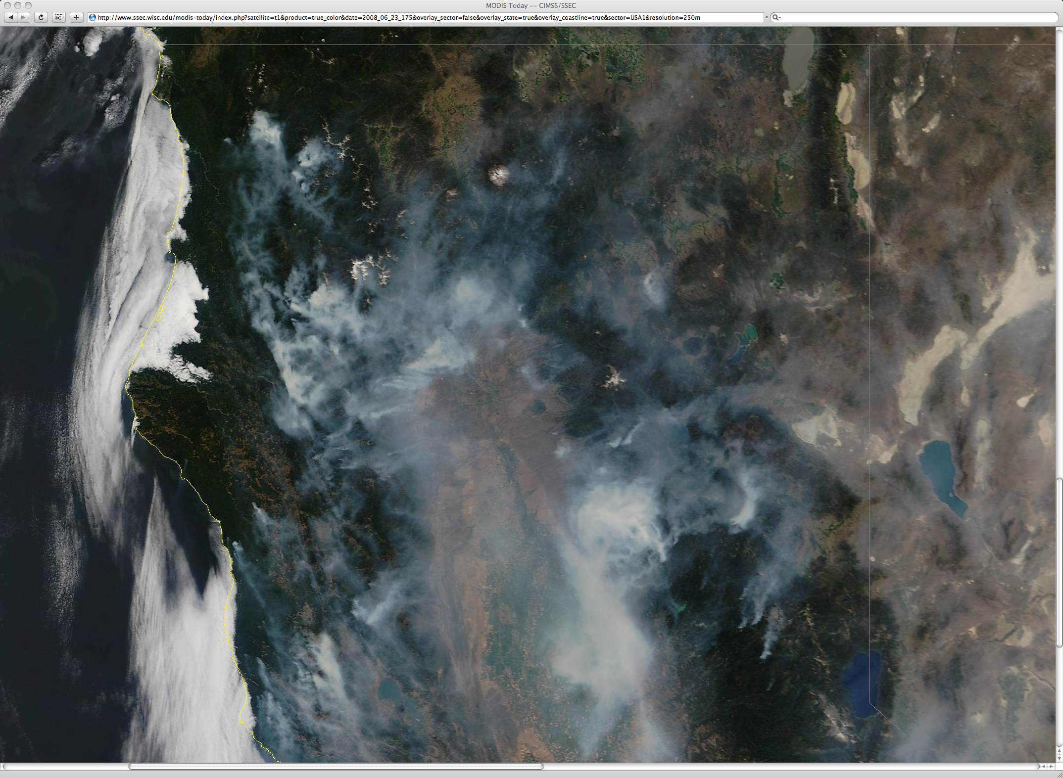
Numerous wildfires were started by lightning activity across Northern California on 21 June 2008, and GOES-11 visible images from 22 June (above) showed a large number of smoke plumes drifting across that region. A MODIS true color image from the SSEC MODIS Today site (below) showed that areas of thick smoke remained across much of northern California on 23 June, with some of the smoke still trapped in the valleys of the North Coast Range. The thick smoke drifting eastward on 22 June reduced surface visibility to 2 miles at Redding (station identifier KRDD), and was causing major air quality problems over a good deal of that area.
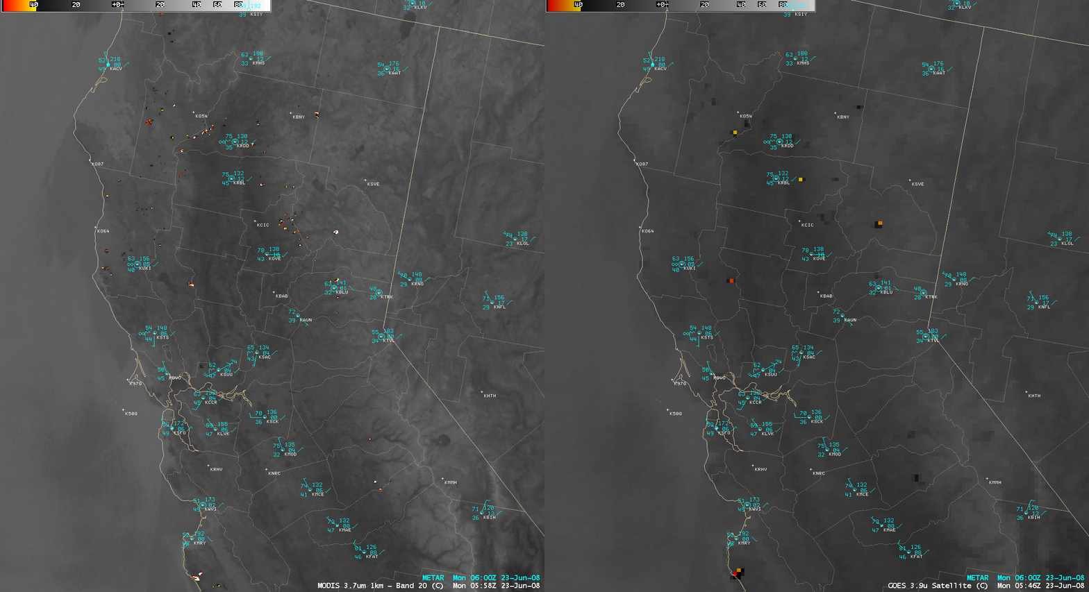
An AWIPS image comparison of the 1-km resolution MODIS 3.7 µm and the 4-km resolution GOES-11 3.9 µm shortwave IR channels from around 06 UTC on 23 June (11 PM local time on 22 June) demonstrated the improved ability to detect many of the smaller fires using higher spatial resolution data (below) . In addition, the actual locations of the larger fires were more correctly depicted on the 1-km MODIS image; the comparatively large 4-km GOES IR field of view (and to a lesser extent, the large geostationary satellite viewing angle) tends to diminish the accuracy of such small-scale image details. Improved fire monitoring will eventually be possible using the Advanced Baseline Imager (ABI) instrument on the upcoming GOES-R satellite (scheduled to be launched in 2014), which will offer similar IR imagery at a 2-km spatial resolution (at 5-minute intervals on a routine basis).
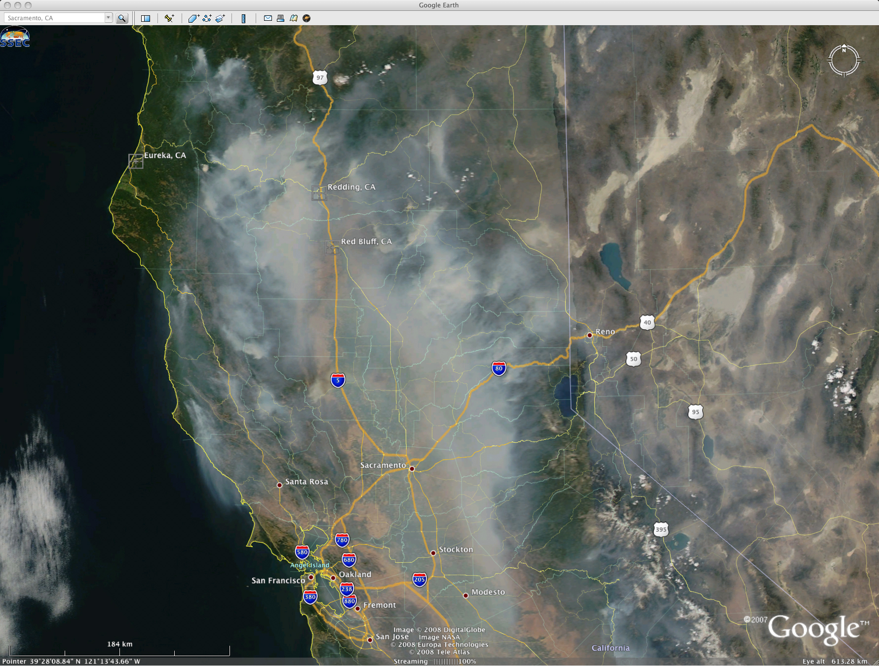
UPDATE: A MODIS true color image from 24 June (below, displayed using Google Earth) showed that the thick smoke had increased in areal coverage across much of northern California. MODIS Aerosol Optical Depth values as high as 1.0 were seen across much of the Sacramento Valley region of northern California; surface visibilities on that day at Redding and Red Bluff were as low as 1 mile due to smoke.


