Meso-vortex and lake-effect snow band over Lake Michigan
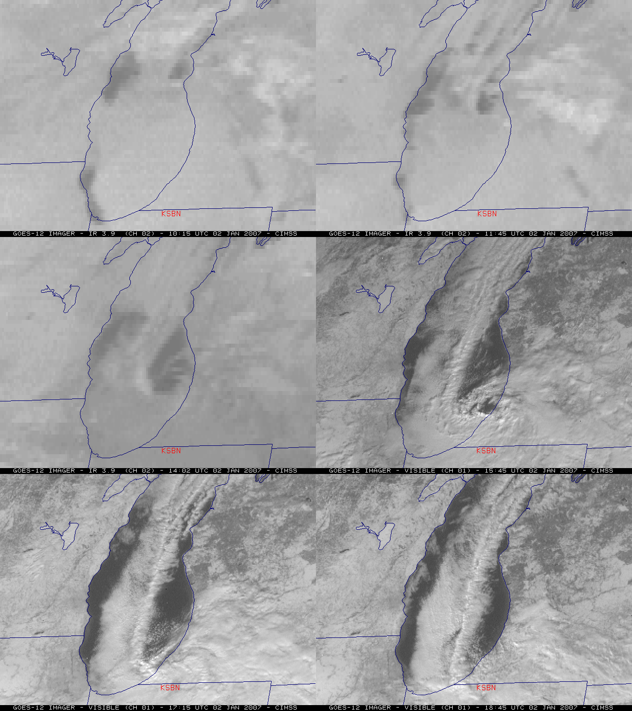
An animation of GOES-12 3.9 µm shortwave IR (nighttime) and visible channel (daytime) images (above) shows a well-defined meso-vortex and single lake-effect snow (LES) band moving southward across the southern portion of Lake Michigan on 02 January 2008. This narrow (but intense) LES band and meso-vortex contributed to impressive storm total snowfall amounts that included 26.0 inches at Hudson Lake, Indiana (located about 15 miles west of South Bend, Indiana — station identifier KSBN) and 18.5 inches at Buchanan, Michigan (located about 10 miles northwest of KSBN) — however, it appears that the majority of those storm total snowfall amounts were due to synoptic-scale snow and lake-enhanced snow processes during the preceding 24-48 hours.
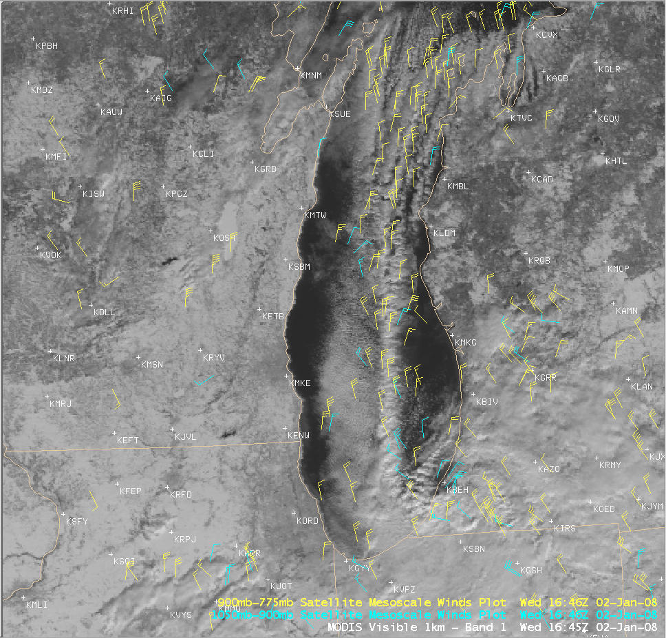
Mid-lake convergence played a role in the formation and maintenance of the LES band, as seen in an AWIPS image of the MODIS visible channel with CIMSS GOES Mesoscale Winds overlaid (below).
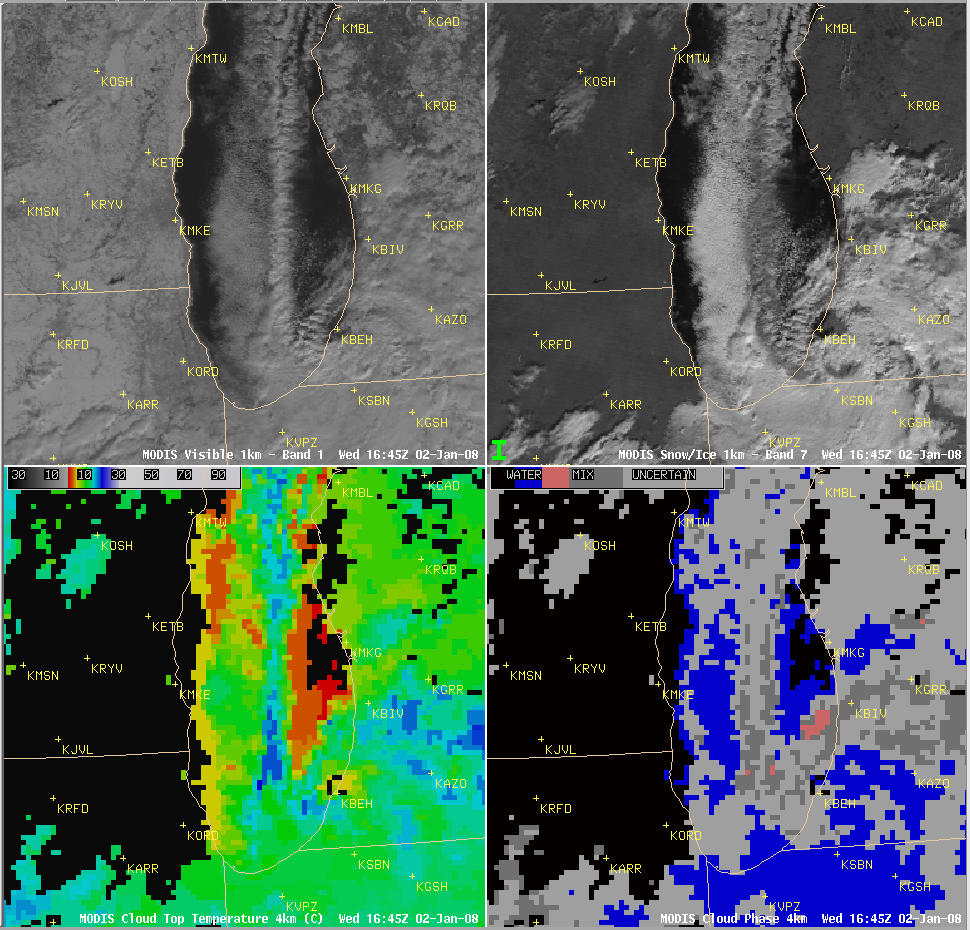
An AWIPS 4-panel display of MODIS images (below) shows the visible channel (upper left panel), 2.1 µm near-IR “Snow/Ice” channel (upper right panel), Cloud Top Temperature product (lower left panel), and Cloud Phase product (lower right panel) at 16:45 UTC (10:45 am local time). The darker appearance of the thickest (eastern) portion of the LES band on the MODIS “snow/ice” image suggested that part of the cloud band had glaciated and was composted primarily of ice crystals at that time (snow and ice are strong absorbers at the 2.1 µm wavelength, and appear much darker than supercooled water droplet clouds on the MODIS Snow/Ice channel imagery); this idea was further supported by corresponding MODIS Cloud Top Temperatures in the -15ºC to -20ºC range (cyan to dark blue enhancement, lower left panel) and “mixed phase” pixels on the MODIS Cloud Phase product (dark gray enhancement, lower right panel).


