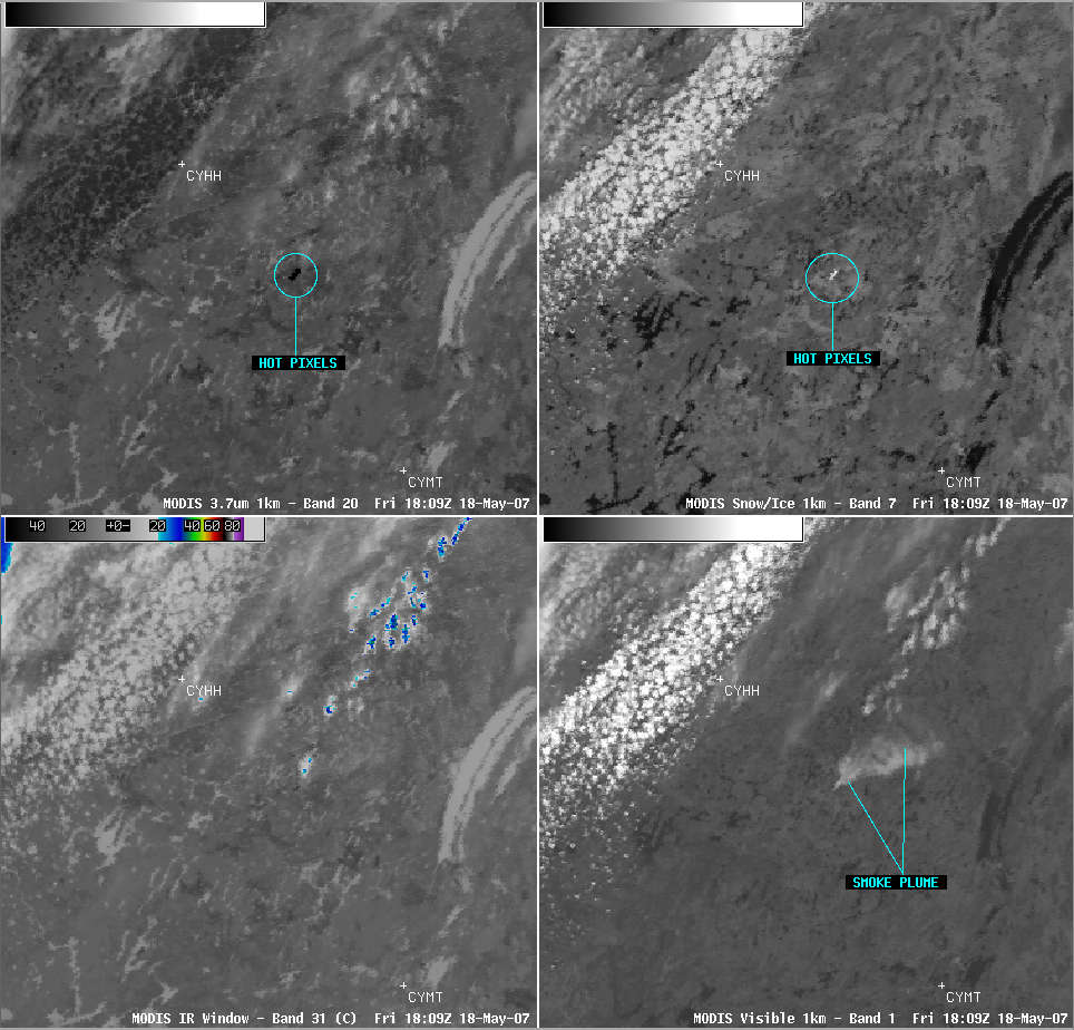
Fire and ice in Quebec, Canada
The AWIPS 4-panel display of MODIS imagery (above) shows a portion of west-central Quebec, Canada (between Nemiscau Airport, CYHH, and Chibougamau, CYMT) on 18 May 2007. The 3.7µm Band 20 shortwave IR image (upper left panel) and the 2.1µm Band 7 snow/ice image (upper right panel) both indicate a cluster of hot pixels (dark black on the Band 20 image, bright white on the Band 7 image) associated with a wildfire that started to burn at that location several hours earlier. This fire was hot enough to saturate the 3.9µm IR detectors on GOES-12, causing the indicated brightness temperatures to “roll over” and be displayed as very cold (bright white) pixels. The corresponding MODIS visible Band 1 image (lower right panel) shows the smoke plume from this fire, which was drifting northeastward.
There are numerous lakes in that region, including the long, curved Lake Mistassini (the largest lake in Quebec) located north-northeast of CYMT. Since the lakes in that area had only recently thawed, their water temperatures were still quite cold as confirmed by the light gray brightness temperatures on the MODIS Band 20 and Band 31 IR images (upper left and lower left panels). However, a close examination of the northern portion of Lake Mistassini on the MODIS visible Band 1 image (lower right panel) tells us that part of the lake still had significant ice (indicated by the lighter gray shades over the northern half of the lake). A MODIS true color image of Hudson Bay (below) includes the partially-ice-covered Lake Mistassini (as well as the fire smoke plume) in the extreme southeastern corner of the image.


