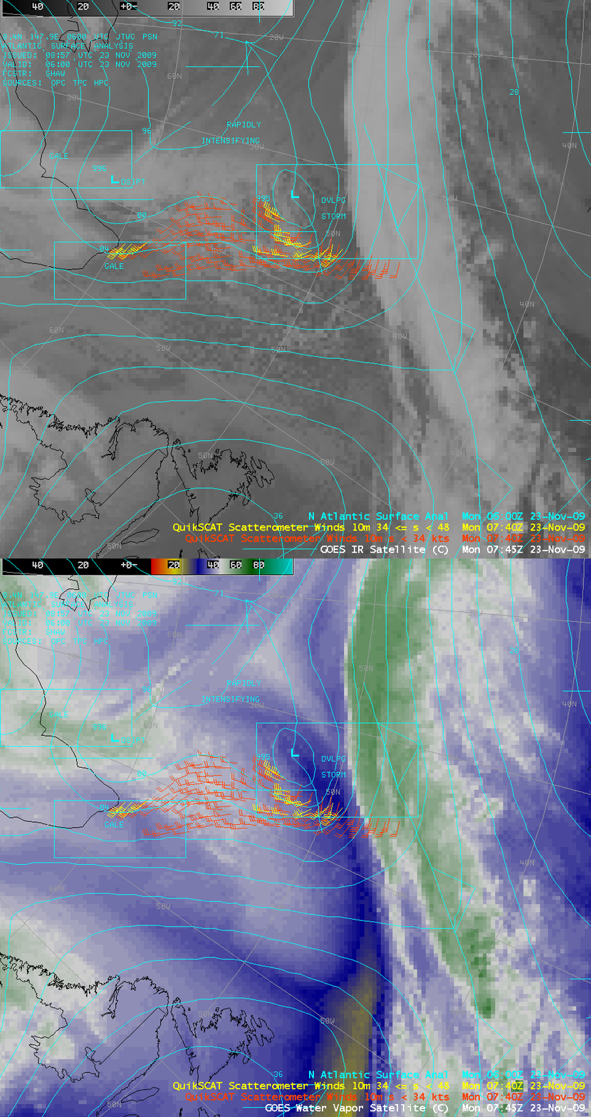
QuikSCAT satellite ceases operations
From an email received on the morning of 23 November 2009: “Several hours ago, shortly past 7:00Z today, telemetry received from QuikSCAT indicates that the antenna rotation rate has dropped to zero and remains at zero. The motor remains powered. The system can be operated safely in this state for an indefinite period. The QuikSCAT operations team will be meeting later this morning, but in all likelihood this is probably the end of the nominal mission.”
The image above shows the last QuikSCAT data processed on the AWIPS system at the Cooperative Institute for Meteorological Satellite Studies (CIMSS). The scatterometer wind data show the flow around a developing cyclone located southeast of the southern tip of Greenland. The underlying GOES-12 IR and water vapor images also reveal a classic baroclinic leaf pattern southeast of the developing cyclone, which is a satellite signature of impending cyclogenesis.
With the loss of QuikSCAT, the only scatterometer winds available in AWIPS are those from ASCAT. For additional information, see the VISIT training modules QuikSCAT Winds and ASCAT Winds.
Addendum (24 November 2009): A loop of infrared imagery over the North Atlantic using imagery from every three hours after the image above nicely shows the evolution of cyclogenesis. The swirl at low levels diagnosed by QuikSCAT is evident as is the development of a comma shape to the higher clouds. Both are hallmarks of the developing storm.
The 1200 UTC analysis from 24 November shows a vigorous cyclone has developed over the North Atlantic from the region where the QuikSCAT near-surface winds showed a swirl on Monday.


