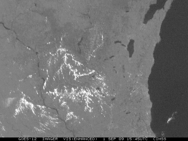
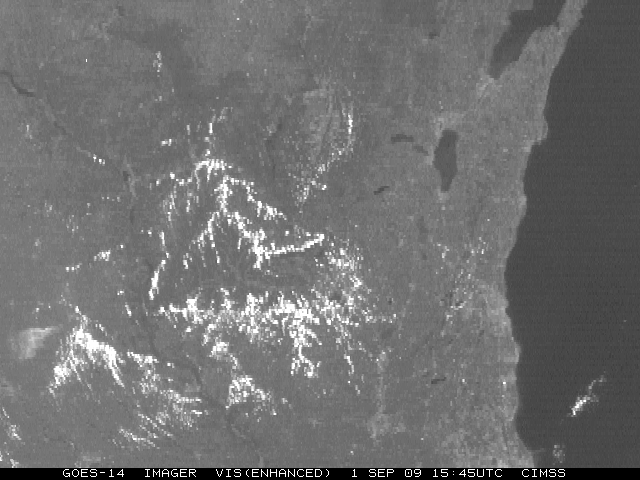
GOES-14 vs GOES-12 visible channel
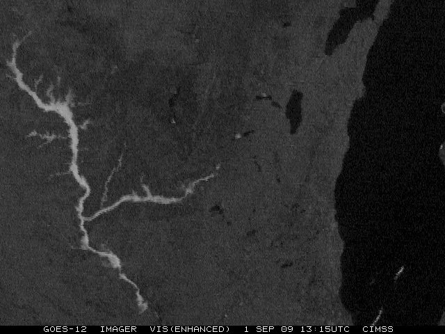
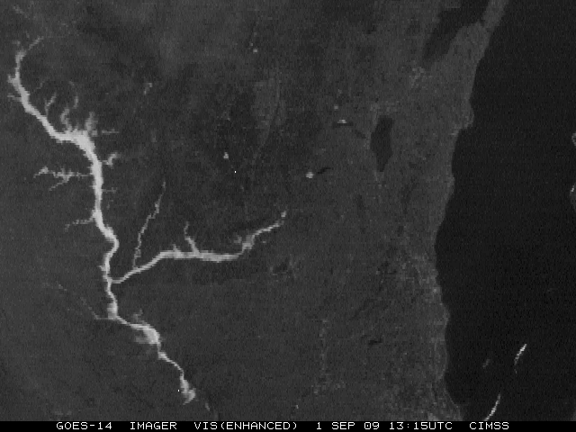
A comparison of enhanced visible channel images from GOES-12 and GOES-14 at 13:15 UTC on 01 September 2009 is shown above — both images have been remapped to a Mercator projection over the state of Wisconsin. The obvious “meteorological” phenomenon is the early morning fog in the Mississippi, Wisconsin, and Kickapoo River basins, in addition to numerous other valleys and river basins feeding into the Mississippi River.
There are a couple of significant differences to note between the 2 visible images. First of all, the fog is a bit brighter and a little more extensive in the GOES-14 image compared to the GOES-12 image. This is primarily due to the relative age of the visible sensors (which noticeably degrades with time). The second major difference is the relative contrast of lakes, rivers, vegetation, and land usage. GOES-12 has slightly more contrast between land and lakes (and/or other bodies of water) than GOES-14.
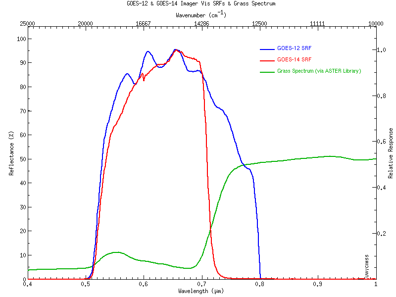
On the other hand, GOES-14 is able to discern urban centers more readily than GOES-12, as well as variations in vegetation type. Examples of this are around the large metropolitan region of southeastern Wisconsin and northeastern Illinois (i.e. Milwaukee to Chicago). Also, both the Baraboo Range (located just to the northwest of Madison) and the “Military Ridge” (which runs east to west from Madison to Prairie du Chien) stand out more boldly in the GOES-14 image compared to the GOES-12 image (AWIPS topography image). This difference is primarily due to the slight variation in the spectral width of the two visible bands on the GOES-12 and GOES-14 Imager instruments. A comparison of the visible channel spectral response function for GOES-12 and GOES-14 (below) shows that the sharper cutoff for wavelengths beyond 0.7µm on the GOES-14 visible channel makes it less sensitive to the signal from the mature corn crops, allowing greater contrast between the thick vegetation of the agricultural fields and the more sparsely vegetated cities, towns, and highway corridors.
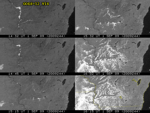
A time series of GOES-12 visible images (below) illustrates how the cumulus cloud field developed during the morning hours as solar heating increased — convective clouds were seen to develop right over the Baraboo Range and the Military Ridge (AWIPS topography image). At 15:15 UTC and 15:32 UTC, effect of the terrain on cumulus initiation was quite evident, while more “ridge-line cumulus” developed and filled the region by 16:00 UTC and later.
Re-mapped GOES-12 and GOES-14 visible images at 15:45 UTC are shown below, after cumulus development had progressed.


