Bay Effect and Ocean Effect Snows in Virginia and North Carolina
![GOES-13 Visible (0.65 µm) Imagery, 1300-2045 UTC on 5 January 2015 [click to animate]](https://cimss.ssec.wisc.edu/satellite-blog/wp-content/uploads/sites/5/2016/01/GOES13_BAYEFFECT_5JAN2015anim_1300_2045.gif)
GOES-13 Visible (0.65 µm) Imagery, 1300-2045 UTC on 5 January 2015 [click to animate]
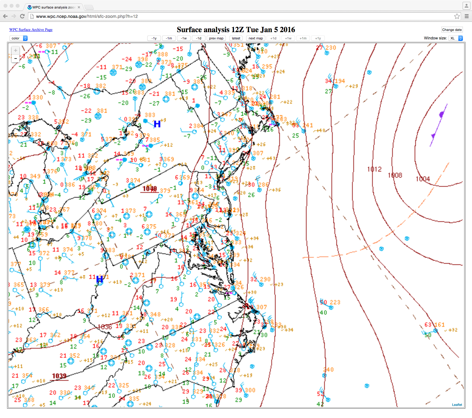
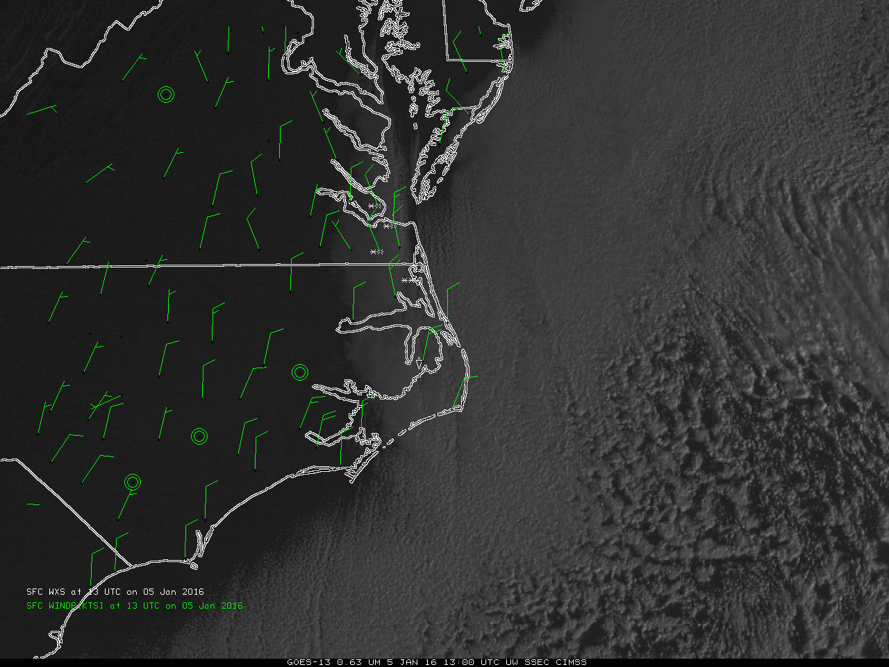
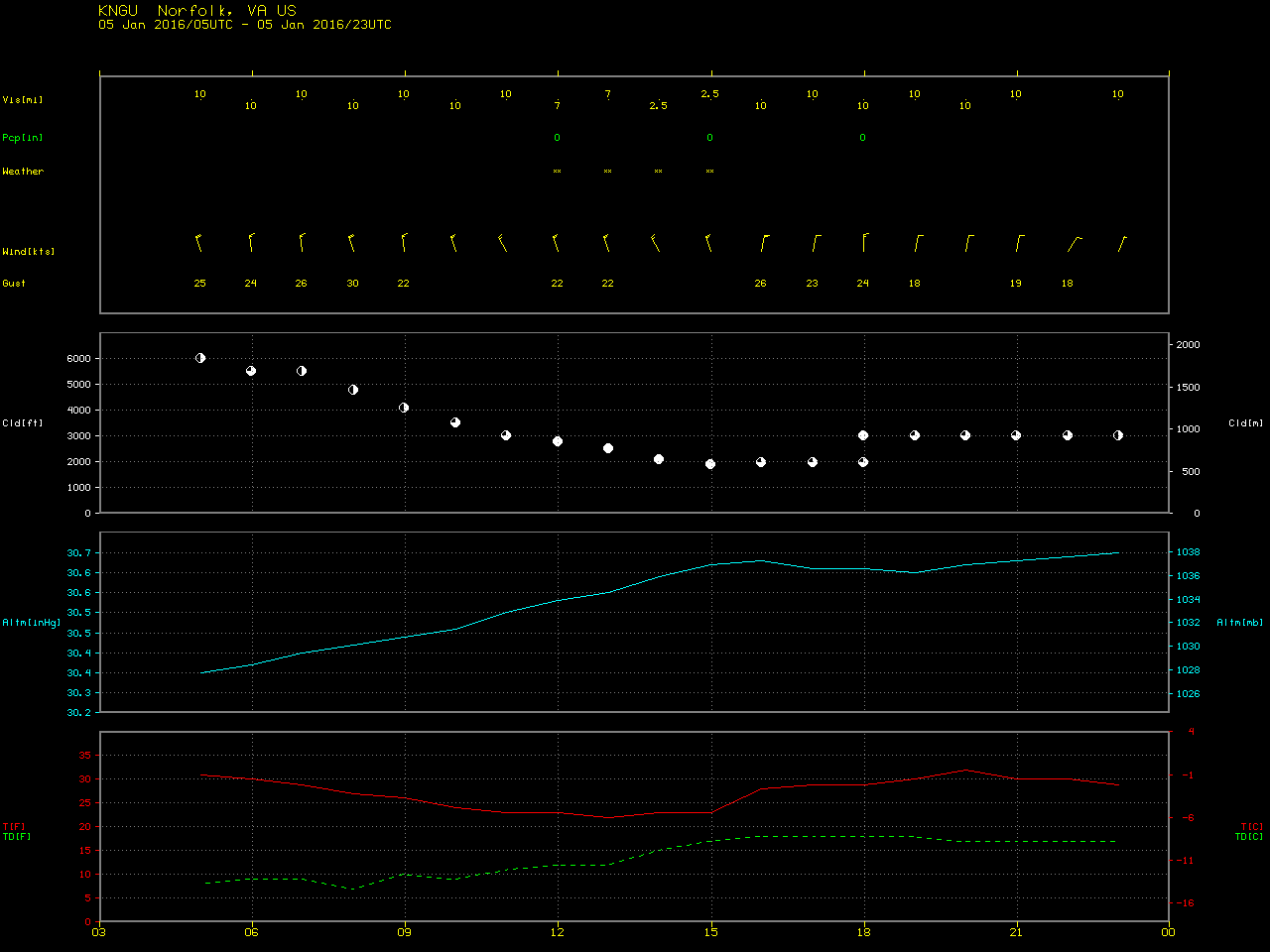
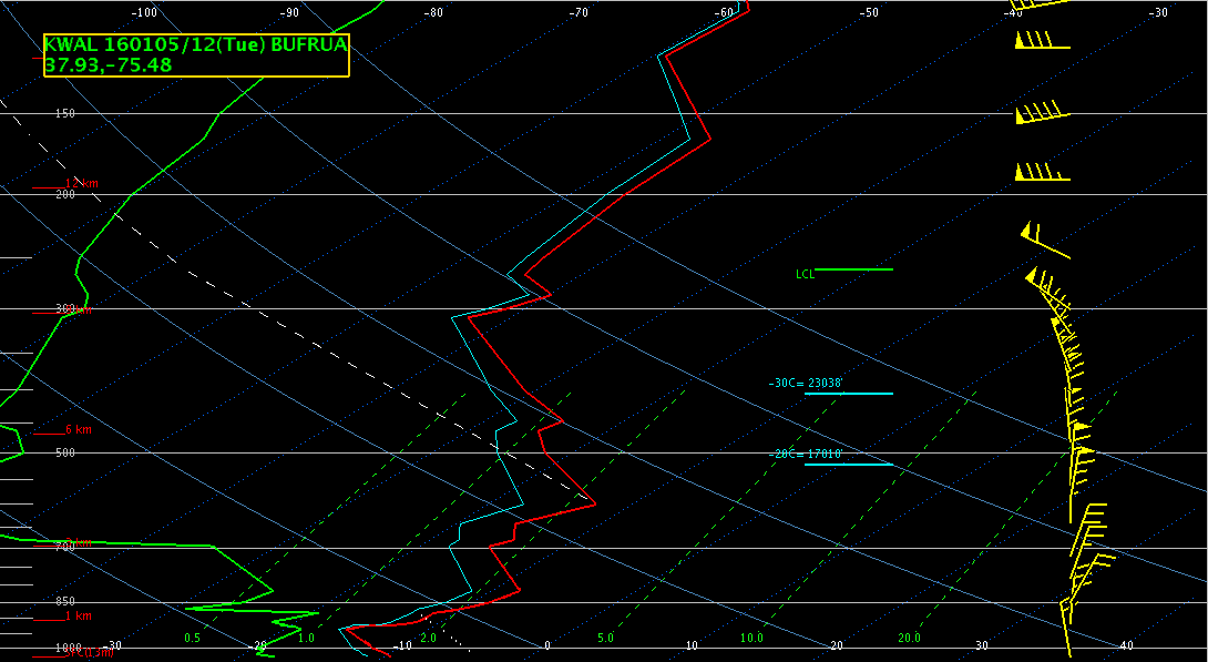
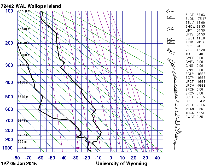
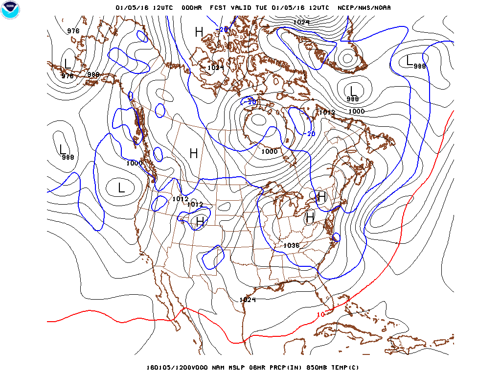
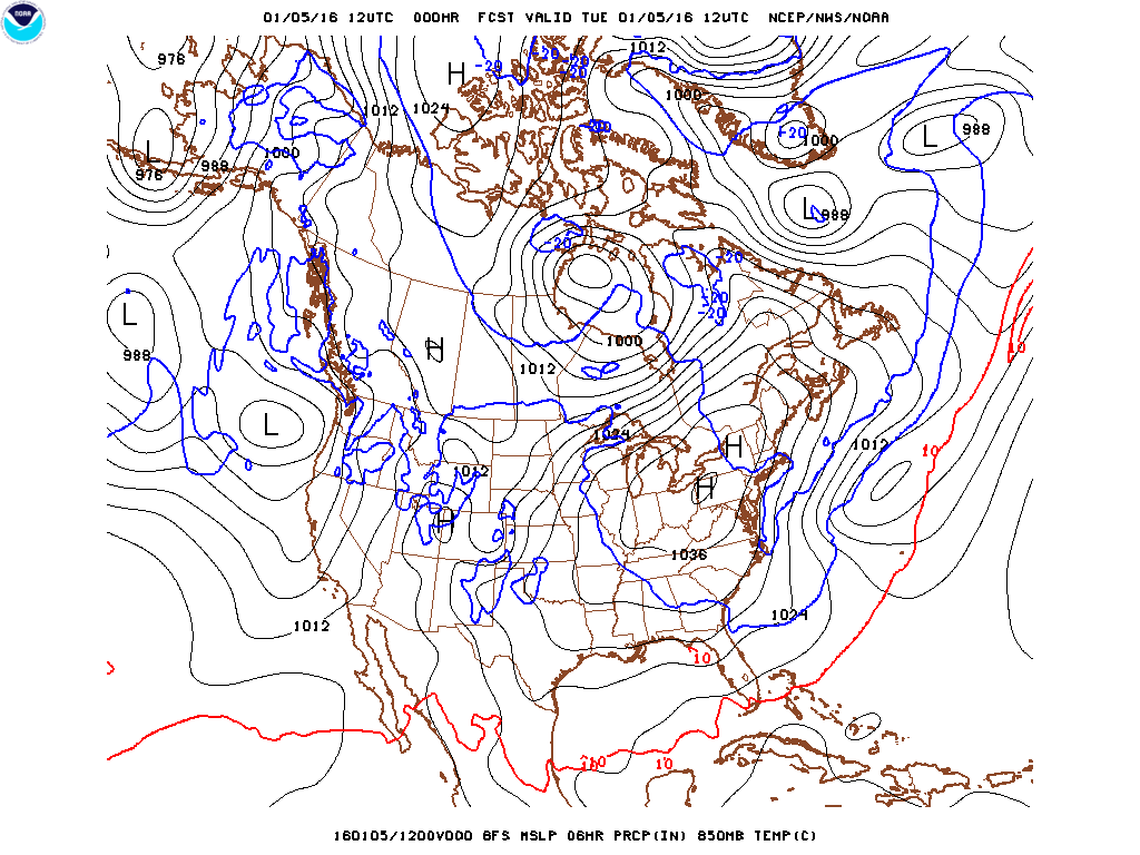
As a Low pressure center moved away from the coast, and a High pressure system approached from the west (link), cold air swept south along the east coast of the United States and produced light snow/flurries over Tidewater Virginia and the Outer Banks of North Carolina on Tuesday, 5 January 2016. The animation above, of the GOES-13 Visible Imagery, shows a band of cloudiness originating over the northern Chesapeake Bay that widened as it moved south. By the time it reached southern Virginia, it was producing snow. Conditions over the Outer Banks of North Carolina were very icy, as shown in this Video, courtesy of Sam Walker. The snow closed schools in Dare County. The 1300 UTC observations, below, in a toggle with 2100 UTC observations, showed morning snow over the Tidewater region and over extreme eastern North Carolina with strong north-northwest winds (gusting to 30 knots at Norfolk Naval Air Station). By 2100 UTC, winds had shifted and weakened and snow was no longer reported (an intermediate 1754 UTC MODIS image showed the cloud bands 1 hour after reports of snow had ended). It was still cold however: the sub-freezing daytime high in Norfolk VA was the first of the winter and the coldest day since late February 2015 (Temperatures did rise above freezing after sunset, however, to 35 at 11:59 PM on the 5th).
![GOES-13 Visible (0.65 µm) Imagery, 1300 and 2045 UTC on 5 January 2015, with surface weather observations and wind barbs [click to enlarge]](https://cimss.ssec.wisc.edu/satellite-blog/wp-content/uploads/sites/5/2016/01/GOES13_SURFACEOBS_1300_2100UTC_5JANUARY2016toggle.gif)
GOES-13 Visible (0.65 µm) Imagery, 1300 and 2045 UTC on 5 January 2015, with surface weather observations and wind barbs [click to enlarge]
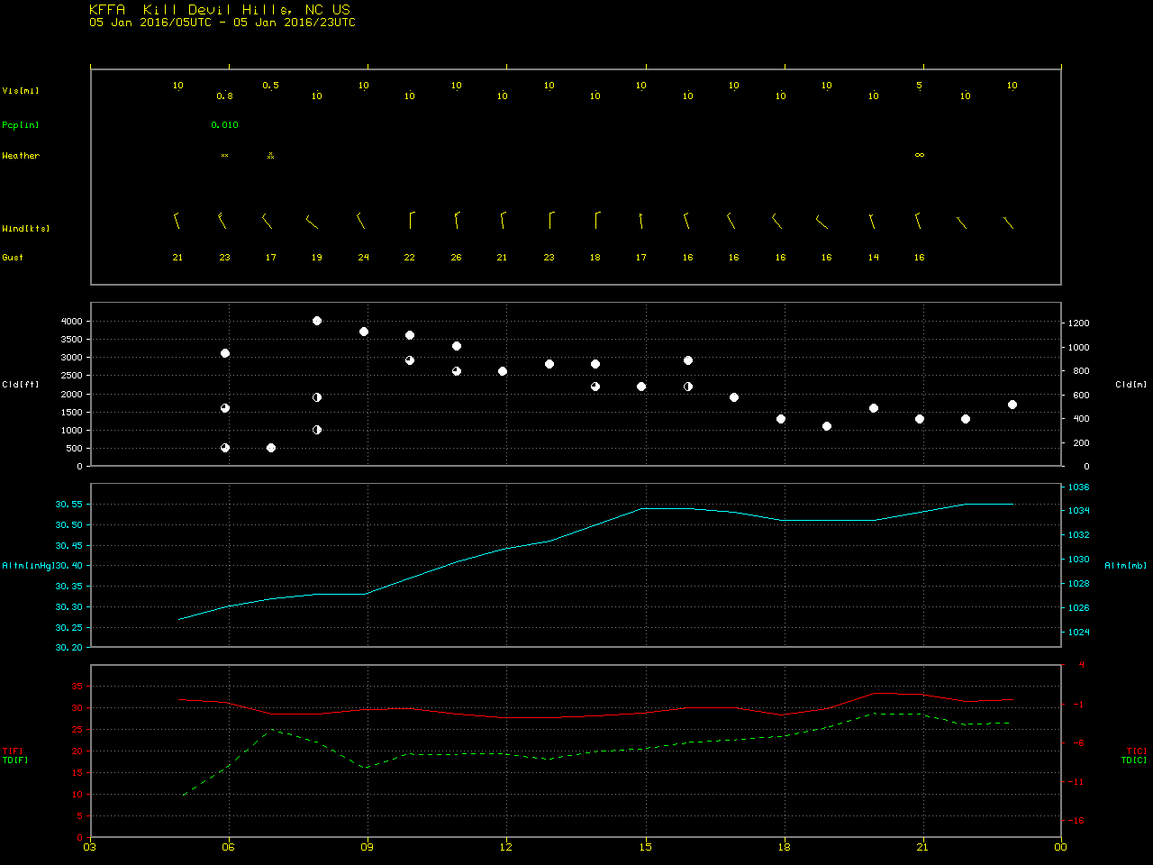
In the preceding nighttime hours before visible imagery was available, long and well-defined bay effect and ocean effect cloud bands were evident on 1-km resolution Terra and Aqua MODIS 11.0-3.7 µm IR brightness temperature difference (legacy “fog/stratus product”) images, below. One cloud band was slowly moving westward over time toward the Outer Banks of North Carolina; at 07 UTC, Kill Devil Hills (located just north of Manteo, station identifier KMQI on the images) was reporting moderate snow reducing the surface visibility to 1/2 mile.
![MODIS 11.0-3.7 µm IR brightness temperature difference images [click to enlarge]](https://cimss.ssec.wisc.edu/satellite-blog/wp-content/uploads/sites/5/2016/01/160105_modis_fog_stratus_ir_btd_anim.gif)
MODIS 11.0-3.7 µm IR brightness temperature difference images [click to enlarge]