“River-effect” snow in South Dakota
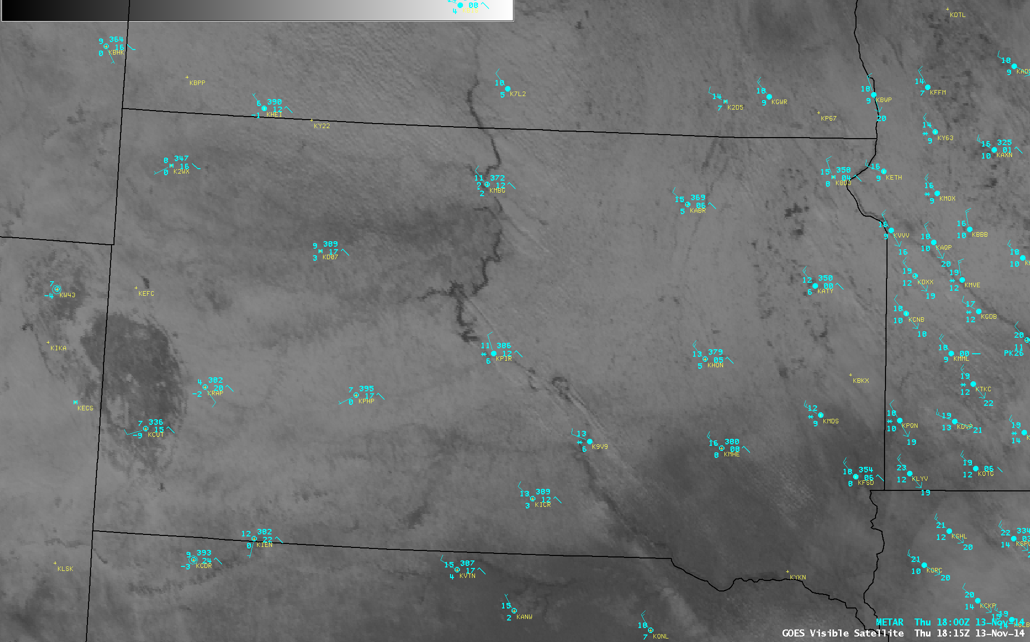
GOES-13 0.63 µm visible channel images (above; click image to play animation) revealed the presence of numerous cloud streamers originating over the Lake Oahe and Lake Sharpe reservoirs along the Missouri River in South Dakota on 13 November 2014. At times these cloud bands were producing snow that was reducing surface visibility to 4 miles at Pierre (KPIR) and 5 miles at Chamberlain (K9V9).

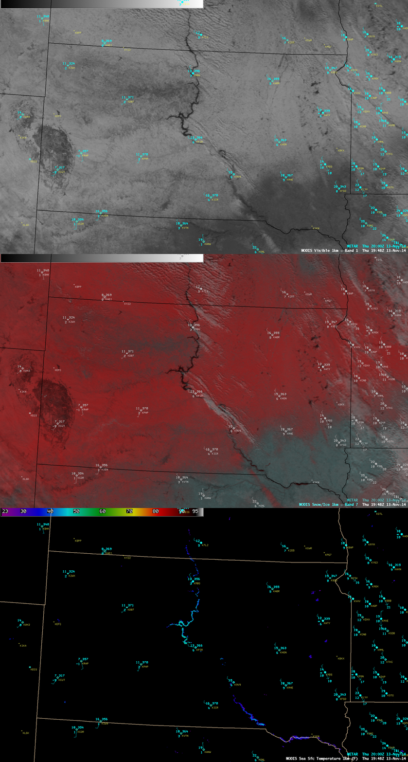
Aqua MODIS 0.65 µm visible channel image, False-color RGB image, and Sea Surface Temperature product at 19:48 UTC
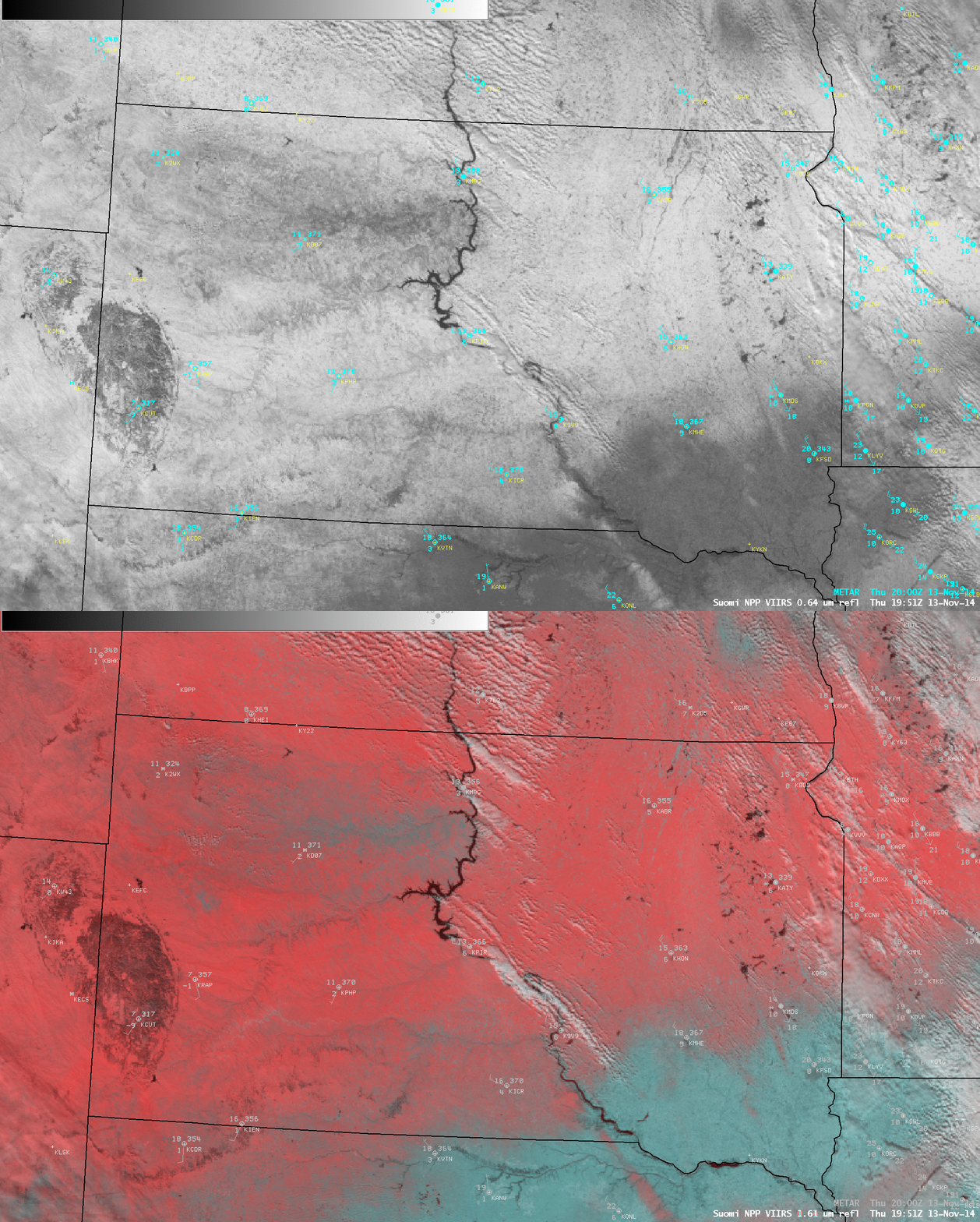
Comparisons of visible channel and false-color Red/Green/Blue (RGB) images from Aqua MODIS (above) and Suomi NPP VIIRS (below) demonstrated the value of RGB products to more easily identify such supercooled water droplet cloud features (which appear as varying shades of white) in areas that have underlying snow cover (which appears as varying shades of red). In addition, the MODIS Sea Surface Temperature (SST) product (above) showed that SST values were in the 40-50º F range (cyan color enhancement) in those Missouri River reservoirs, making them significantly warmer than the cold arctic air mass that had overspread the region.


