Super Typhoon Sanba
McIDAS images of MTSAT-2 10.8 µm IR channel images (above; click image to play animation) showed the formation of a large and well-defined eye as Super Typhoon 17W (Sanba) intensified over the West Pacific Ocean on 13 September 2012.
A plot of the CIMSS Advanced Dvorak Technique intensity estimate (below) showed the trend of rapid intensification.
Sanba was in an environment characterized by relatively low values of Deep Layer Wind Shear (below), which favored intensification.
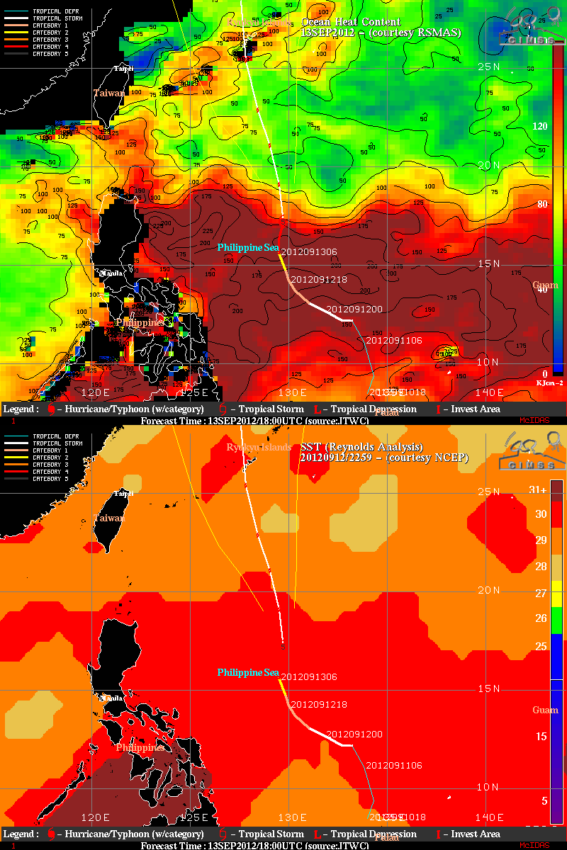
Sanba had also been moving over a region with very warm Sea Surface Temperatures and a very high Ocean Heat Content values (below).
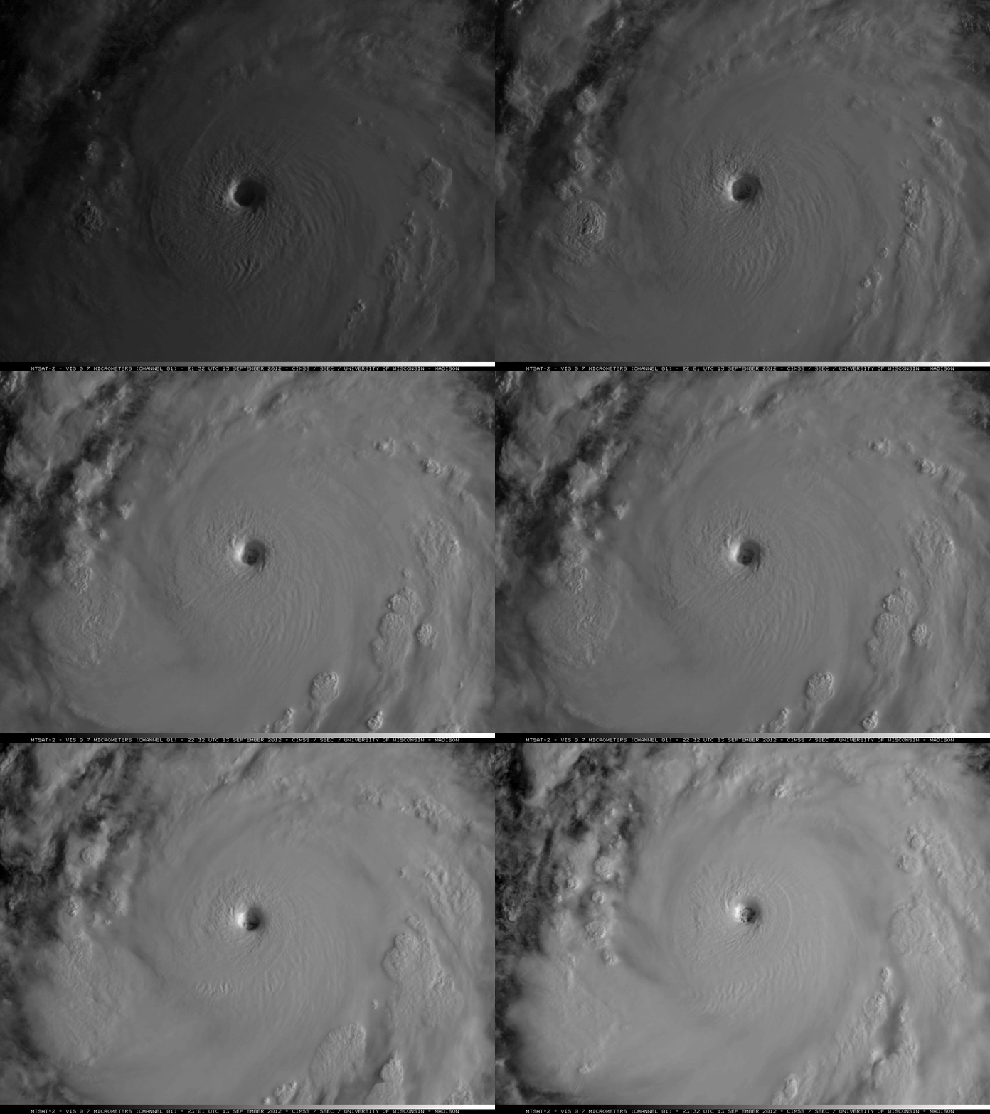
The first daylight MTSAT-2 0.7 µm visible channel images (below) showed nice eye and eyewall structure.


