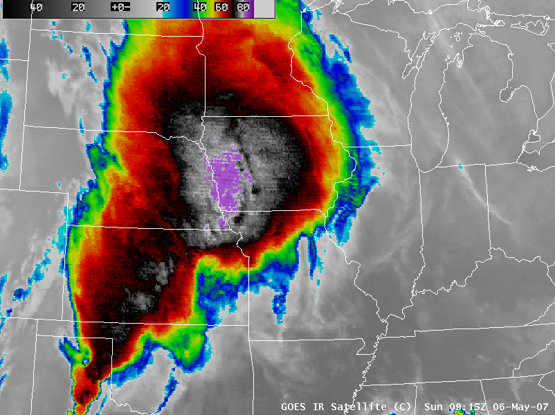
Severe weather in the central US
The largest outbreak of severe weather so far this season developed across a large portion of the central US on 04 May / 05 May / 06 May 2007, producing tornadoes from Texas to South Dakota, hail up to 4.25 inches in diameter in Nebraska, and wind gusts to 90 mph in Kansas. GOES-12 images of the 10.7µm InfraRed (IR) channel (above; QuickTime animation) show the development of the severe convection that spawned the deadly EF-5 tornado that destroyed much of Greensburg, Kansas (located near the center of the images) around 02:38 UTC on 05 May (9:38 PM on 04 May, local time). This was the first F5/EF-5 tornado damage in the US since May 1999.
One striking aspect of the IR satellite imagery on 06 May was the large areal coverage of unusually cold cloud top temperatures (colder than -80º C, purple enhancement) early in the day over eastern Nebraska and western Iowa (above; QuickTime animation). A comparison of 1-km resolution NOAA-18 IR and 4-km resolution GOES-12 IR (below) reveals cloud top temperatures as cold as -87º C (-125º F) and -85º C (-121º F), respectively; such a close agreement between AVHRR vs. GOES IR temperatures is also somewhat unusual, since the higher spatial resolution of the AVHRR instrument often senses cloud top temperatures that are as much as 10-20º C colder than GOES in the areas of convective storm tops.


