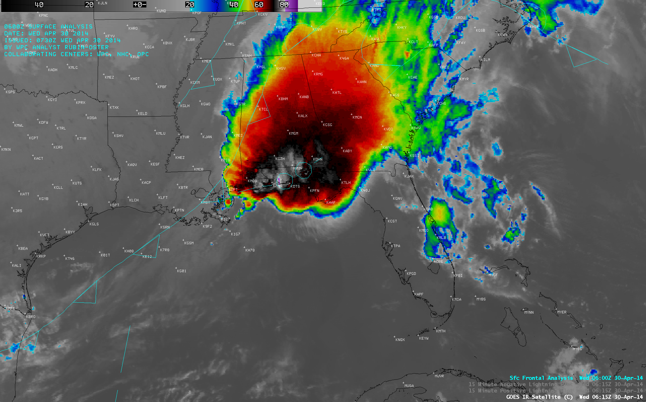
Mesoscale Convective System along the Gulf Coast region
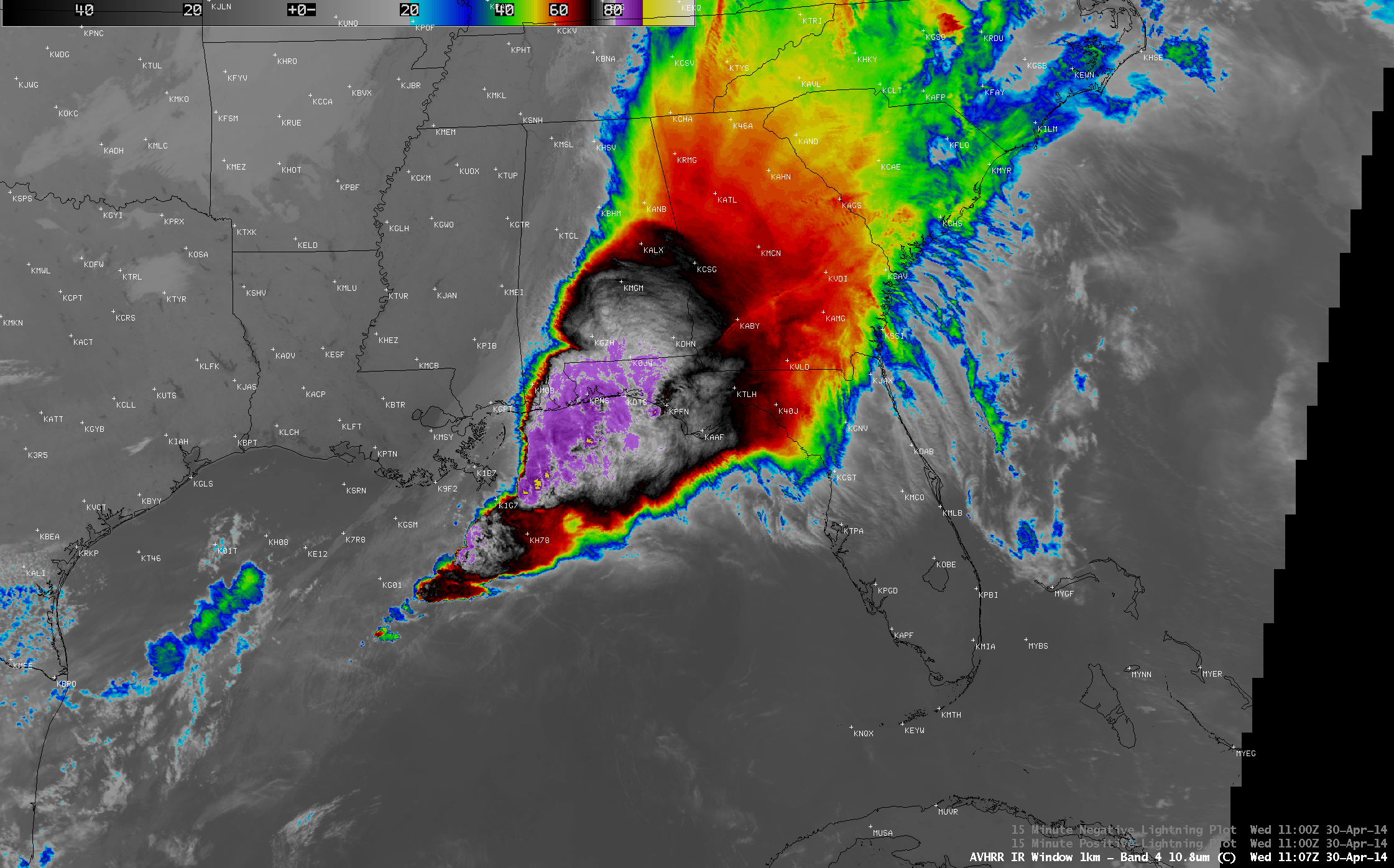
A large Mesoscale Convective System (MCS) developed ahead of a slow-moving cold front and moved over the Gulf Coast region of the US on 29 April – 30... Read More
A large Mesoscale Convective System (MCS) developed ahead of a slow-moving cold front and moved over the Gulf Coast region of the US on 29 April – 30... Read More

A Suomi NPP VIIRS true-color Red/Green/Blue (RGB) image visualized using the SSEC RealEarth web map server (above) showed large areas of blowing dust across parts of the central Plains states on the afternoon of 27 April 2014.... Read More
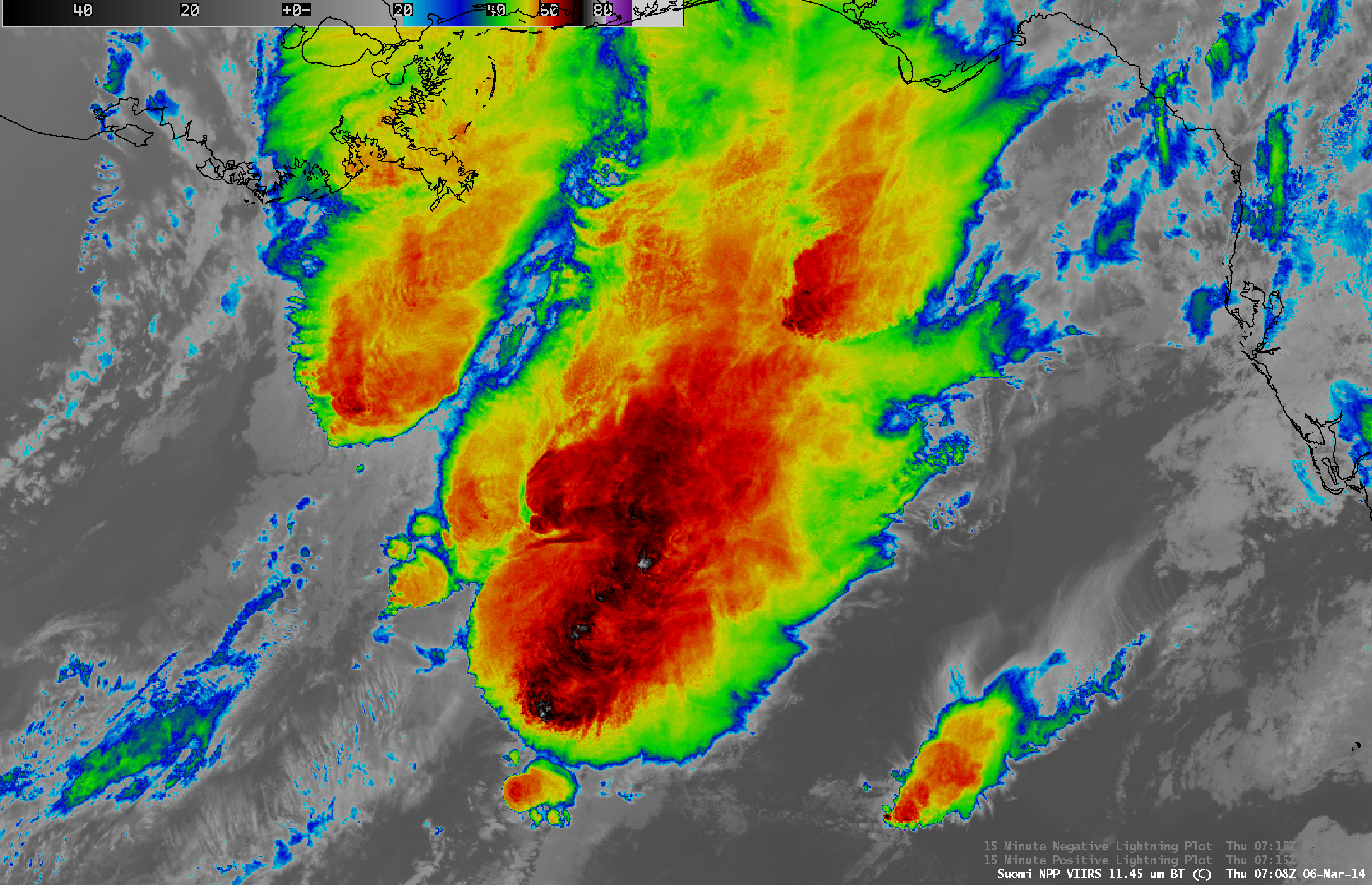
A night-time AWIPS image comparison of Suomi NPP VIIRS 11.45 µm IR and 0.7 µm Day/Night Band data (above) showed a large mesoscale convective system (MCS) over the Gulf of Mexico at 07:08 UTC (2:08 AM local time) on 06 March 2014. On... Read More
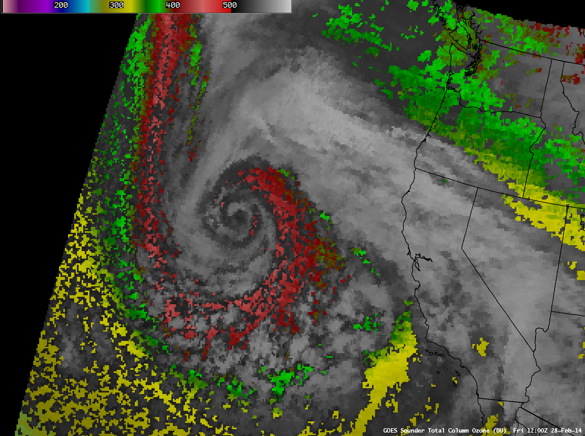
McIDAS images of 4-km resolution GOES-15 6.5 µm water vapor channel data (above; click image to play animation; also available as an MP4 animation) showed the development of a strong and rapidly-occluding storm off the coast of California during the Read More
