
GOES-13 6.5 µm water vapor imagery + surface analyses + storm reports
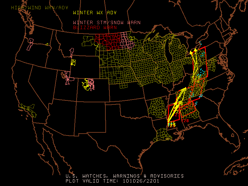
An unusually large and strong mid-latitude cyclone rapidly intensified over the western Great Lakes region on 26 October 2010 (see HPC 18 UTC surface analysis and 22 UTC SPC Watches, Warnings, and Advisories). AWIPS images of GOES-13 6.5 µm water vapor channel data with overlays of surface analyses and SPC storm reports (above) showed a well-defined dry slot (yellow color enhancement) wrapping into the southern and eastern quadrants of the storm. Very strong surface wind gusts (NWS Milwaukee | NWS Green Bay | HPC) associated with this cyclone were reported in Wisconsin (79 mph at Sherwood), the Upper Peninsula of Michigan (70 mph at Point Aux Barques), South Dakota (70 mph at Union Center), and Minnesota (65 mph at Mehurin).
AWIPS Northern Hemisphere composite water vapor images covering the period 23-27 October 2010 (below; also available as a QuickTime movie) revealed the large amount of jet stream energy that was approaching the Lower 48 states from the central and eastern Pacific Ocean during the days leading up to the development of the strong Great Lakes cyclone.
")
Northern Hemisphere composite water vapor images (23-27 October 2010)
One notable aspect of this storm is that it set new all-time lowest barometric pressure readings for the states of Wisconsin and Minnesota (which were the equivalent to those that would be seen in a Category 3 hurricane):
PUBLIC INFORMATION STATEMENT
NATIONAL WEATHER SERVICE DULUTH MN
1227 PM CDT WED OCT 27 2010…LOW PRESSURE RECORDS BROKEN ON OCTOBER 26 2010…
THIS IS A PRELIMINARY STATEMENT ON THESE PRESSURE RECORDS. HERE IS WHAT WE KNOW SO FAR ABOUT THE LOW PRESSURE RECORDS SET ON OCTOBER 26TH:
A FEW OF THE RECORDS HAVE BEEN RECALCULATED TO ADJUST FOR TRUE MEAN SEA LEVEL PRESSURE. SOME OF THE PREVIOUS VALUES WERE CALCULATED USING A STANDARD ATMOSPHERE ASSUMPTION /THE ALTIMETER SETTING AT THE STATION/. THE VALUES IN MILLIBARS ARE THE ONES THAT WILL BE MORE EXACT.
AN UNUSUALLY INTENSE LOW AFFECTED THE STATE OF MINNESOTA. AT 513 PM CDT…THE AUTOMATED WEATHER OBSERVING SYSTEM AT BIGFORK MINNESOTA RECORDED A 955.2 MILLIBAR /28.21 INCHES/ PRESSURE. THIS BREAKS THE ALL TIME MINNESOTA STATE RECORD FOR THE LOWEST OBSERVED PRESSURE.
THE PREVIOUS RECORD WAS 962.7 MB SET ON NOVEMBER 10 1998 AT ALBERT LEA AND AUSTIN IN SOUTHERN MINNESOTA. THE RECORD WAS INITIALLY BROKEN SHORTLY AFTER 10 AM AS THE LOW PASSED BY AITKIN MINNESOTA. HOWEVER…THE LOW CONTINUED TO INTENSIFY INTO THE AFTERNOON OVER NORTH CENTRAL MINNESOTA WHERE THE RECORD PRESSURE READING WAS ULTIMATELY ESTABLISHED AT BIGFORK.
.DULUTH…THE LOW PRESSURE RECORD AT DULUTH WAS SET AT 1115 AM WITH A PRESSURE OF 960.2 MILLIBARS /28.35 INCHES/. THE PREVIOUS RECORD WAS 964.3 MILLIBARS WHICH OCCURRED ON NOVEMBER 10 1998.
.INTERNATIONAL FALLS…THE LOW PRESSURE RECORD AT INTERNATIONAL FALLS WAS SET AT 345 PM WITH A PRESSURE OF 956.0 MILLIBARS /28.23 INCHES/. THE PREVIOUS RECORD WAS 971.9 MILLIBARS ON OCTOBER 10 1949.
.WISCONSIN…THE LOW PRESSURE RECORD FOR THE STATE OF WISCONSIN WAS SET IN SUPERIOR AT 1115 AM WITH A PRESSURE OF 961.3 MILLIBARS /28.39 INCHES/. THE PREVIOUS RECORD WAS 963.43 MILLIBARS /28.45 INCHES/ WHICH OCCURRED AT GREEN BAY ON APRIL 3 1982.
$$
LAMERS
A comparison of 1-km resolution MODIS 6.7 µm and 4-km resolution GOES-13 6.5 µm water vapor images (below) demonstrated the advantage of higher spatial resolution for detecting subtle wave features that could be indicators of possible turbulence. In this case, the MODIS water vapor image did indicate the presence of a subtle packet of waves aloft over central Lake Michigan — and there were pilot reports of moderate turbulence very near these wave features at 20,000 and 23,000 feet. Satellite-derived atmospheric motion vectors also showed that the axis of highest jet stream winds (134 knots at 300 hPa) was located along the far eastern edge of the dry slot on the water vapor image.

MODIS vs GOES-13 water vapor images + turbulence reports + satellite winds
AWIPS images of 1-km resolution POES AVHRR 10.8 µm IR data with overlays of surface analyses (below) showed the evolution of the deepening storm, which exhibited very detailed cloud top structure on many of the IR images.

POES AVHRR 10.8 µm IR images + surface analyses
To get a feel for the overall size of the cyclone, a GOES-13 false color full disk image is shown below (courtesy of Rick Kohrs, SSEC).
")
GOES-13 false color full disk image (14:15 UTC , 27 November)
View only this post Read Less

")


