")
Composite of GOES-15/GOES-13 3.9 µm shortwave IR images (click image to play animation)
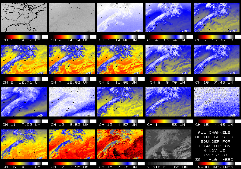
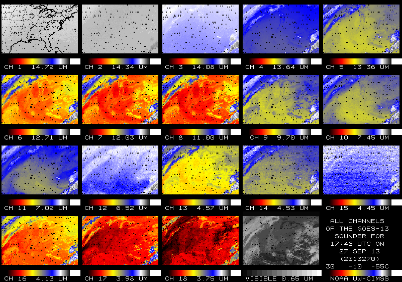
The GOES-13 Sounder has been experiencing anomalies that manifest themselves as missing pixels since mid-Summer. The missing pixels apparently arise because of slight fluctuations in the speed of the sounder instrument filter wheel. The number of missing pixels per Sounder image peaked in late September, just after the Equinox, with up to 700 missing pixels (out of 63000) per Sounder image over CONUS. At present, missing pixels vary between 100 and 250, with a maximum typically around 2200 UTC and a minimum between 0600 and 1000 UTC. In the animation above, the missing pixels show as black; the GOES-15 Sounder data have no missing pixels.
Realtime GOES Sounder imagery is available at this link. The Sounder anomalies are present in all 19 of the GOES-13 spectral bands, as evident in the toggle below between an image in late September (when error counts were highest) and early November (when error counts were lower). GOES Engineers continue to monitor this situation and investigate possible solutions.
")
GOES-13 Sounder 19-band display, 1800 UTC 27 September and 1600 UTC 4 Nov 2013 (click image to enlarge)
View only this post Read Less
")


")

")
")
")

