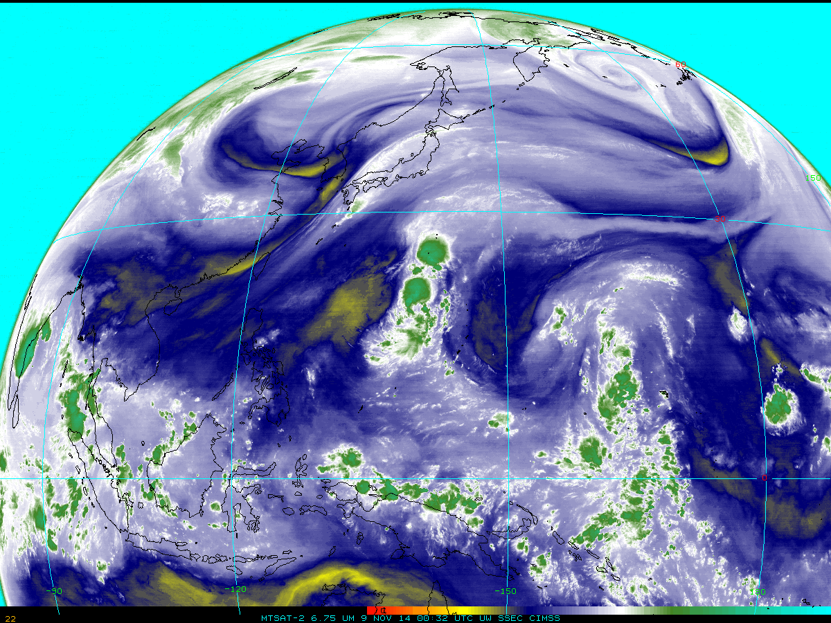
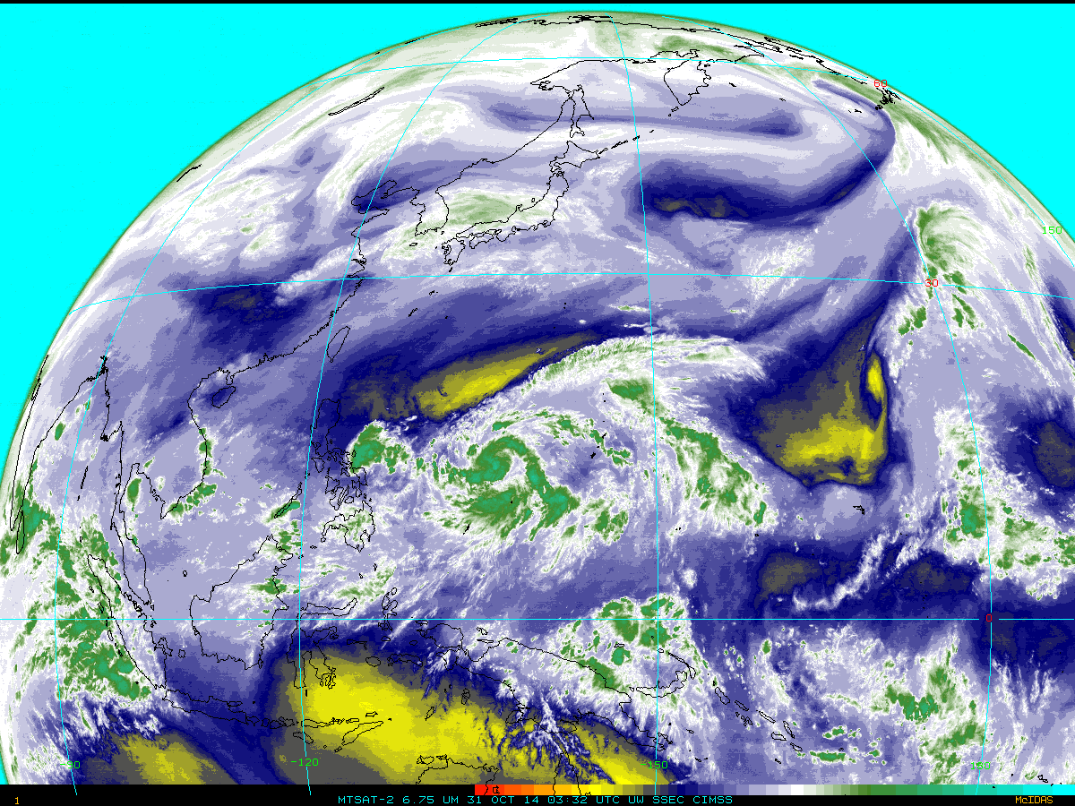
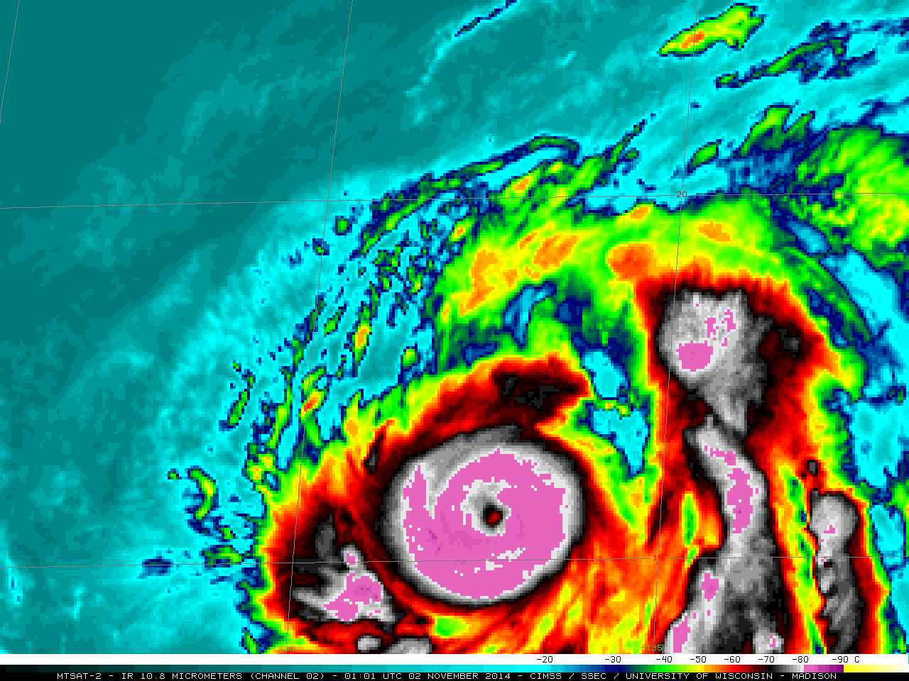
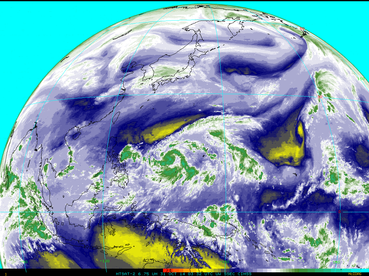
MTSAT-2 6.75 µm IR water vapor channel images (click to play animation)
Super Typhoon Nuri has completed its transition to one of the strongest extratropical cyclones ever on record in the Bering Sea (Link; Shemya Island had a gust to 96 miles per hour!). The animation above (click here for an mp4, or view it on YouTube) covers the entire lifecycle, from birth out of the ITCZ over the western Pacific to occlusion 7500 km north in the Bering Sea. (A faster animation is available as a animated gif or mp4).
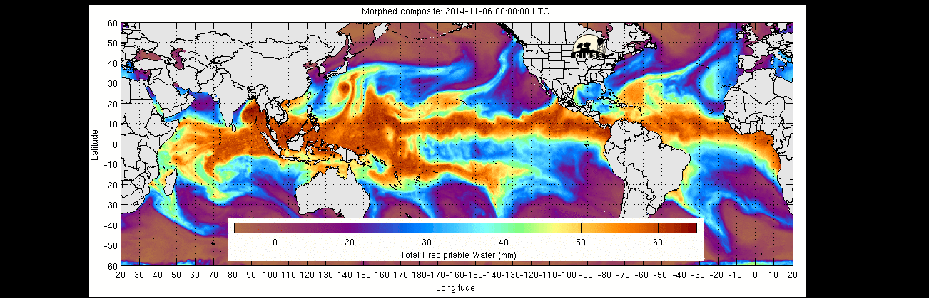
Total Precipitable Water, 0000 6 November 2014 through 0600 9 November 2014 (click to enlarge)
Animations of Total Precipitable Water (from MIMIC) from 6-9 November, above, show that deep tropical moisture associated with Nuri did not make it up into the Bering Sea, but instead was shunted off to the east. Earlier, moisture from Nuri was entrained into the development of a storm in the Bering Sea on 4-5 November. A streamer of high-level moisture in the outflow from Nuri moves northeastward and eastward. That storm subsequently slipped southeastward and made landfall over the Pacific Northwest on 8 November.
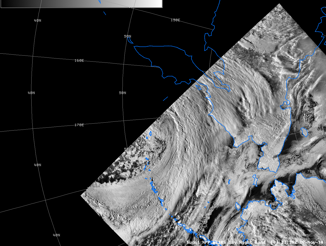
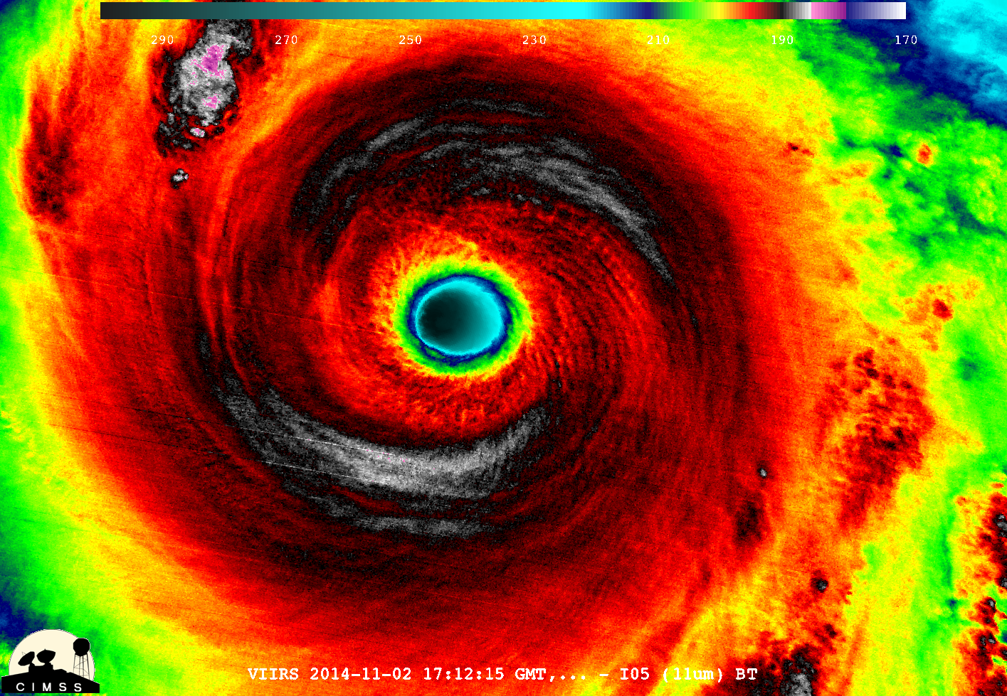
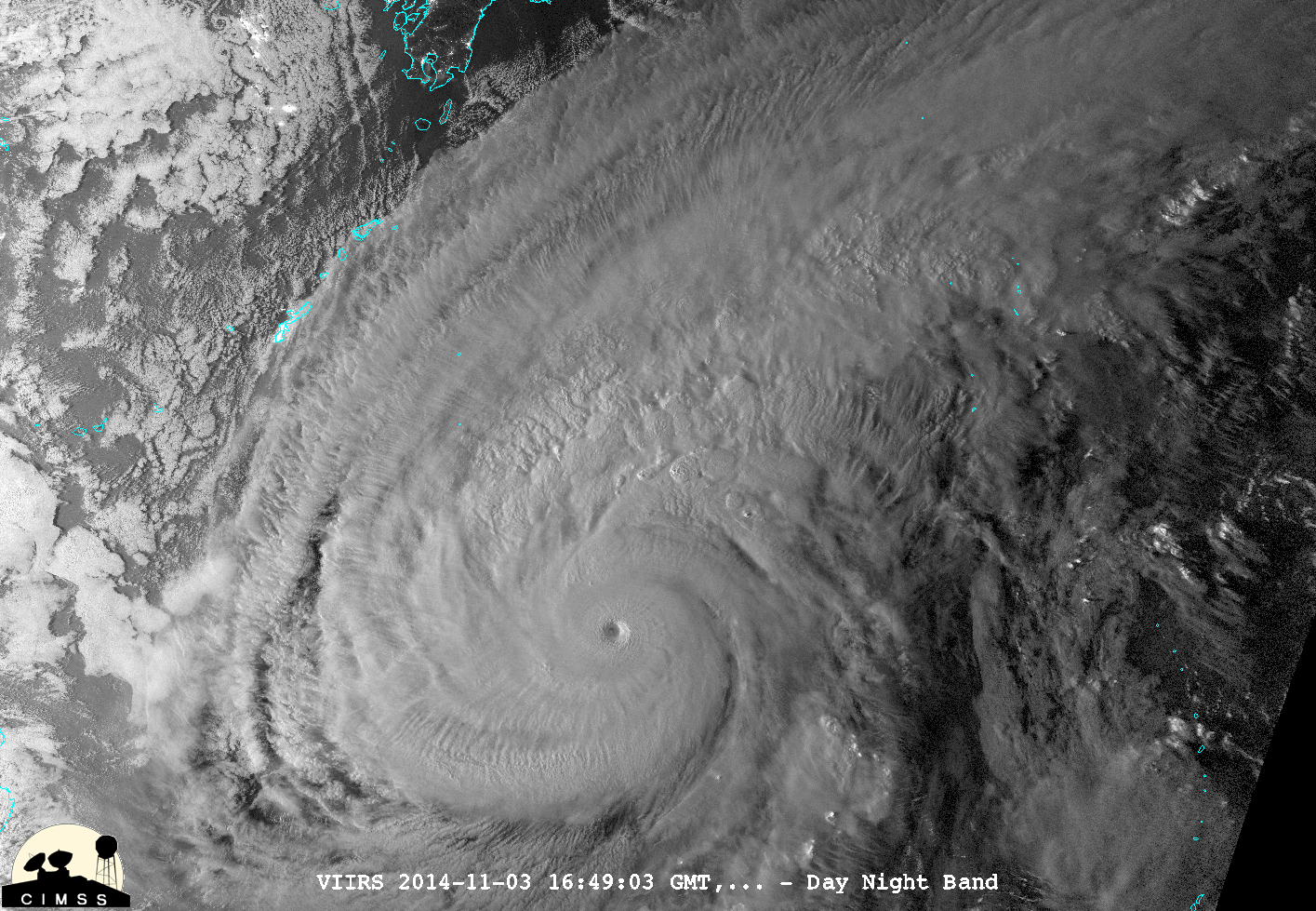
Suomi NPP Day Night Band Visibe Imagery (0.70 µm) over the Bering Sea, 7-10 November 2014 (click to enlarge)
Suomi NPP overflew the developing storm in the Bering Sea about every twelve hours, and the imagery above, from the GINA Direct Broadcast Antenna at the University of Alaska-Fairbanks, shows the rapid development of a tight swirl of clouds by early on 8 November. Subsequently, the weakening storm drifted northward through the Bering Sea.
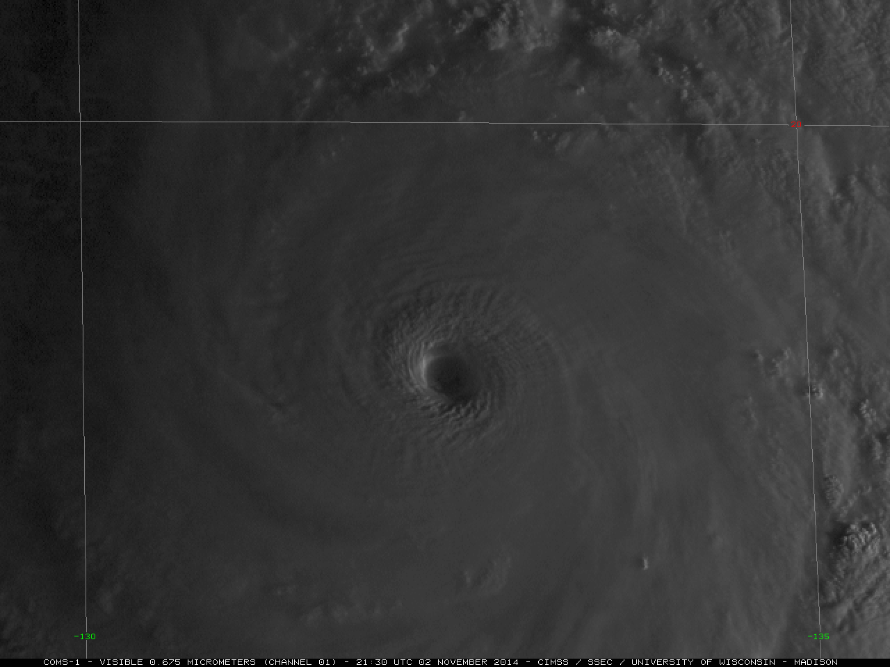
GOES-15 also viewed the strong development, both in the window channel (YouTube video) and in the water vapor channel (YouTube video (Color Enhanced)). The visible animation, below, shows a strong cyclone by 0300 UTC on 8 November; at the subsequent sunrise, 2000 UTC, the system had occluded.

GOES-15 0.62 µm IR Visible Imagery on 7, 8 and 9 November 2014 (click to play animation)
View only this post Read Less
