This website works best with a newer web browser such as Chrome, Firefox, Safari or Microsoft
Edge. Internet Explorer is not supported by this website.
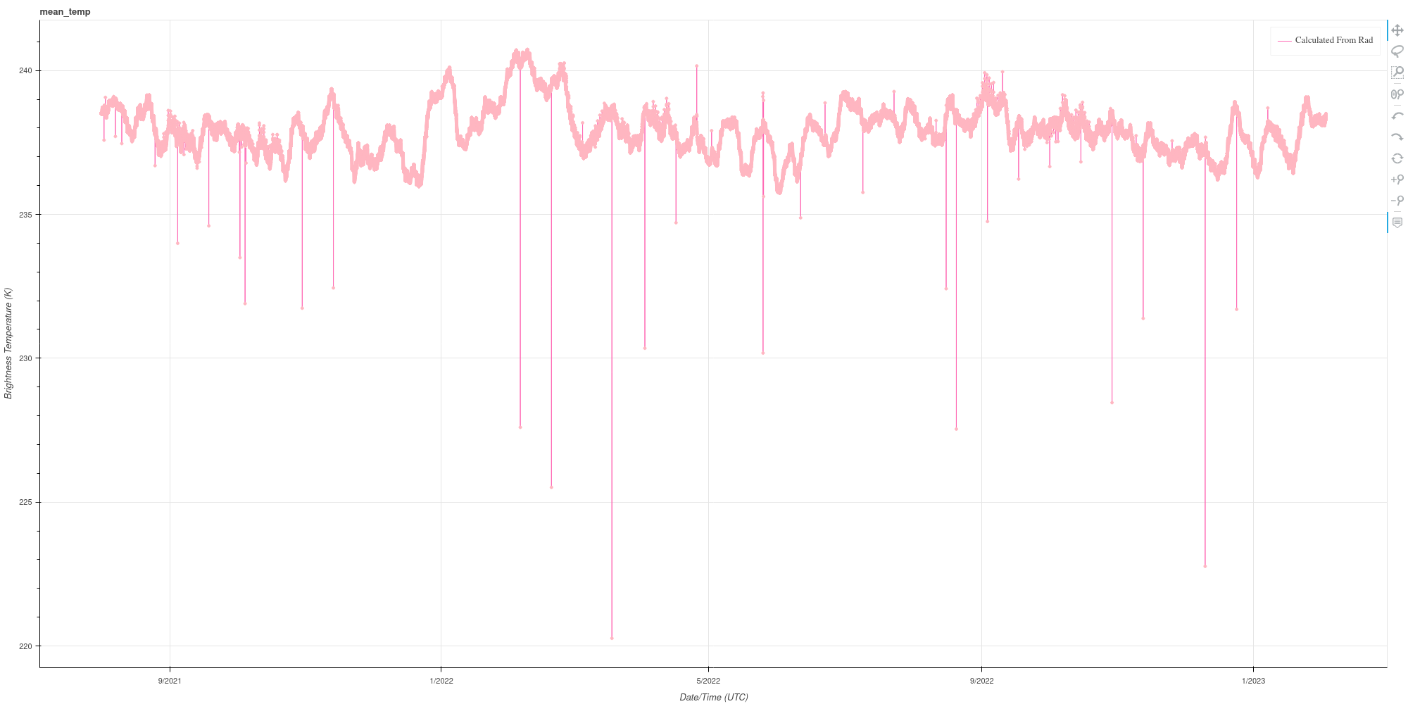
CIMSS scientists have created a website that extracts from the Level 1b ABI files information on the global mean radiance (and maximum, and minimum radiances) for each of the 16 channels at this link. The figure above tracks the global mean temperature of the GOES-16 Band 8 (Upper Level Water Vapor,... Read More
GOES-16 Mean Brightness Temperature (computed from the mean Radiance Values for 6.19 µm), June 2021 – February 2023 (Click to enlarge)
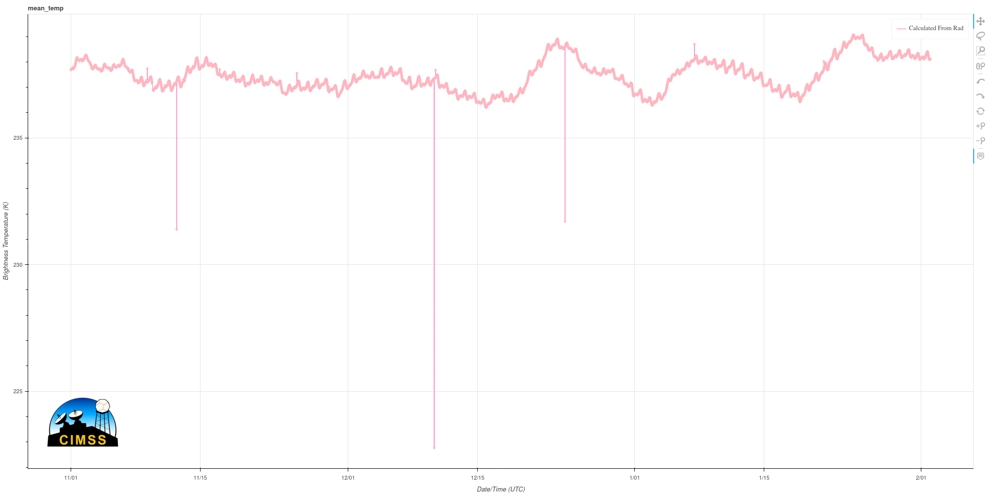
CIMSS scientists have created a website that extracts from the Level 1b ABI files information on the global mean radiance (and maximum, and minimum radiances) for each of the 16 channels at this link. The figure above tracks the global mean temperature of the GOES-16 Band 8 (Upper Level Water Vapor, 6.19 µm) from June 2021 (the earliest date yet available) through the present. Some rare data dropouts are obvious (and have not been filtered out). There are interesting time scales within this time series; for example, there is a 2-week oscillation starting near the end of 2022. That’s more apparent, starting after 15 December 2022, in the blown-up image shown below, from 1 November through 2 February. You can also see daily changes in the Brightness Temperature in the time series below, likely related to solar forcing.
GOES-16 Global Mean Brightness Temperatures for Band 8 (6.19 µm), 1 November 2022 – 2 February 2023 (Click to enlarge)
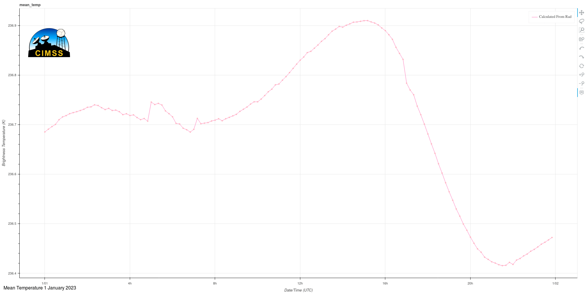
The toggle below compares the Global Mean 6.19 µm brightness temperature on 1 January and 1 February 2023. Note the peak near solar noon at 75.2oW, the GOES-16 sub-satellite point. This might also be influenced by high topography that is sensed by Band 8 (that is: the Andes Mountains).
GOES-16 Mean Global Band 8 (6.19 µm) Brightness Temperatures, 1 January and 1 February 2023 (Click to enlarge)
A similar site for monitoring cloud products (Cloud-top Height, Cloud-top Pressure, etc.) is here.
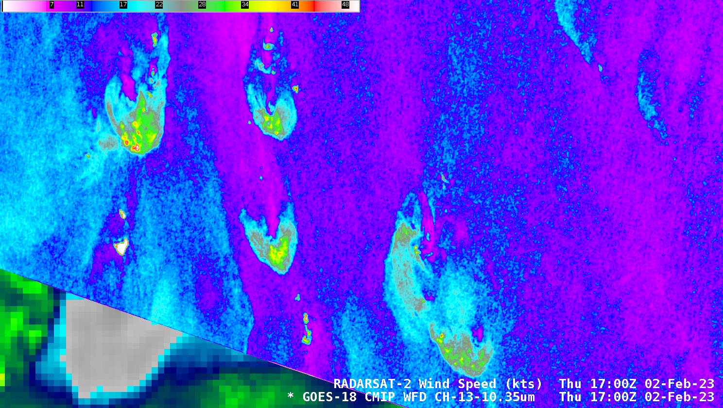
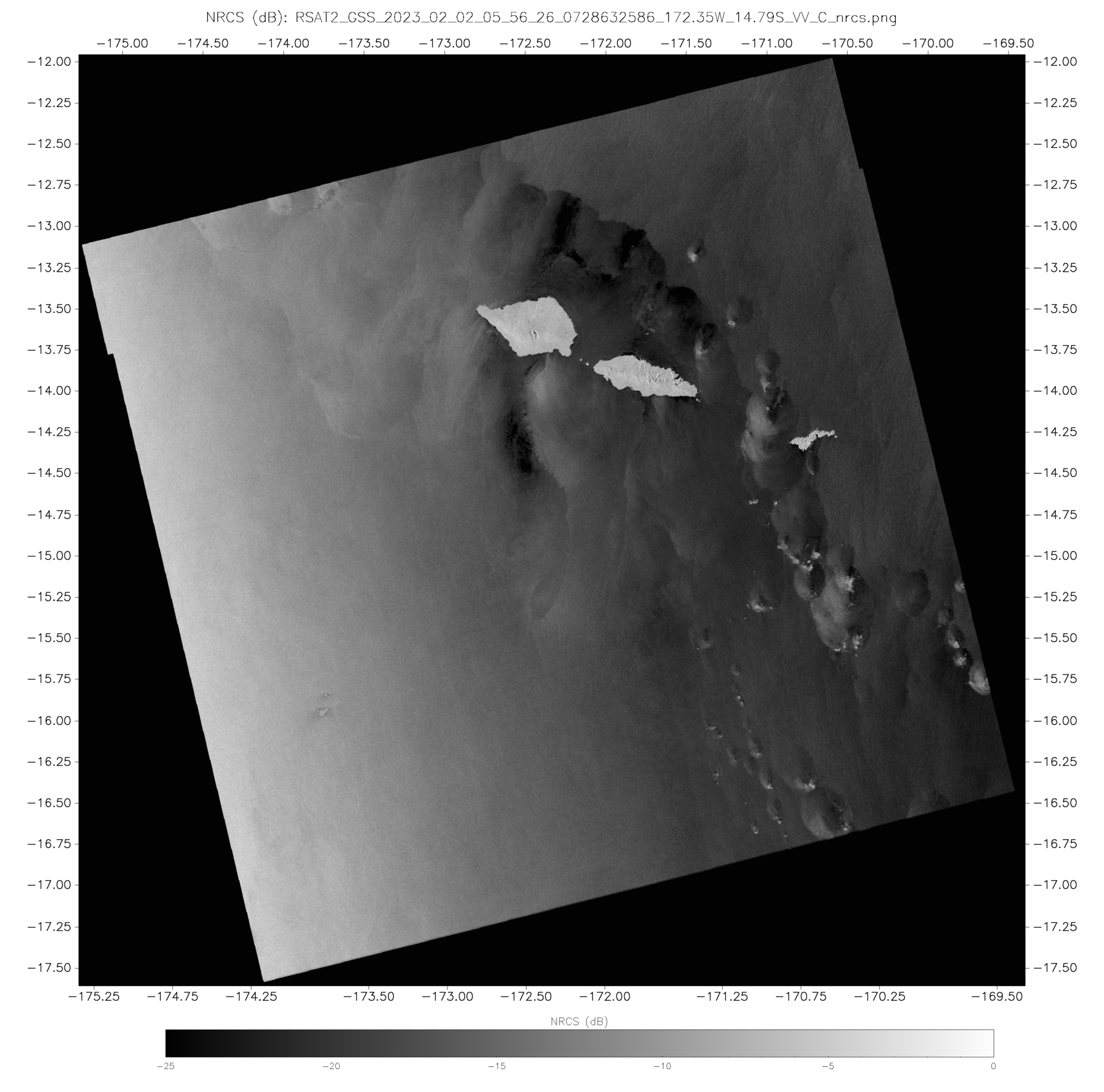
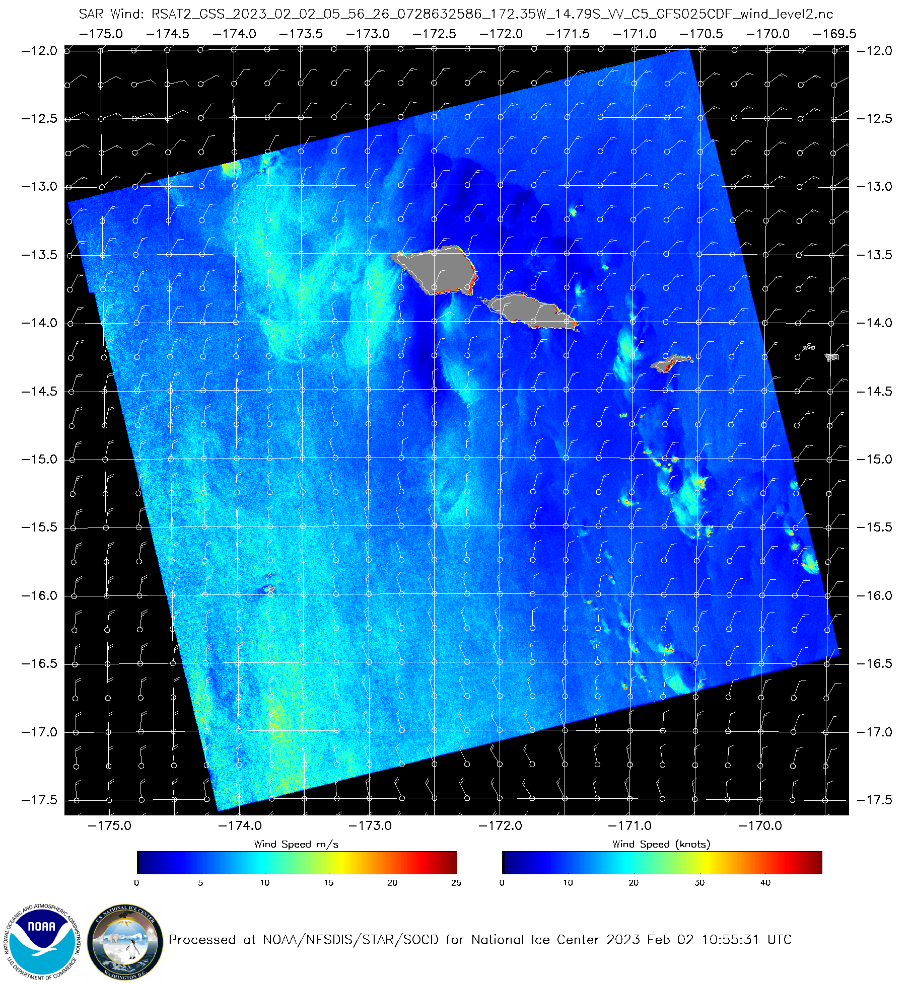
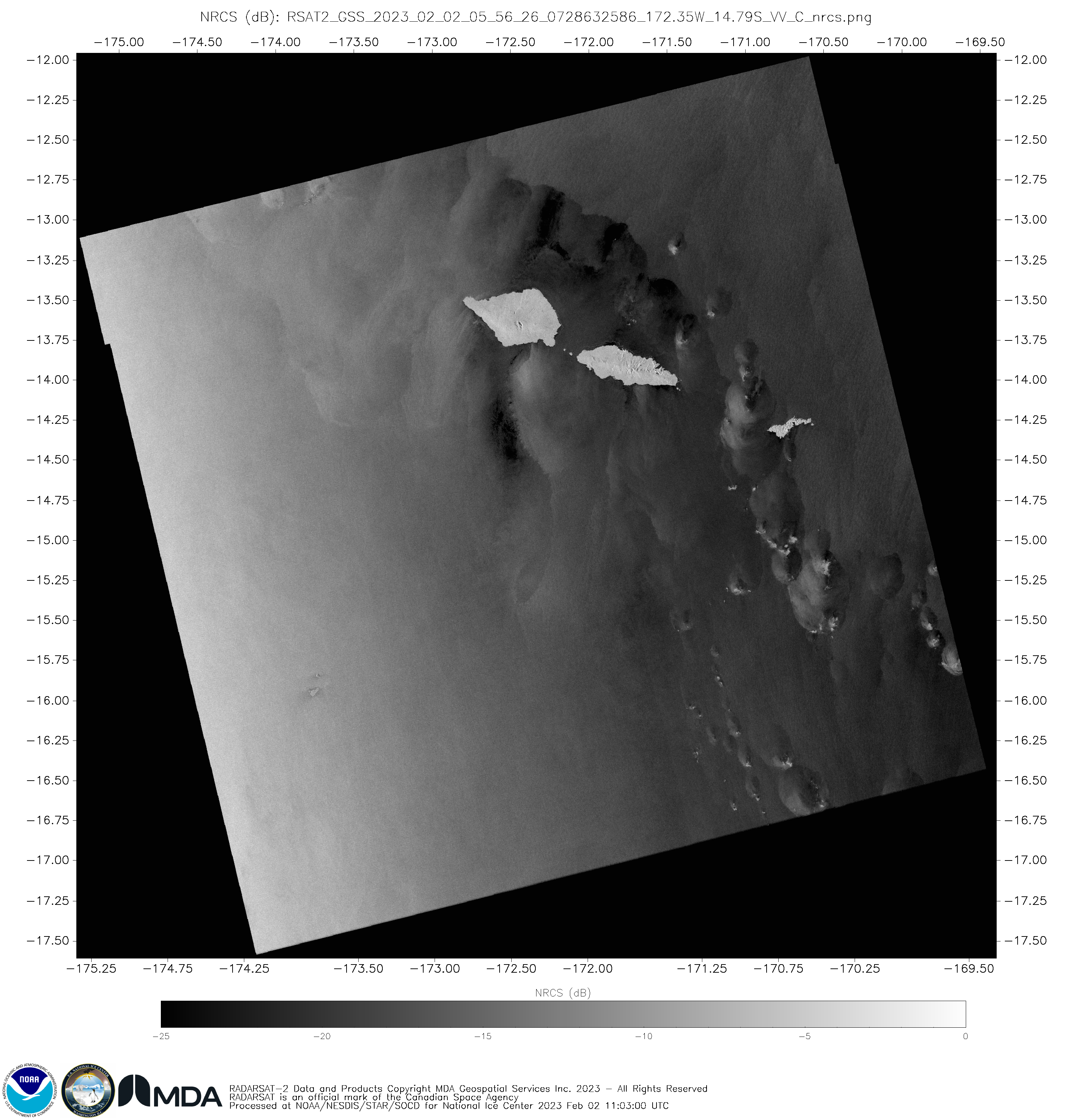
As noted in the past blog post, the NWS Water Surface Conditions / Synthetic Aperture Radar Science Team has arranged for observations over the Samoan Islands on 9 dates between 30 January 2023 and 5 March 2023 (imagery is available online here). The image above shows both the derived winds and the Normalized Radar Cross Section (NRCS) from 0556... Read More
RADARSAT-2 Synthetic Aperture Radar (SAR) winds and Normalized Radar Cross Section values over the Samoan Islands, 0556 UTC on 2 February 2023 (Click to enlarge)
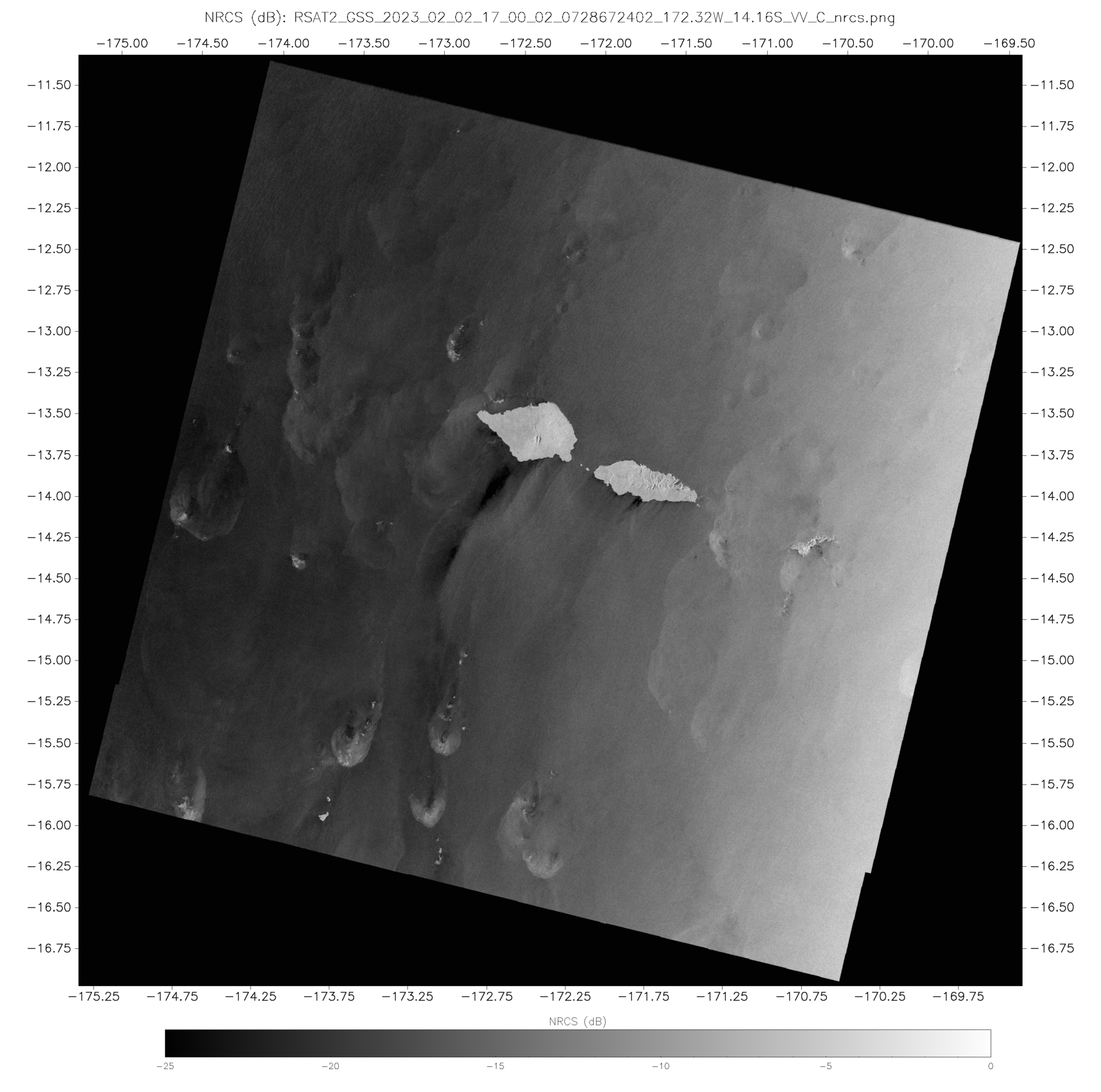
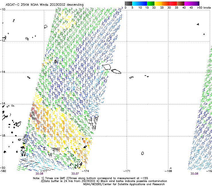
As noted in the past blog post, the NWS Water Surface Conditions / Synthetic Aperture Radar Science Team has arranged for observations over the Samoan Islands on 9 dates between 30 January 2023 and 5 March 2023 (imagery is available online here). The image above shows both the derived winds and the Normalized Radar Cross Section (NRCS) from 0556 UTC on 2 February 2023; Derived winds and NRCS at 1700 UTC on 2 February 2023 are shown below. At both times, north or northeast winds are indicated. (Advanced Scatterometer — ASCAT — winds from the descending pass of MetopC at ca. 2030 UTC on 2 February 2023 show the same wind direction).
RADARSAT-2 Synthetic Aperture Radar (SAR) winds and Normalized Radar Cross Section values over the Samoan Islands, 1700 UTC on 2 February 2023 (Click to enlarge)
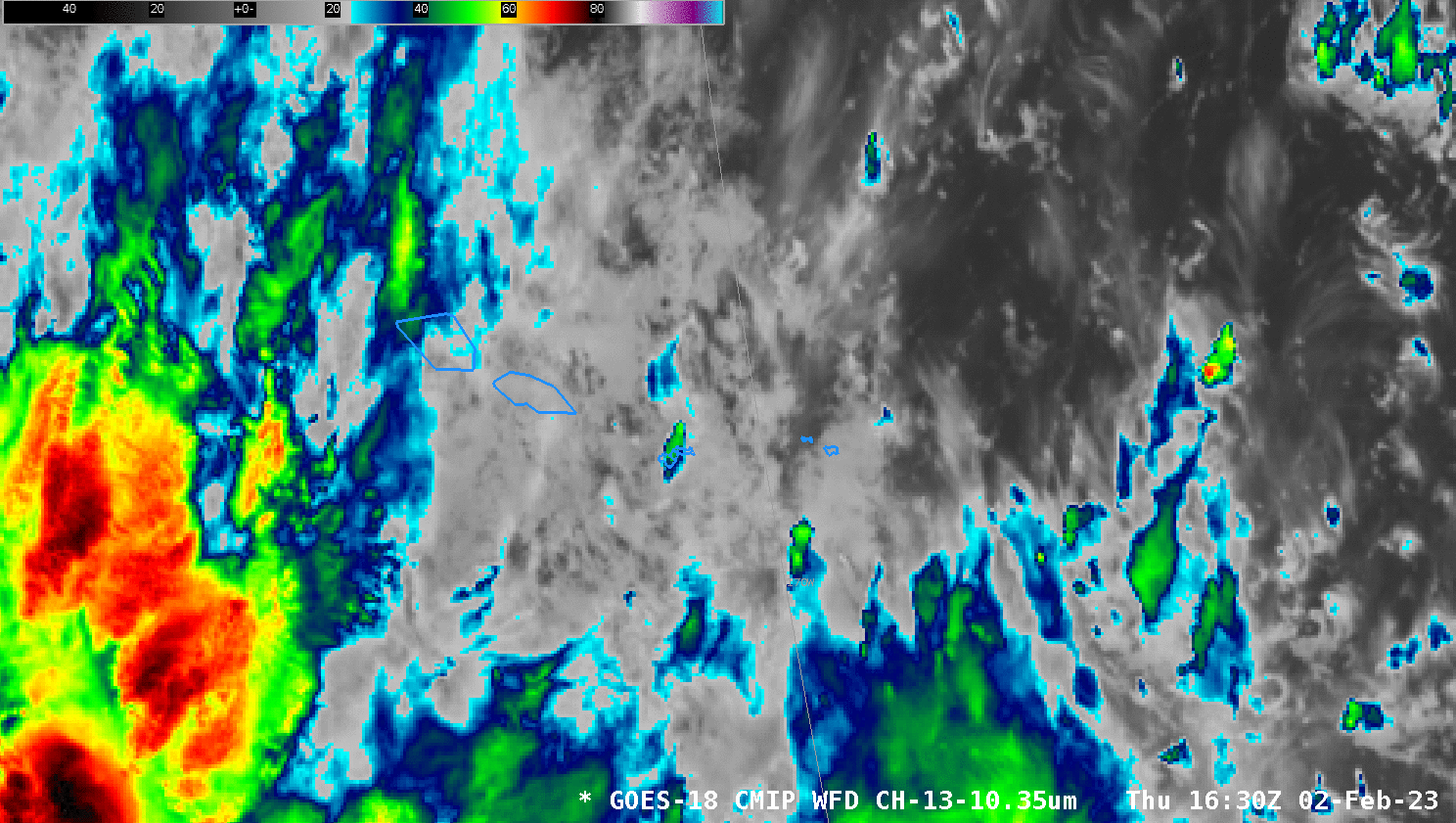
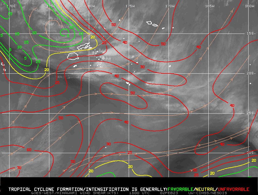
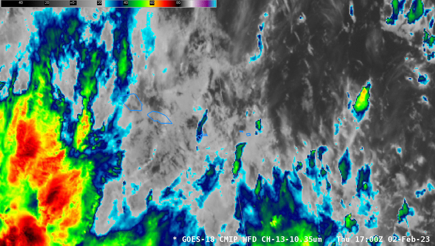
GOES-18 Clean Window infrared imagery (Band 13, 10.3 µm) from 1630 to 1730 UTC, below, (bracketing the SAR observation at 1700 UTC), shows cloud motions from south to north, suggesting considerable shear over the region. (This 1800 UTC/2 February 2023 shear analysis from the SSEC/CIMSS Tropical website shows the strong southwesterly shear).
GOES-18 Band 13 Clean Window Infrared (10.3 µm) imagery, 1630-1730 UTC on 2 February 2023 (Click to enlarge)
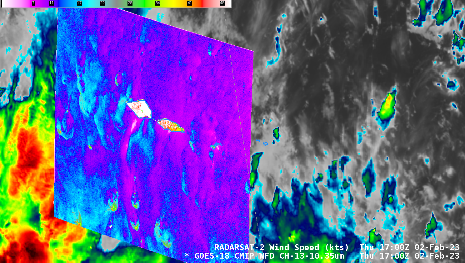
GOES-18 Band 13 Clean Window infrared (10.3) infrared imagery and RADARSAT-2 wind analysis, 1700 UTC on 2 February 2023; the wind enhancement color bar shows values from 0-50 knots (Click to enlarge)
The difficulty in attributing a Band 13 feature to the wind field features is also shown in the zoomed-in scene shown in the slider comparison below.
Some of the stronger SAR winds in the convective storms in the southern part of this scene (shown in the comparison above and in the image below) likely arise because of ice within convective clouds. Such ice strongly reflects microwave energy from the SAR satellite and that strong signal is misinterpreted as a strong wind return from the ocean surface. The NRCS imagery from that time will show a diffuse/feathery structure in regions where ice is present in the clouds.
Zoomed-in analysis of RADARSAT winds at 1700 UTC 2 February 2023 (Click to enlarge)
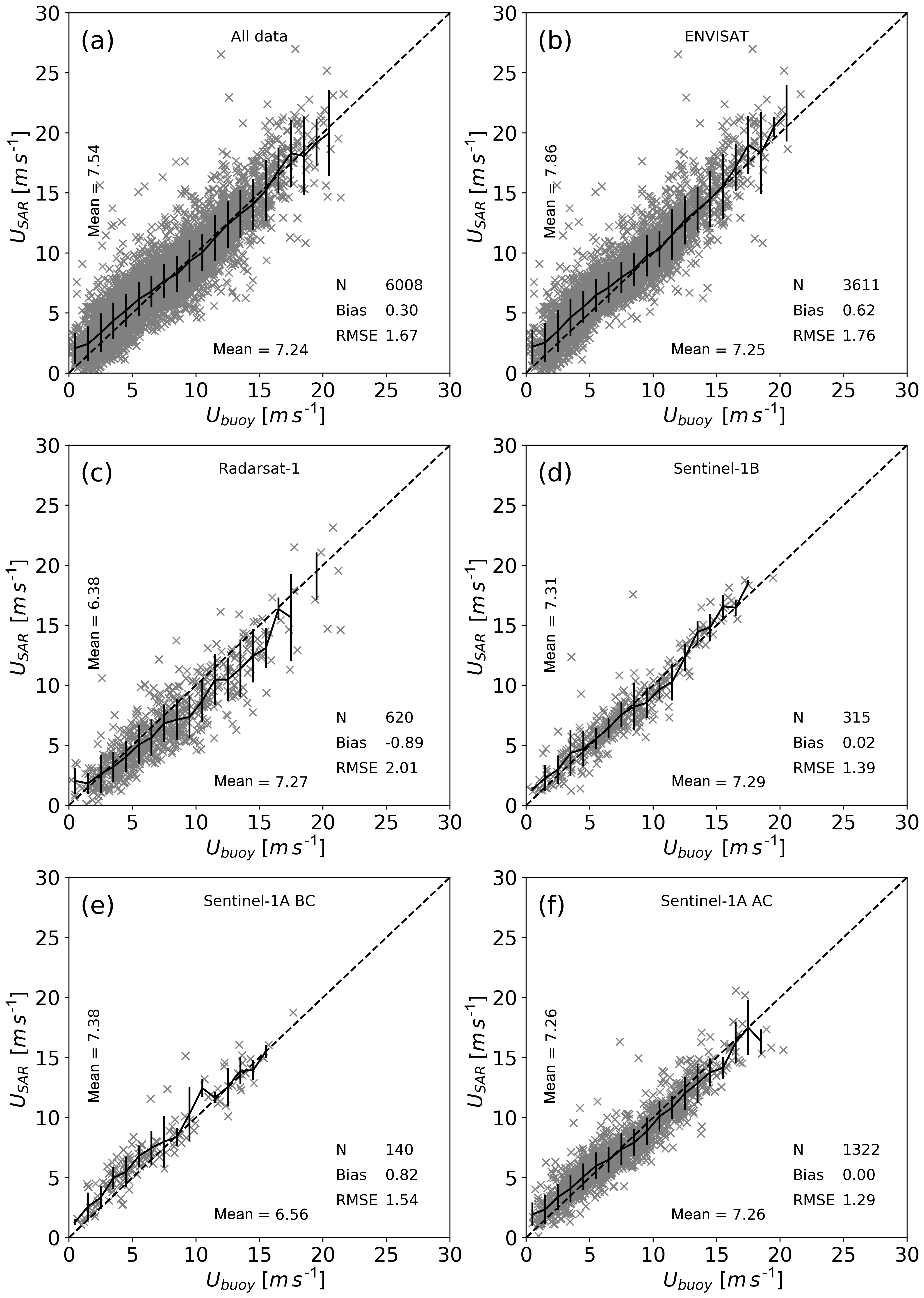
Should you believe the winds over the ocean? Yes. This study compared SAR winds to ocean buoys in the Atlantic. See in particular Figure 2 in Section 3, also available here.
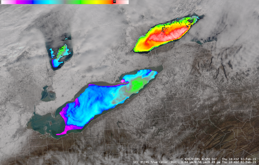
A NOAA-20 overpass across the Great Lakes on 2 February showed primarily clear skies over Lake Erie and western Lake Ontario, allowing for computation of ACSPO (Advanced Clear-Sky Processor for Ocean) Sea-Surface Temperatures. (Note that the colorbar has been rescaled from its default so that only values between 32 and 41o F (i.e., 0 and 5o... Read More
NOAA-20 True-Color imagery over Lakes Erie and Ontario, and derived ACSPO SSTs, 1843 UTC on 2 February 2023 (Click to enlarge)
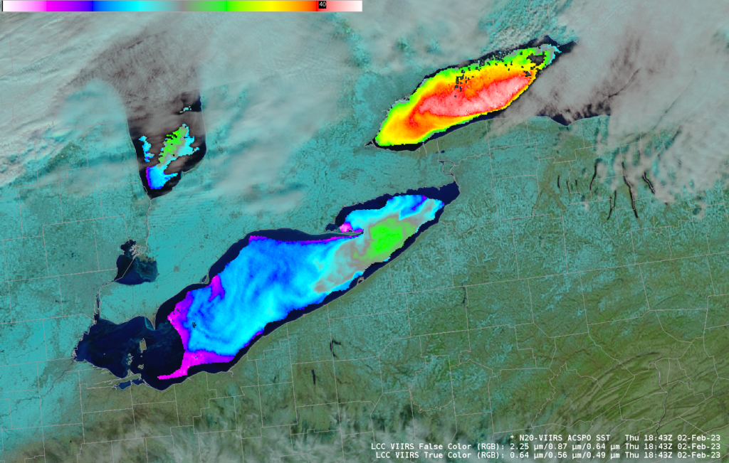
A NOAA-20 overpass across the Great Lakes on 2 February showed primarily clear skies over Lake Erie and western Lake Ontario, allowing for computation of ACSPO (Advanced Clear-Sky Processor for Ocean) Sea-Surface Temperatures. (Note that the colorbar has been rescaled from its default so that only values between 32 and 41o F (i.e., 0 and 5o C) are shown). The warmest lake surface temperatures over Lake Erie are around 37.5oF; those over Lake Ontario are around 40.8oF. The image below shows False Color imagery rather than True Color, allowing better identification of snow-covered surfaces over land, and better identification of clouds holding liquid cloud droplets.
NOAA-20 False-Color imagery over Lakes Erie and Ontario, and derived ACSPO SSTs, 1843 UTC on 2 February 2023 (Click to enlarge)
VIIRS True- and False-Color imagery and ACSPO SSTs were created using CSPP Software and data from the Direct Broadcast antenna at CIMSS. They are available as AWIPS tiles via LDM, and are also viewable at this website, in RealEarth, and at the VIIRS viewer.
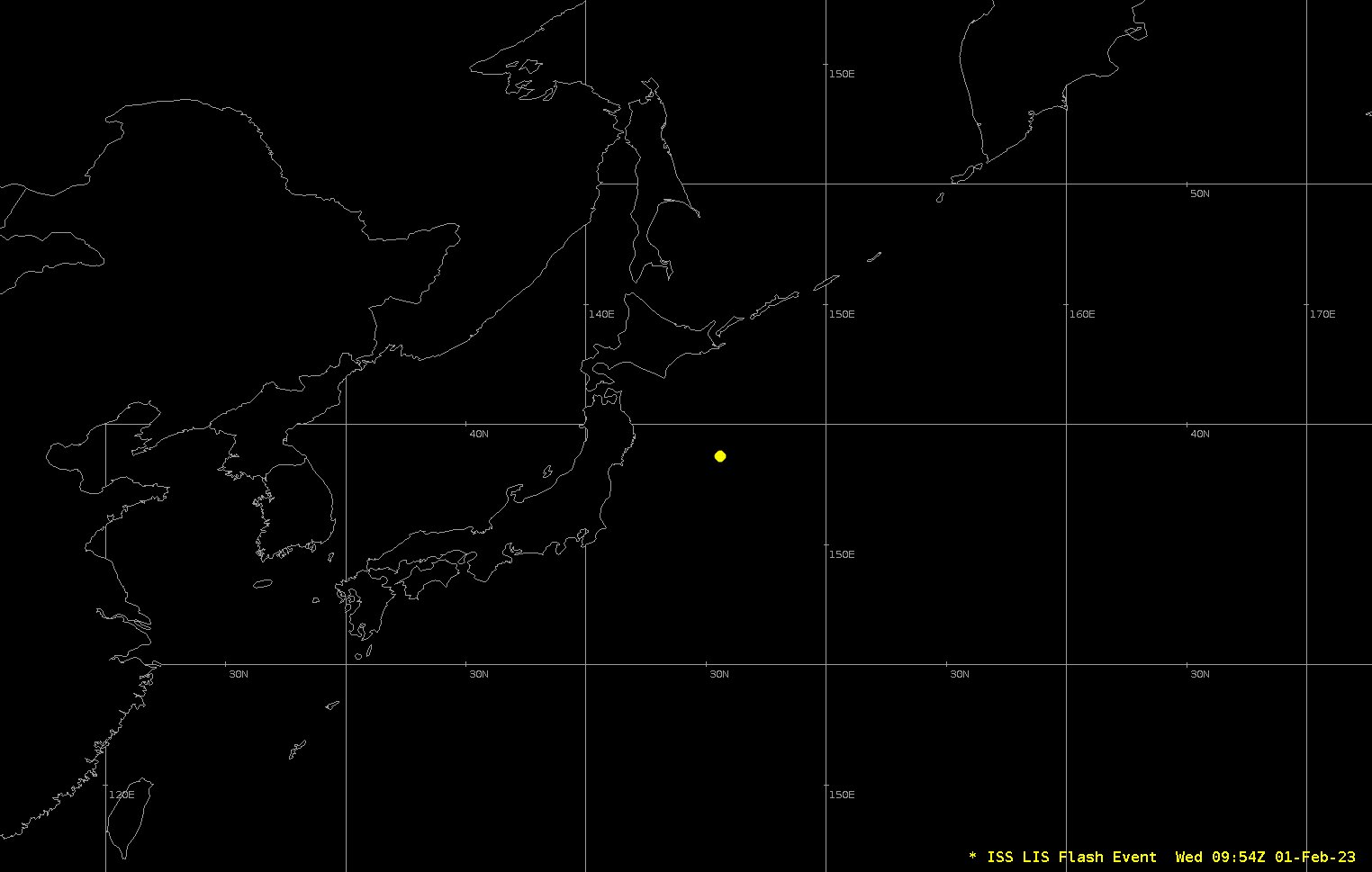
The Lightning Imaging Sensor (LIS) that flies on the International Space Station (ISS) observed about 20 individual flashes in about a minute to the east of Japan on 1 February 2023, as shown in the animation above. Himawari-9 Band 13 clean window infrared (10.41 µm) imagery, below, bracketing the lightning... Read More
LIS Observations to the east of Japan, 0954-0955 UTC on 1 February 2023 (Click to enlarge)
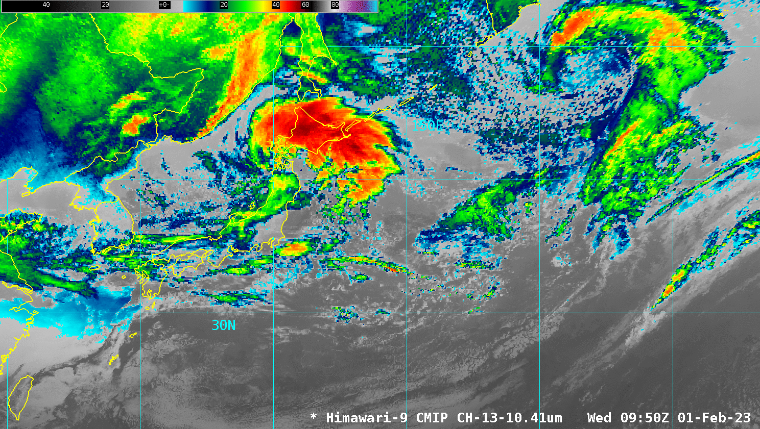
The Lightning Imaging Sensor (LIS) that flies on the International Space Station (ISS) observed about 20 individual flashes in about a minute to the east of Japan on 1 February 2023, as shown in the animation above. Himawari-9 Band 13 clean window infrared (10.41 µm) imagery, below, bracketing the lightning observation times above shows a developing storm system moving out over the Pacific — the comma head of the system is over southern Hokkaido Island. Convective development can be inferred between 35o and 40o N off the coast of Honshu.
Himawari-9 Clean Window infrared (10.41 µm) imagery, 0950 and 1000 UTC on 1 February 2023 (Click to enlarge)
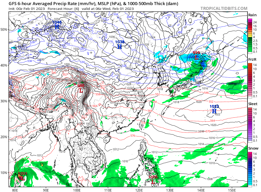
Did this system intensify, as one might expect given the presence of lightning? It did. The imagery below, from this site, shows the storm forecast to strengthen from 999 hPa at 0600 UTC to 989 hPa at 1800 UTC on 1 February. LIS data, though infrequent, can give useful information about convection.


