
During what was the last full day of GOES-16’s duty as GOES-East, a comparison of Shortwave Infrared Images from GOES-16 and GOES-19 (Preliminary/Non-operational) (above) showed thermal signatures of prescribed burning in the Flint Hills area of eastern Kansas. These annual Springtime prescribed burns are performed by cattle ranchers in order to... Read More
Shortwave Infrared (3.9 µm) images from GOES-16 (left) and GOES-19 (Preliminary/Non-operational, right), from 1401 UTC on 06 April to 0256 UTC on 07 April [click to play animated GIF | MP4]
During what was the last full day of GOES-16’s duty as GOES-East, a comparison of Shortwave Infrared Images from GOES-16 and GOES-19 (Preliminary/Non-operational)
(above) showed thermal signatures of prescribed burning in the
Flint Hills area of eastern Kansas. These annual Springtime prescribed burns are performed by cattle ranchers in order to remove thatch and weeds that compete with the native grasses, to improve the rangeland grasses for livestock grazing. Other examples of Flint Hills burning activity have been documented
here on this blog.
GOES-16 Visible images with an overlay of the Fire Mask derived product (a component of the GOES Fire Detection and Characterization Algorithm FDCA) also depicted the areal coverage and diurnal behavior of the fire thermal signatures (below).
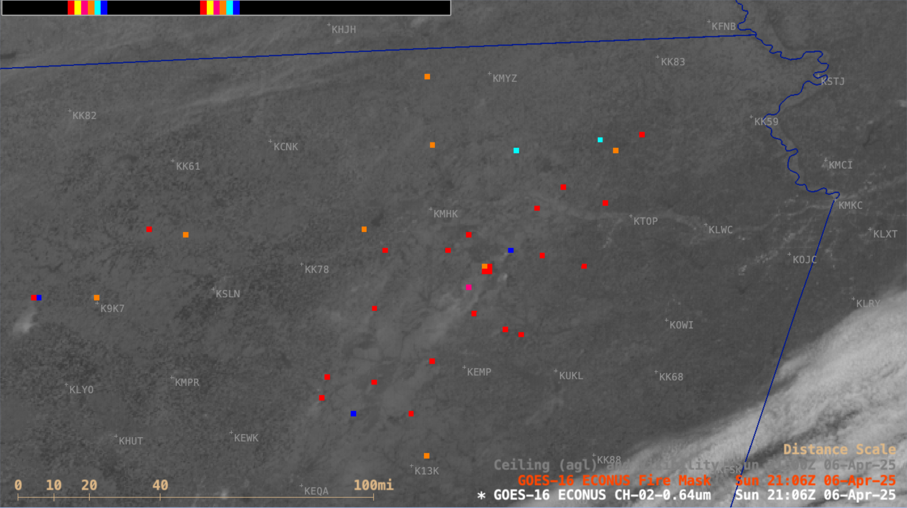
GOES-16 Visible (0.64 µm) images + GOES-16 Fire Mask derived product, from 1436 UTC on 06 April to 0031 UTC on 07 April [click to play MP4 animation]
The smoke plumes from this prescribed burning activity were better visualized using GOES-16 True Color RGB imagery from the
CSPP GeoSphere site
(below).
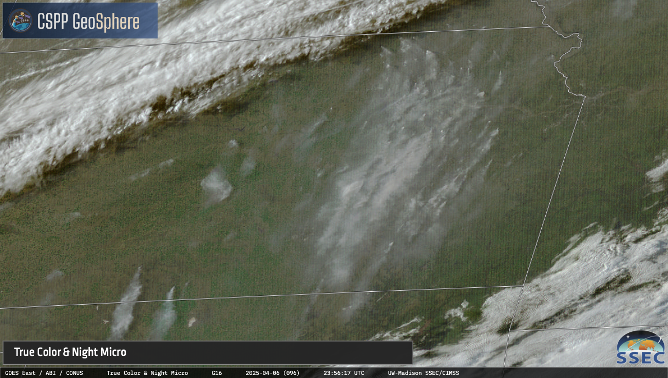
GOES-16 True Color RGB images, from 1431 UTC on 06 April to 0031 UTC on 07 April [click to play MP4 animation]
View only this post
Read Less


